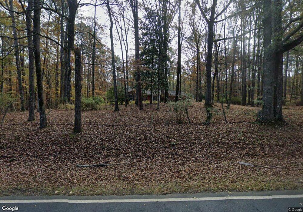
1026 Denney Rd Cataula, GA 31804
Estimated Value: $278,000 - $310,000
3
Beds
2
Baths
1,713
Sq Ft
$174/Sq Ft
Est. Value
About This Home
This home is located at 1026 Denney Rd, Cataula, GA 31804 and is currently estimated at $297,215, approximately $173 per square foot. 1026 Denney Rd is a home located in Harris County with nearby schools including Pine Ridge Elementary School, Creekside School, and Harris County Carver Middle School.
Ownership History
Date
Name
Owned For
Owner Type
Purchase Details
Closed on
Dec 30, 2024
Sold by
Leonard Elise
Bought by
Cataula Land Partnership Lllp
Current Estimated Value
Purchase Details
Closed on
Feb 3, 2020
Sold by
Foster Anna
Bought by
Leonard Elise
Purchase Details
Closed on
Oct 11, 2017
Sold by
Waters Jeffrey Wayne
Bought by
Foster Anna
Home Financials for this Owner
Home Financials are based on the most recent Mortgage that was taken out on this home.
Original Mortgage
$156,120
Interest Rate
3.75%
Mortgage Type
FHA
Purchase Details
Closed on
Oct 6, 2015
Sold by
Mcgowan Guy Edsel
Bought by
Waters Jeffrey Wayne and Waters Lori Dawne
Purchase Details
Closed on
May 14, 2015
Sold by
Tew Johnnie Berry
Bought by
Mcgowan Guy Edsel
Purchase Details
Closed on
May 7, 2001
Sold by
Tew Vernon F Estate
Bought by
Tew Johnnie Berry
Create a Home Valuation Report for This Property
The Home Valuation Report is an in-depth analysis detailing your home's value as well as a comparison with similar homes in the area
Purchase History
| Date | Buyer | Sale Price | Title Company |
|---|---|---|---|
| Cataula Land Partnership Lllp | $300,000 | -- | |
| Leonard Elise | $175,000 | -- | |
| Foster Anna | $159,000 | -- | |
| Waters Jeffrey Wayne | $50,000 | -- | |
| Mcgowan Guy Edsel | -- | -- | |
| Tew Johnnie Berry | -- | -- |
Source: Public Records
Mortgage History
| Date | Status | Borrower | Loan Amount |
|---|---|---|---|
| Previous Owner | Foster Anna | $156,120 |
Source: Public Records
Tax History
| Year | Tax Paid | Tax Assessment Tax Assessment Total Assessment is a certain percentage of the fair market value that is determined by local assessors to be the total taxable value of land and additions on the property. | Land | Improvement |
|---|---|---|---|---|
| 2025 | $3,431 | $114,634 | $20,000 | $94,634 |
| 2024 | $1,863 | $71,936 | $23,945 | $47,991 |
| 2023 | $1,400 | $71,852 | $23,945 | $47,907 |
| 2022 | $1,960 | $71,852 | $23,945 | $47,907 |
| 2021 | $1,972 | $69,801 | $23,945 | $45,856 |
| 2020 | $1,972 | $69,801 | $23,945 | $45,856 |
| 2019 | $1,702 | $62,286 | $23,945 | $38,341 |
| 2018 | $1,736 | $62,286 | $23,945 | $38,341 |
| 2017 | $1,623 | $54,182 | $23,945 | $30,237 |
| 2016 | $1,500 | $54,686 | $23,945 | $30,742 |
| 2015 | $1,088 | $57,507 | $23,945 | $33,562 |
| 2014 | $1,088 | $57,507 | $23,945 | $33,562 |
| 2013 | -- | $57,507 | $23,944 | $33,562 |
Source: Public Records
Map
Nearby Homes
- 13145 Ga Highway 315
- 0 Georgia 315
- 141 Voorhees Rd
- 33 White Pine Dr
- 1578 Ga Highway 208
- 909 Red Fox Ct
- 73 Cataula Dr
- 556 Douglas Dr
- 226.04+/-AC Kingsboro Rd
- 226.04 Ac Kingsboro Rd
- 84 Dunley Ct
- 443 Abberly Ln
- 492 Mulberry Crossing Dr
- 169 Cotton Ln
- Undefined Scott Rd
- 0 Maria Ln Unit LotWP001
- 0 Maria Ln Unit 10525789
- 1140 Central Church Rd
- 303 Rocky Springs Dr
- 111 Shadewood Dr
Your Personal Tour Guide
Ask me questions while you tour the home.
