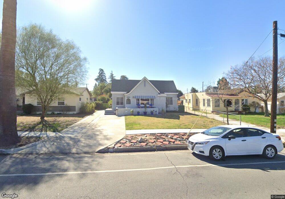
1026 E Brockton Ave Redlands, CA 92374
North Redlands NeighborhoodEstimated Value: $522,789 - $603,000
3
Beds
2
Baths
1,317
Sq Ft
$427/Sq Ft
Est. Value
About This Home
This home is located at 1026 E Brockton Ave, Redlands, CA 92374 and is currently estimated at $562,197, approximately $426 per square foot. 1026 E Brockton Ave is a home located in San Bernardino County with nearby schools including Franklin Elementary School, Clement Middle School, and Redlands East Valley High School.
Ownership History
Date
Name
Owned For
Owner Type
Purchase Details
Closed on
Oct 5, 2022
Sold by
Slaughter Marja Christine
Bought by
Maria C Slaughter Living Trust
Current Estimated Value
Purchase Details
Closed on
Feb 23, 2022
Sold by
Michele Buirge Danielle
Bought by
Danielle Buirge Living Trust
Purchase Details
Closed on
May 29, 2021
Sold by
Slaughter Marja Christine and Paul Joseph Kelly Jr Trust
Bought by
Buirge Danielle Michele and Slaughter Marja Christine
Purchase Details
Closed on
Feb 25, 2021
Sold by
Kelly Paul J
Bought by
Slaughter Marja Christine and Paul Joseph Kelly Jr Trust
Create a Home Valuation Report for This Property
The Home Valuation Report is an in-depth analysis detailing your home's value as well as a comparison with similar homes in the area
Home Values in the Area
Average Home Value in this Area
Purchase History
| Date | Buyer | Sale Price | Title Company |
|---|---|---|---|
| Maria C Slaughter Living Trust | -- | -- | |
| Danielle Buirge Living Trust | -- | Elder And Disability Law Firm | |
| Buirge Danielle Michele | -- | None Available | |
| Slaughter Marja Christine | -- | None Available |
Source: Public Records
Tax History
| Year | Tax Paid | Tax Assessment Tax Assessment Total Assessment is a certain percentage of the fair market value that is determined by local assessors to be the total taxable value of land and additions on the property. | Land | Improvement |
|---|---|---|---|---|
| 2025 | $1,271 | $99,339 | $15,546 | $83,793 |
| 2024 | $1,190 | $97,391 | $15,241 | $82,150 |
| 2023 | $1,188 | $95,481 | $14,942 | $80,539 |
| 2022 | $1,198 | $93,609 | $14,649 | $78,960 |
| 2021 | $1,220 | $93,960 | $14,642 | $79,318 |
| 2020 | $1,115 | $92,997 | $14,492 | $78,505 |
| 2019 | $1,083 | $91,174 | $14,208 | $76,966 |
| 2018 | $1,055 | $89,386 | $13,929 | $75,457 |
| 2017 | $1,045 | $87,633 | $13,656 | $73,977 |
| 2016 | $1,032 | $85,914 | $13,388 | $72,526 |
| 2015 | $1,023 | $84,624 | $13,187 | $71,437 |
| 2014 | $1,004 | $82,967 | $12,929 | $70,038 |
Source: Public Records
Map
Nearby Homes
- 1017 E Colton Ave
- 259 East Dr
- 853 Railway Ln
- 873 Railway Ln
- 848 Railway Ln
- 1174 Benbow Place
- 1331 Century St
- 632 Church St
- 620 Church St Unit 6
- 610 E Lugonia Ave Unit 4
- 0 E Lugonia Ave
- 1251 E Lugonia Ave Unit 109
- 1251 E Lugonia Ave Unit 27
- 1251 E Lugonia Ave Unit 24
- 1251 E Lugonia Ave Unit 18
- 1251 E Lugonia Ave Unit 75
- 1429 Berkeley Dr
- 1322 Campus Ave
- 1326 Campus Ave
- 323 E Colton Ave
- 1030 E Brockton Ave
- 1022 E Brockton Ave
- 1018 E Brockton Ave
- 1014 E Brockton Ave
- 1016 E Brockton Ave
- 1021 N University St
- 1011 N University St
- 1031 Campus Ave
- 1012 E Brockton Ave
- 1017 Campus Ave
- 1007 N University St
- 1013 Campus Ave
- 1008 E Brockton Ave
- 1017 E Brockton Ave
- 1011 Campus Ave
- 1003 N University St
- 1030 Occidental Dr
- 1024 Occidental Dr
- 1007 Campus Ave
- 1004 Occidental Dr
Your Personal Tour Guide
Ask me questions while you tour the home.