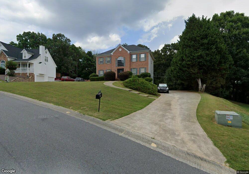
1026 Fieldstone Dr Unit 1 Canton, GA 30114
Estimated Value: $421,996 - $437,000
3
Beds
3
Baths
2,188
Sq Ft
$196/Sq Ft
Est. Value
About This Home
This home is located at 1026 Fieldstone Dr Unit 1, Canton, GA 30114 and is currently estimated at $429,498, approximately $196 per square foot. 1026 Fieldstone Dr Unit 1 is a home located in Cherokee County with nearby schools including J. Knox Elementary School, Teasley Middle School, and Cherokee High School.
Ownership History
Date
Name
Owned For
Owner Type
Purchase Details
Closed on
Jun 30, 2000
Sold by
Woodford Raymond W and Woodford Elizabeth A
Bought by
Bamigboye Sam B and Bamigboye Bosede T
Current Estimated Value
Home Financials for this Owner
Home Financials are based on the most recent Mortgage that was taken out on this home.
Original Mortgage
$140,400
Outstanding Balance
$49,063
Interest Rate
8.3%
Mortgage Type
New Conventional
Estimated Equity
$380,435
Purchase Details
Closed on
Dec 23, 1997
Sold by
Coker Homes Inc
Bought by
Woodford Raymond W and Woodford Elizabeth Ann
Home Financials for this Owner
Home Financials are based on the most recent Mortgage that was taken out on this home.
Original Mortgage
$159,100
Interest Rate
7.18%
Mortgage Type
VA
Create a Home Valuation Report for This Property
The Home Valuation Report is an in-depth analysis detailing your home's value as well as a comparison with similar homes in the area
Home Values in the Area
Average Home Value in this Area
Purchase History
| Date | Buyer | Sale Price | Title Company |
|---|---|---|---|
| Bamigboye Sam B | $175,500 | -- | |
| Woodford Raymond W | $154,500 | -- |
Source: Public Records
Mortgage History
| Date | Status | Borrower | Loan Amount |
|---|---|---|---|
| Open | Bamigboye Sam B | $140,400 | |
| Previous Owner | Woodford Raymond W | $159,100 |
Source: Public Records
Tax History Compared to Growth
Tax History
| Year | Tax Paid | Tax Assessment Tax Assessment Total Assessment is a certain percentage of the fair market value that is determined by local assessors to be the total taxable value of land and additions on the property. | Land | Improvement |
|---|---|---|---|---|
| 2025 | $3,650 | $157,064 | $34,000 | $123,064 |
| 2024 | $3,578 | $154,524 | $34,000 | $120,524 |
| 2023 | $3,215 | $157,960 | $34,000 | $123,960 |
| 2022 | $2,891 | $120,280 | $26,000 | $94,280 |
| 2021 | $2,682 | $100,920 | $22,400 | $78,520 |
| 2020 | $2,459 | $91,240 | $20,000 | $71,240 |
| 2019 | $2,358 | $86,880 | $20,000 | $66,880 |
| 2018 | $2,224 | $80,600 | $14,800 | $65,800 |
| 2017 | $1,957 | $175,500 | $14,800 | $55,400 |
| 2016 | $1,966 | $174,600 | $14,800 | $55,040 |
| 2015 | $1,976 | $173,800 | $14,800 | $54,720 |
| 2014 | $1,796 | $158,200 | $14,800 | $48,480 |
Source: Public Records
Map
Nearby Homes
- 320 River Green Ave
- 208 Westbury Ct
- 7840 Knox Bridge Hwy
- 708 Woodlake Ct
- 616 Parkview Dr
- 150 Jaime Dr
- 1209 Lakeside Overlook
- 405 Trumpet Cir
- 537 Oriole Farm Trail Unit 4L
- 117 Market Ln
- 845 Lakemont Dr
- 331 Oakview Way
- 222 Patti Place
- 609 Arches Park Ln
- 710 Bedford Trace Unit 3
- 619 River Bend Way
- 234 Oakview Dr
- 119 Oakview Passage
- 993 Woodbury Rd
- 106 Woodbury Ln
- 1030 Fieldstone Dr
- 330 Saddle Wood Dr Unit 1
- 1034 Fieldstone Dr Unit 1
- 201 Stonegate Ct
- 304 Saddle Wood Dr Unit 94
- 304 Saddle Wood Dr
- 349 Saddle Wood Dr
- 1031 Fieldstone Dr Unit 1
- 304 304 Saddlewood Dr
- 1029 Fieldstone Dr Unit 1
- 1035 Fieldstone Dr
- 205 Stonegate Ct
- 328 Saddle Wood Dr
- 328 Saddlewood Dr
- 308 Saddle Wood Dr
- 216 Stonegate Ct
- 1039 Fieldstone Dr Unit 1
- 301 Saddlewood Dr
- 345 Saddle Wood Dr Unit 1
- 204 Stonegate Ct