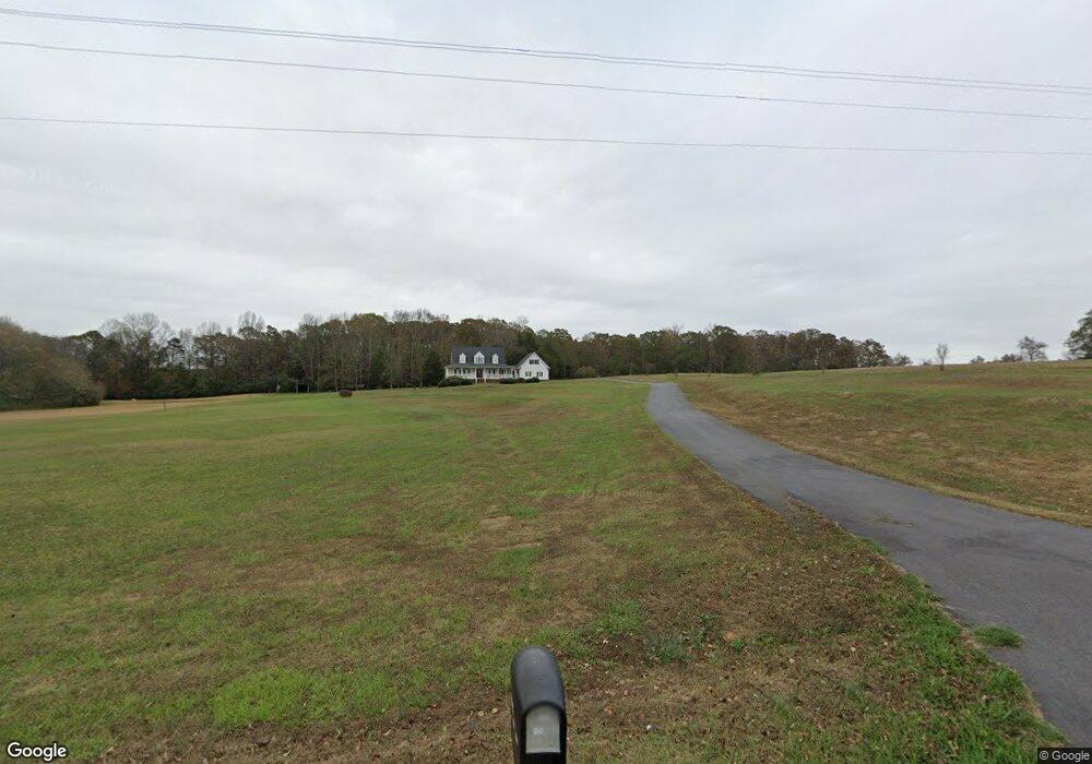
1026 Irvin Kirk Rd Danielsville, GA 30633
Estimated Value: $195,000 - $352,000
--
Bed
1
Bath
1,626
Sq Ft
$163/Sq Ft
Est. Value
About This Home
This home is located at 1026 Irvin Kirk Rd, Danielsville, GA 30633 and is currently estimated at $265,084, approximately $163 per square foot. 1026 Irvin Kirk Rd is a home located in Madison County with nearby schools including Madison County High School.
Ownership History
Date
Name
Owned For
Owner Type
Purchase Details
Closed on
Jun 13, 2003
Sold by
Green Ray
Bought by
Green Linda F
Current Estimated Value
Purchase Details
Closed on
Feb 11, 2003
Sold by
Green Linda F
Bought by
Green Ray
Purchase Details
Closed on
Mar 24, 2000
Sold by
Freeman Linda W
Bought by
Green Linda F
Create a Home Valuation Report for This Property
The Home Valuation Report is an in-depth analysis detailing your home's value as well as a comparison with similar homes in the area
Home Values in the Area
Average Home Value in this Area
Purchase History
| Date | Buyer | Sale Price | Title Company |
|---|---|---|---|
| Green Linda F | -- | -- | |
| Green Ray | -- | -- | |
| Green Linda F | -- | -- | |
| Green Linda F | -- | -- |
Source: Public Records
Tax History Compared to Growth
Tax History
| Year | Tax Paid | Tax Assessment Tax Assessment Total Assessment is a certain percentage of the fair market value that is determined by local assessors to be the total taxable value of land and additions on the property. | Land | Improvement |
|---|---|---|---|---|
| 2024 | $1,942 | $74,619 | $47,858 | $26,761 |
| 2023 | $1,984 | $65,005 | $39,881 | $25,124 |
| 2022 | $1,381 | $50,061 | $27,419 | $22,642 |
| 2021 | $1,107 | $36,247 | $22,404 | $13,843 |
| 2020 | $1,014 | $32,988 | $19,145 | $13,843 |
| 2019 | $4,066 | $140,764 | $38,403 | $102,361 |
| 2018 | $3,907 | $135,274 | $35,135 | $100,139 |
| 2017 | $3,871 | $134,442 | $32,684 | $101,758 |
| 2016 | $3,186 | $120,983 | $32,684 | $88,299 |
| 2015 | $3,182 | $120,983 | $32,684 | $88,299 |
| 2014 | $3,055 | $116,040 | $29,416 | $86,625 |
| 2013 | -- | $116,040 | $29,416 | $86,625 |
Source: Public Records
Map
Nearby Homes
- 0 Irvin Kirk Rd
- 255 Hillwood Dr Unit 1
- 430 Sherwood Cir
- 105 Georgia 98
- 28 Acres Irvin Kirk Rd
- 1885 Highway 29 N
- 0 New Haven Church Rd Unit CL334534
- 0 New Haven Church Rd Unit 10566118
- 0 New Haven Church Rd Unit CL334526
- 0 New Haven Church Rd Unit 10566119
- 155 Mulberry Ln
- 170 Northridge Dr
- 150 Northridge Dr Unit 3
- 150 Northridge Dr
- 140 Northridge Dr
- 140 Northridge Dr Unit 6
- 112 Northridge Dr Unit 8
- 112 Northridge Dr
- 96 Northridge Dr Unit 10
- 96 Northridge Dr
- 0 Rocky Quarry Rd Unit 7336118
- 291 Rock Quarry Rd
- 1111 Irvin Kirk Rd
- 1035 Highway 29 N
- 1145 Highway 29 N
- 1225 Highway 29 N
- 44 Spring Lake Dr
- 1075 Highway 29 N
- 1176 Irvin Kirk Rd
- 40 Spring Lake Dr
- 11 Spring Lake Dr
- 12 Spring Lake Dr
- 8 Spring Lake Dr
- 10 Spring Lake Dr
- 9 Spring Lake Dr
- 212 Rock Quarry Rd
- Lot 2 Lake View Dr
- Lot 4 Lake View Dr
- Lot 6 Lake View Dr
- Lot 40 Lakeview Dr