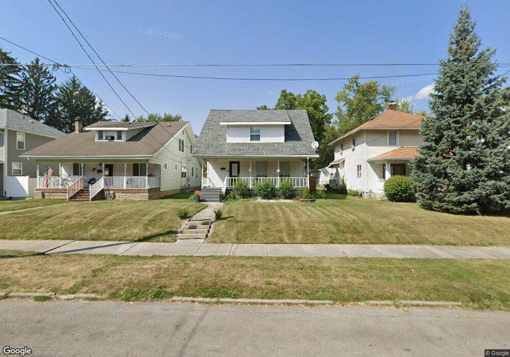
1026 Leland Ave Lima, OH 45805
Central Lima NeighborhoodEstimated Value: $92,822 - $202,000
3
Beds
1
Bath
1,550
Sq Ft
$86/Sq Ft
Est. Value
About This Home
This home is located at 1026 Leland Ave, Lima, OH 45805 and is currently estimated at $133,206, approximately $85 per square foot. 1026 Leland Ave is a home located in Allen County with nearby schools including Heritage Elementary School, Lima North Middle School, and Lima West Middle School.
Ownership History
Date
Name
Owned For
Owner Type
Purchase Details
Closed on
Jun 8, 2005
Sold by
Hurlburt Susan J and Hurlburt Leroy B
Bought by
Moore Robert A and Moore Janet L
Current Estimated Value
Home Financials for this Owner
Home Financials are based on the most recent Mortgage that was taken out on this home.
Original Mortgage
$68,900
Outstanding Balance
$36,224
Interest Rate
5.87%
Mortgage Type
New Conventional
Estimated Equity
$96,982
Purchase Details
Closed on
Feb 7, 1995
Sold by
Harr Ralph
Bought by
Hulburt Leroy and Hulburt Susan
Purchase Details
Closed on
Dec 31, 1990
Bought by
Harr Ralph S
Create a Home Valuation Report for This Property
The Home Valuation Report is an in-depth analysis detailing your home's value as well as a comparison with similar homes in the area
Home Values in the Area
Average Home Value in this Area
Purchase History
| Date | Buyer | Sale Price | Title Company |
|---|---|---|---|
| Moore Robert A | $68,900 | None Available | |
| Hulburt Leroy | $45,000 | -- | |
| Harr Ralph S | $36,500 | -- |
Source: Public Records
Mortgage History
| Date | Status | Borrower | Loan Amount |
|---|---|---|---|
| Open | Moore Robert A | $68,900 |
Source: Public Records
Tax History Compared to Growth
Tax History
| Year | Tax Paid | Tax Assessment Tax Assessment Total Assessment is a certain percentage of the fair market value that is determined by local assessors to be the total taxable value of land and additions on the property. | Land | Improvement |
|---|---|---|---|---|
| 2024 | $846 | $22,860 | $2,450 | $20,410 |
| 2023 | $847 | $20,030 | $2,140 | $17,890 |
| 2022 | $851 | $20,030 | $2,140 | $17,890 |
| 2021 | $902 | $20,030 | $2,140 | $17,890 |
| 2020 | $877 | $17,230 | $2,070 | $15,160 |
| 2019 | $877 | $17,230 | $2,070 | $15,160 |
| 2018 | $868 | $17,230 | $2,070 | $15,160 |
| 2017 | $880 | $17,230 | $2,070 | $15,160 |
| 2016 | $892 | $17,230 | $2,070 | $15,160 |
| 2015 | $927 | $17,230 | $2,070 | $15,160 |
| 2014 | $927 | $17,680 | $2,170 | $15,510 |
| 2013 | $902 | $17,680 | $2,170 | $15,510 |
Source: Public Records
Map
Nearby Homes
- 1023 Leland Ave
- 1120 Richie Ave
- 618 Woodward Ave
- 1206 Rice Ave
- 648 Hazel Ave
- 638 Hazel Ave
- 631 Hazel Ave
- 676 Cortlandt Ave
- 1036 W High St
- 576 Cortlandt Ave
- 745 Brice Ave
- 1116 Belvidere Ave
- 1517 Allentown Rd
- 0 Sherman Ave
- 621 Fairfield Dr
- 708 N Metcalf St
- 612 N Metcalf St
- 849 Runyan Ave
- 627 Brice Ave
- 434 N Washington St
- 1012 Leland Ave
- 1028 Leland Ave
- 1008 Leland Ave
- 1019 Hazel Ave
- 1015 Hazel Ave
- 1023 Hazel Ave
- 1002 Leland Ave
- 809 N Charles St
- 1017 Leland Ave
- 823 N Charles St
- 1021 Leland Ave
- 1009 Leland Ave
- 1015 Leland Ave
- 720 N Jameson Ave
- 1003 Leland Ave
- 815 N Charles St
- 950 Leland Ave
- 714 N Jameson Ave
- 812 N Charles St
- 719 N Charles St