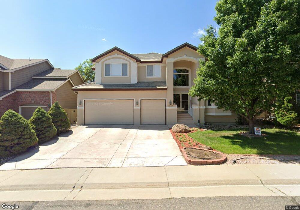
1026 Monroe Way Superior, CO 80027
Estimated Value: $1,102,903 - $1,224,000
4
Beds
4
Baths
3,287
Sq Ft
$358/Sq Ft
Est. Value
About This Home
This home is located at 1026 Monroe Way, Superior, CO 80027 and is currently estimated at $1,177,976, approximately $358 per square foot. 1026 Monroe Way is a home located in Boulder County with nearby schools including Eldorado K-8 School, Superior Elementary School, and Monarch High School.
Ownership History
Date
Name
Owned For
Owner Type
Purchase Details
Closed on
May 21, 2021
Sold by
Lencioni Letha C and Lencioni Sheldon C
Bought by
Myers Anthony Lee and Myers Yen Lin
Current Estimated Value
Home Financials for this Owner
Home Financials are based on the most recent Mortgage that was taken out on this home.
Original Mortgage
$800,000
Outstanding Balance
$723,866
Interest Rate
3%
Mortgage Type
New Conventional
Estimated Equity
$454,110
Purchase Details
Closed on
Jan 29, 1999
Sold by
Golden Design Group Inc
Bought by
Lencioni Sheldon C
Home Financials for this Owner
Home Financials are based on the most recent Mortgage that was taken out on this home.
Original Mortgage
$227,000
Interest Rate
6.68%
Purchase Details
Closed on
Mar 24, 1993
Bought by
Lencioni Letha C and Lencioni Sheldon C
Create a Home Valuation Report for This Property
The Home Valuation Report is an in-depth analysis detailing your home's value as well as a comparison with similar homes in the area
Home Values in the Area
Average Home Value in this Area
Purchase History
| Date | Buyer | Sale Price | Title Company |
|---|---|---|---|
| Myers Anthony Lee | $1,000,000 | Land Title Guarantee | |
| Lencioni Sheldon C | $409,560 | -- | |
| Lencioni Letha C | -- | -- |
Source: Public Records
Mortgage History
| Date | Status | Borrower | Loan Amount |
|---|---|---|---|
| Open | Myers Anthony Lee | $800,000 | |
| Previous Owner | Lencioni Sheldon C | $227,000 |
Source: Public Records
Tax History
| Year | Tax Paid | Tax Assessment Tax Assessment Total Assessment is a certain percentage of the fair market value that is determined by local assessors to be the total taxable value of land and additions on the property. | Land | Improvement |
|---|---|---|---|---|
| 2025 | $8,043 | $75,107 | $23,588 | $51,519 |
| 2024 | $8,043 | $75,107 | $23,588 | $51,519 |
| 2023 | $7,932 | $77,620 | $20,850 | $60,454 |
| 2022 | $6,092 | $58,241 | $16,485 | $41,756 |
| 2021 | $5,784 | $64,429 | $18,240 | $46,189 |
| 2020 | $5,957 | $56,700 | $18,733 | $37,967 |
| 2019 | $5,875 | $56,700 | $18,733 | $37,967 |
| 2018 | $5,686 | $54,360 | $12,960 | $41,400 |
| 2017 | $5,811 | $60,098 | $14,328 | $45,770 |
| 2016 | $5,854 | $52,902 | $13,373 | $39,529 |
| 2015 | $5,564 | $44,058 | $16,477 | $27,581 |
| 2014 | -- | $44,058 | $16,477 | $27,581 |
Source: Public Records
Map
Nearby Homes
- 1009 Monarch Way
- 977 Eldorado Dr
- 882 Eldorado Dr
- 1302 Eldorado Dr
- 2280 Clayton Cir
- 743 Eaton Cir
- 1077 Rand Way
- 2515 Andrew Dr
- 2485 Andrew Dr
- 2387 Bristol St
- 2732 Flint Ct
- 390 Andrew Way
- 2457 Ajax Ct
- 1747 Reliance Cir
- 2713 Slate Ct
- 2855 Rock Creek Cir Unit 211
- 2927 W Yarrow Cir
- 2750 Calmante Cir
- 2790 Calmante Cir
- 1244 S Weldona Ln
- 1046 Monroe Way
- 1016 Monroe Way
- 1089 Monarch Way
- 1049 Monarch Way
- 1006 Monroe Way
- 1021 Monroe Way
- 1029 Monarch Way
- 1041 Monroe Way
- 1001 Monroe Way
- 2124 Lasalle St
- 2144 Lasalle St
- 986 Monroe Way
- 2104 Lasalle St
- 2164 Lasalle St
- 981 Monroe Way
- 2059 Lasalle St
- 2219 Lasalle St
- 2084 Lasalle St
- 2184 Lasalle St
- 989 Monarch Way
Your Personal Tour Guide
Ask me questions while you tour the home.