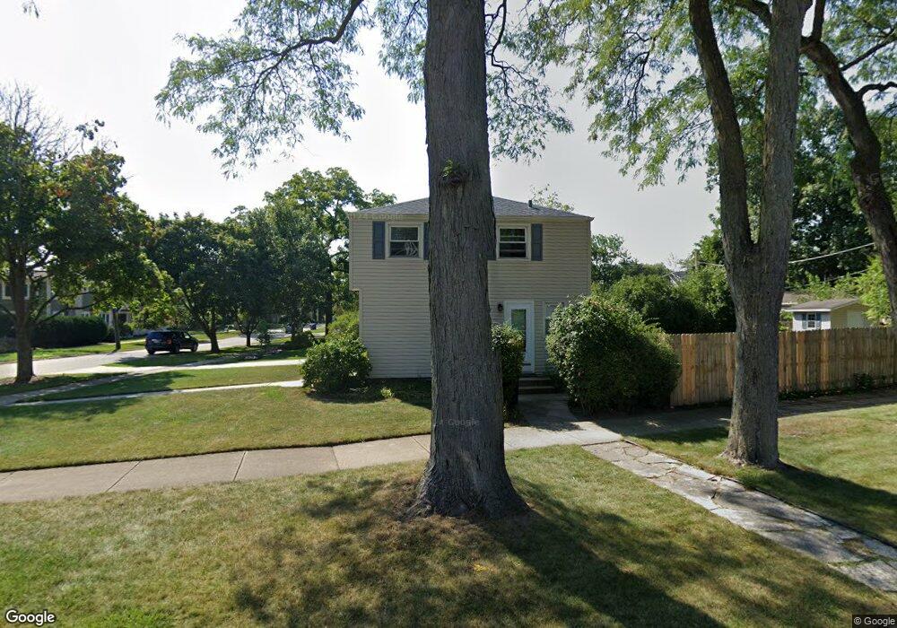
1026 Somerset Ave Deerfield, IL 60015
Estimated Value: $401,443 - $513,000
3
Beds
2
Baths
1,200
Sq Ft
$372/Sq Ft
Est. Value
About This Home
This home is located at 1026 Somerset Ave, Deerfield, IL 60015 and is currently estimated at $446,111, approximately $371 per square foot. 1026 Somerset Ave is a home located in Lake County with nearby schools including Walden Elementary School, Alan B Shepard Middle School, and Deerfield High School.
Ownership History
Date
Name
Owned For
Owner Type
Purchase Details
Closed on
Nov 13, 2023
Sold by
Doherty Mary Ann
Bought by
Mary Ann Doherty Revocable Trust and Doherty
Current Estimated Value
Purchase Details
Closed on
Jul 12, 1998
Sold by
Leeds Norman H and Leeds Joyce O
Bought by
Doherty Mary Ann
Home Financials for this Owner
Home Financials are based on the most recent Mortgage that was taken out on this home.
Original Mortgage
$168,300
Interest Rate
7.13%
Create a Home Valuation Report for This Property
The Home Valuation Report is an in-depth analysis detailing your home's value as well as a comparison with similar homes in the area
Home Values in the Area
Average Home Value in this Area
Purchase History
| Date | Buyer | Sale Price | Title Company |
|---|---|---|---|
| Mary Ann Doherty Revocable Trust | -- | None Listed On Document | |
| Doherty Mary Ann | $187,000 | First American Title |
Source: Public Records
Mortgage History
| Date | Status | Borrower | Loan Amount |
|---|---|---|---|
| Previous Owner | Doherty Mary Ann | $168,300 |
Source: Public Records
Tax History Compared to Growth
Tax History
| Year | Tax Paid | Tax Assessment Tax Assessment Total Assessment is a certain percentage of the fair market value that is determined by local assessors to be the total taxable value of land and additions on the property. | Land | Improvement |
|---|---|---|---|---|
| 2024 | $8,658 | $104,190 | $31,770 | $72,420 |
| 2023 | $9,376 | $99,990 | $30,489 | $69,501 |
| 2022 | $9,376 | $104,955 | $32,750 | $72,205 |
| 2021 | $11,043 | $124,980 | $31,575 | $93,405 |
| 2020 | $10,621 | $125,243 | $31,641 | $93,602 |
| 2019 | $10,380 | $125,030 | $31,587 | $93,443 |
| 2018 | $9,847 | $123,670 | $33,480 | $90,190 |
| 2017 | $9,768 | $123,275 | $33,373 | $89,902 |
| 2016 | $9,492 | $118,613 | $32,111 | $86,502 |
| 2015 | $9,289 | $111,447 | $30,171 | $81,276 |
| 2014 | $8,811 | $104,614 | $30,386 | $74,228 |
| 2012 | $8,603 | $103,691 | $30,118 | $73,573 |
Source: Public Records
Map
Nearby Homes
- 1045 Fairoaks Ave
- 1103 Hazel Ave
- 970 Ivy Ln Unit C
- 904 Forest Ave
- 934 Wayne Ave
- 1131 Linden Ave
- 745 Price Ln
- 1423 Northwoods Rd
- 926 Cedar St
- 1265 Woodland Dr
- 1410 Berkley Ct
- 1504 Wincanton Dr
- 1009 Central Ave
- 816 Appletree Ln
- 505 Margate Terrace
- 1038 Brookside Ln
- 956 Brookside Ln
- 677 Timber Hill Rd
- 610 Robert York Ave Unit 104
- 1127 Kenton Rd
- 1034 Somerset Ave
- 1038 Somerset Ave
- 1124 Forest Ave
- 1107 Forest Ave
- 1058 Forest Ave
- 1067 Forest Ave
- 1044 Somerset Ave
- 1063 Forest Ave
- 1057 Sheridan Rd
- 1023 Fairoaks Ave
- 1052 Forest Ave
- 1059 Forest Ave
- 1051 Sheridan Rd
- 1051 Sheridan Ave
- 1051 Fairoaks Ave
- 1055 Forest Ave
- 1047 Sheridan Rd
- 1046 Forest Ave
- 1055 Fairoaks Ave