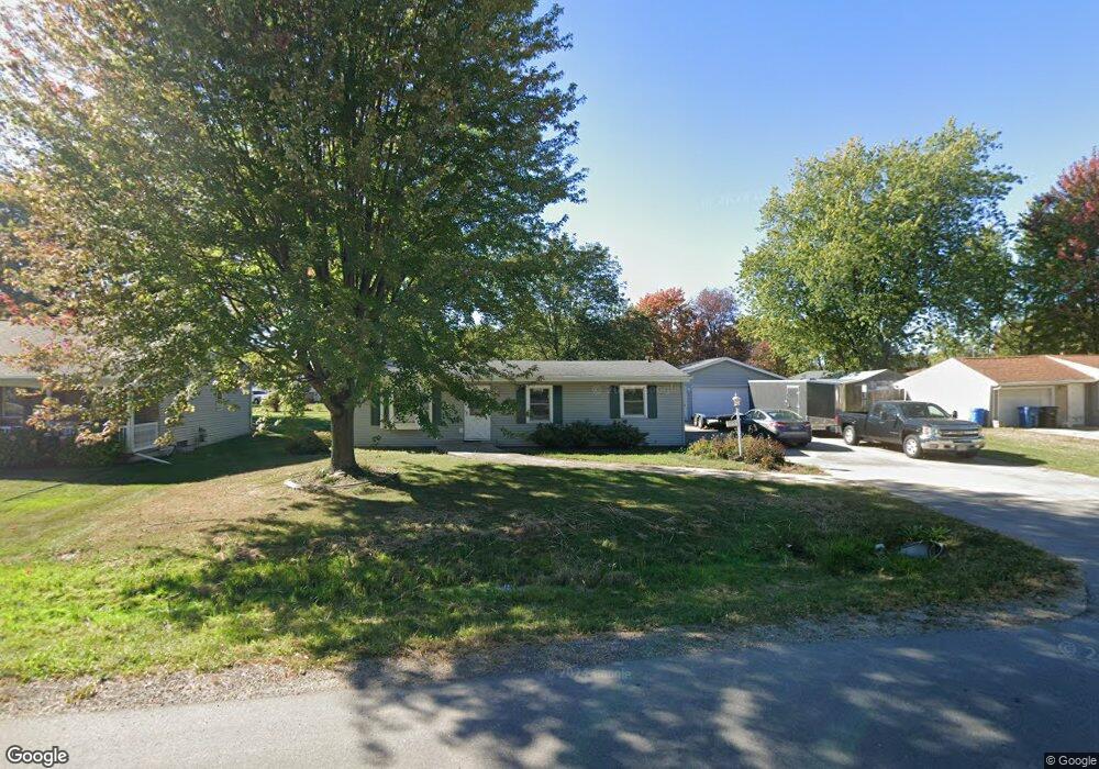
1026 Stead Dr Menasha, WI 54952
Estimated Value: $241,573 - $263,000
--
Bed
--
Bath
--
Sq Ft
0.3
Acres
About This Home
This home is located at 1026 Stead Dr, Menasha, WI 54952 and is currently estimated at $251,643. 1026 Stead Dr is a home located in Winnebago County with nearby schools including Menasha High School, St. Mary Elementary School, and St. John the Baptist School.
Ownership History
Date
Name
Owned For
Owner Type
Purchase Details
Closed on
Dec 21, 2020
Sold by
Blohm Family Irrevocable Trust
Bought by
Wolf Scott
Current Estimated Value
Home Financials for this Owner
Home Financials are based on the most recent Mortgage that was taken out on this home.
Original Mortgage
$100,395
Outstanding Balance
$89,541
Interest Rate
2.8%
Mortgage Type
New Conventional
Estimated Equity
$162,102
Purchase Details
Closed on
Sep 26, 2014
Sold by
Blohm Sandra L
Bought by
Blohm Family Irrevocable Trust
Purchase Details
Closed on
Nov 10, 2005
Sold by
Tesch Cal L and Tesch Cathy M
Bought by
Benjamin L
Create a Home Valuation Report for This Property
The Home Valuation Report is an in-depth analysis detailing your home's value as well as a comparison with similar homes in the area
Home Values in the Area
Average Home Value in this Area
Purchase History
| Date | Buyer | Sale Price | Title Company |
|---|---|---|---|
| Wolf Scott | $103,500 | First American Title | |
| Blohm Family Irrevocable Trust | -- | None Available | |
| Benjamin L | $121,000 | None Available |
Source: Public Records
Mortgage History
| Date | Status | Borrower | Loan Amount |
|---|---|---|---|
| Open | Wolf Scott | $100,395 |
Source: Public Records
Tax History Compared to Growth
Tax History
| Year | Tax Paid | Tax Assessment Tax Assessment Total Assessment is a certain percentage of the fair market value that is determined by local assessors to be the total taxable value of land and additions on the property. | Land | Improvement |
|---|---|---|---|---|
| 2024 | $3,578 | $219,900 | $26,600 | $193,300 |
| 2023 | $3,580 | $205,300 | $26,600 | $178,700 |
| 2022 | $3,452 | $183,100 | $26,600 | $156,500 |
| 2021 | $3,144 | $159,200 | $26,600 | $132,600 |
| 2020 | $3,314 | $147,700 | $26,600 | $121,100 |
| 2019 | $2,949 | $137,300 | $26,600 | $110,700 |
| 2018 | $2,688 | $122,400 | $26,600 | $95,800 |
| 2017 | $2,673 | $122,400 | $26,600 | $95,800 |
| 2016 | $2,622 | $116,600 | $26,600 | $90,000 |
| 2015 | $2,428 | $116,600 | $26,600 | $90,000 |
| 2014 | -- | $116,600 | $26,600 | $90,000 |
| 2013 | -- | $0 | $0 | $0 |
Source: Public Records
Map
Nearby Homes
- 1103 Stead Dr
- 910 Meadowview Dr
- 1008 Meadowview Dr
- 1079 Bartlein Ct
- 1450 Plank Rd
- 1236 Meadowview Dr
- 1124 Woodland Dr
- 1025 Oneida St
- 0 Oneida St
- 1025 Woodland Dr
- 1121 Alva St
- 845 Woodland Dr
- W6794 State Road 10 114
- 1208 Grove St
- 1327 Province Terrace
- 2000 Dreamfield Ln
- 1040 Grove St
- 828 Arthur St
- 1029 London St
- N8811 Hwy 10 & 114