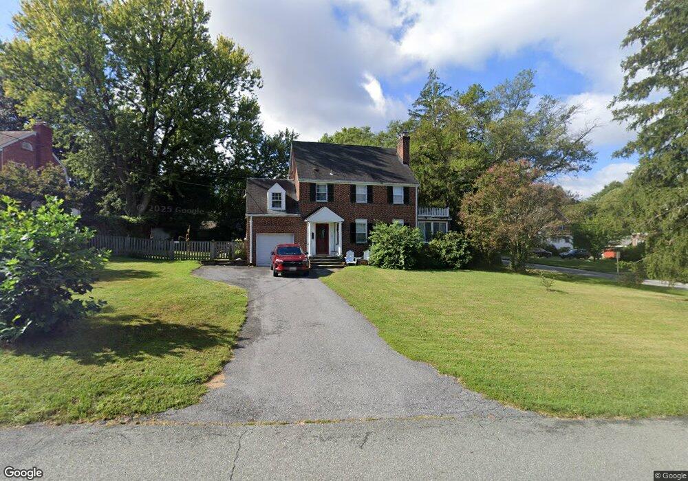
1026 Woodside Pkwy Silver Spring, MD 20910
Estimated Value: $888,250 - $1,160,000
4
Beds
3
Baths
2,482
Sq Ft
$416/Sq Ft
Est. Value
About This Home
This home is located at 1026 Woodside Pkwy, Silver Spring, MD 20910 and is currently estimated at $1,033,313, approximately $416 per square foot. 1026 Woodside Pkwy is a home located in Montgomery County with nearby schools including Woodlin Elementary School, Sligo Middle School, and Albert Einstein High School.
Ownership History
Date
Name
Owned For
Owner Type
Purchase Details
Closed on
Mar 3, 2006
Sold by
Liberatore Stephen A
Bought by
Liberatore Virginia B Tr
Current Estimated Value
Purchase Details
Closed on
Feb 9, 2006
Sold by
Liberatore Stephen A
Bought by
Liberatore Virginia B Tr
Purchase Details
Closed on
Mar 4, 2004
Sold by
Dickson Frances C
Bought by
Liberatore Stephen A
Create a Home Valuation Report for This Property
The Home Valuation Report is an in-depth analysis detailing your home's value as well as a comparison with similar homes in the area
Home Values in the Area
Average Home Value in this Area
Purchase History
| Date | Buyer | Sale Price | Title Company |
|---|---|---|---|
| Liberatore Virginia B Tr | -- | -- | |
| Liberatore Virginia B Tr | -- | -- | |
| Liberatore Virginia B Tr | -- | -- | |
| Liberatore Virginia B Tr | -- | -- | |
| Liberatore Stephen A | $346,000 | -- |
Source: Public Records
Tax History Compared to Growth
Tax History
| Year | Tax Paid | Tax Assessment Tax Assessment Total Assessment is a certain percentage of the fair market value that is determined by local assessors to be the total taxable value of land and additions on the property. | Land | Improvement |
|---|---|---|---|---|
| 2025 | $8,731 | $710,367 | -- | -- |
| 2024 | $8,731 | $694,900 | $362,300 | $332,600 |
| 2023 | $7,515 | $651,300 | $0 | $0 |
| 2022 | $6,667 | $607,700 | $0 | $0 |
| 2021 | $6,085 | $564,100 | $362,300 | $201,800 |
| 2020 | $6,085 | $564,100 | $362,300 | $201,800 |
| 2019 | $6,049 | $564,100 | $362,300 | $201,800 |
| 2018 | $6,149 | $575,000 | $362,300 | $212,700 |
| 2017 | $6,238 | $573,633 | $0 | $0 |
| 2016 | $5,752 | $572,267 | $0 | $0 |
| 2015 | $5,752 | $570,900 | $0 | $0 |
| 2014 | $5,752 | $567,367 | $0 | $0 |
Source: Public Records
Map
Nearby Homes
- 1102 Dale Dr
- 9207 Colesville Rd
- 709 Greyrock Dr
- 1202 Burton St
- 700 Roeder Rd Unit 405
- 8613 Cedar St
- 617 Greenbrier Dr
- 9127 Sligo Creek Pkwy
- 8920 Courts Way
- 9407 Colesville Rd
- 1432 Crestridge Dr
- 1320 Fenwick Ln Unit 7
- 1320 Fenwick Ln Unit 606
- 1320 Fenwick Ln Unit 805
- 1320 Fenwick Ln Unit 203
- 1412 Crestridge Dr
- 1409 Crestridge Dr
- 8802 2nd Ave
- 9624 Brunett Ave
- 9039 Sligo Creek Pkwy Unit 806
- 9029 Fairview Rd
- 1022 Woodside Pkwy
- 9025 Fairview Rd
- 1020 Woodside Pkwy
- 9032 Fairview Rd
- 1025 Woodside Pkwy
- 1023 Woodside Pkwy
- 1018 Woodside Pkwy
- 9023 Fairview Rd
- 1017 N Mansion Dr
- 9028 Fairview Rd
- 1104 Woodside Pkwy
- 1021 Woodside Pkwy
- 9026 Fairview Rd
- 1011 N Mansion Dr
- 1014 Woodside Pkwy
- 9105 Fairview Rd
- 1019 Woodside Pkwy
- 9022 Fairview Rd
- 1101 Woodside Pkwy