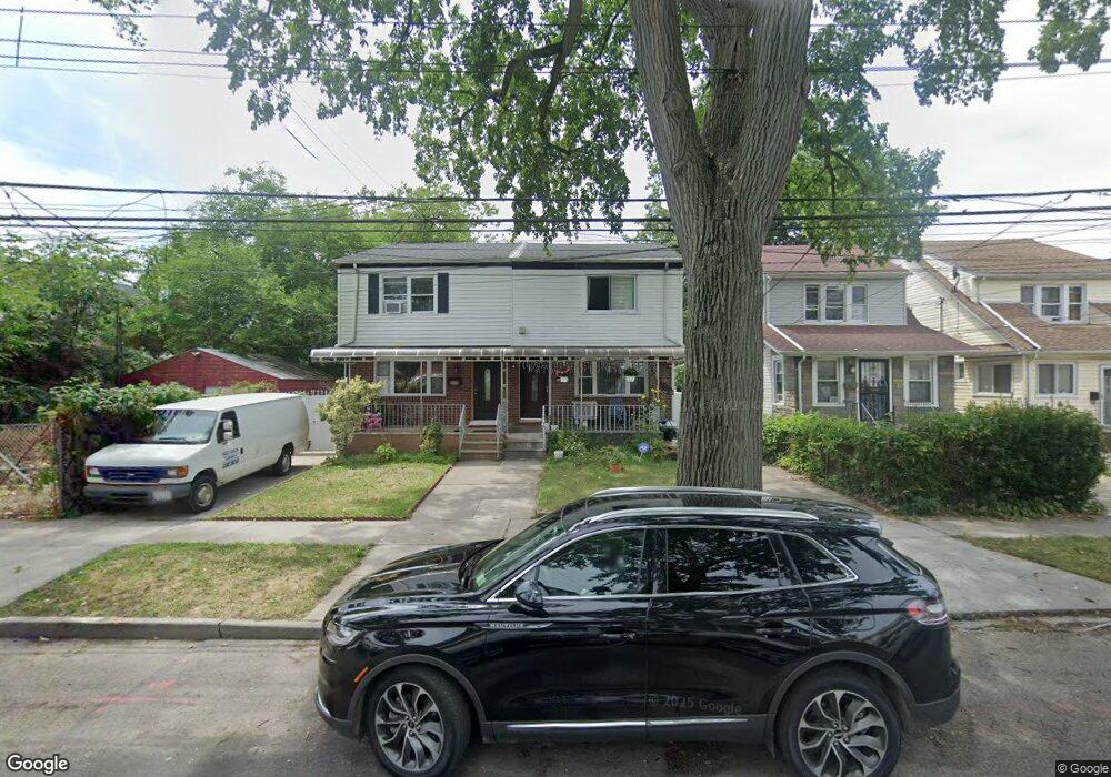
10260 189th St Hollis, NY 11423
Hollis NeighborhoodEstimated Value: $521,464 - $578,000
--
Bed
--
Bath
1,292
Sq Ft
$430/Sq Ft
Est. Value
About This Home
This home is located at 10260 189th St, Hollis, NY 11423 and is currently estimated at $555,866, approximately $430 per square foot. 10260 189th St is a home located in Queens County with nearby schools including P.S. 118 Lorraine Hansberry, I.S. 192 The Linden, and Wellspring Elementary & Middle.
Ownership History
Date
Name
Owned For
Owner Type
Purchase Details
Closed on
Dec 29, 2005
Sold by
Foster Anna M
Bought by
Ahmed Mushtaq
Current Estimated Value
Home Financials for this Owner
Home Financials are based on the most recent Mortgage that was taken out on this home.
Original Mortgage
$314,100
Interest Rate
6.28%
Mortgage Type
Purchase Money Mortgage
Purchase Details
Closed on
Jun 28, 2001
Sold by
Foster Fred L and Foster Anna
Bought by
Foster Fred L (Trustee) and Foster Anna M (Trustee)
Create a Home Valuation Report for This Property
The Home Valuation Report is an in-depth analysis detailing your home's value as well as a comparison with similar homes in the area
Home Values in the Area
Average Home Value in this Area
Purchase History
| Date | Buyer | Sale Price | Title Company |
|---|---|---|---|
| Ahmed Mushtaq | $349,000 | -- | |
| Foster Fred L (Trustee) | -- | -- |
Source: Public Records
Mortgage History
| Date | Status | Borrower | Loan Amount |
|---|---|---|---|
| Previous Owner | Ahmed Mushtaq | $314,100 |
Source: Public Records
Tax History Compared to Growth
Tax History
| Year | Tax Paid | Tax Assessment Tax Assessment Total Assessment is a certain percentage of the fair market value that is determined by local assessors to be the total taxable value of land and additions on the property. | Land | Improvement |
|---|---|---|---|---|
| 2025 | $2,298 | $27,217 | $8,941 | $18,276 |
| 2024 | $2,310 | $25,678 | $9,039 | $16,639 |
| 2023 | $2,239 | $25,100 | $7,452 | $17,648 |
| 2022 | $2,128 | $31,080 | $10,920 | $20,160 |
| 2021 | $2,189 | $31,680 | $10,920 | $20,760 |
| 2020 | $4,505 | $28,440 | $10,920 | $17,520 |
| 2019 | $4,183 | $31,320 | $10,920 | $20,400 |
| 2018 | $3,966 | $20,917 | $8,711 | $12,206 |
| 2017 | $3,810 | $20,160 | $10,920 | $9,240 |
| 2016 | $3,624 | $20,160 | $10,920 | $9,240 |
| 2015 | $2,120 | $18,901 | $9,891 | $9,010 |
| 2014 | $2,120 | $17,832 | $10,982 | $6,850 |
Source: Public Records
Map
Nearby Homes
- 10220 189th St
- 102-35 187th St
- 10211 187th St
- 190-30 103rd Ave
- 185-05 Henderson Ave
- 184-15 Henderson Ave
- 188-14 Woodhull Ave
- 10533 Farmers Blvd
- 102-13 183rd Place
- 188-09 Jamaica Ave
- 19027 109th Rd
- 10532 192nd St
- 187-23 Brinkerhoff Ave
- 104-40 194th St
- 194-10 Hollis Ave
- 90-45 186th St
- 193-21 109th Rd
- 19319 109th Rd
- 90-62 187th St
- 184-09 Jamaica Ave
- 10258 189th St
- 10254 189th St
- 102-54 189th St
- 189 189 Tice Rd
- 10252 189th St
- 10250 189th St
- 18813 104th Ave
- 10255 188th St
- 10246 189th St
- 10253 188th St
- 10257 188th St
- 10249 188th St
- 18817 104th Ave
- 18811 104th Ave
- 18819 104th Ave
- 10253 188th St
- 10253 188th St
- 102-58 189th St
- 10247 188th St
- 10244 189th St