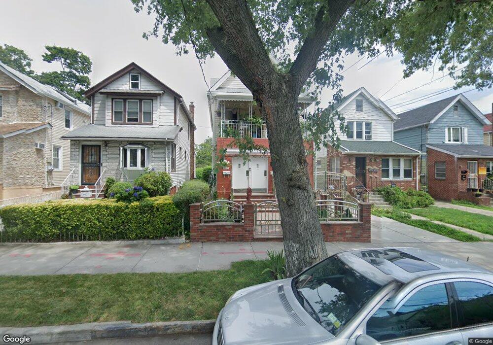
10263 189th St Hollis, NY 11423
Hollis NeighborhoodEstimated Value: $799,274 - $963,000
--
Bed
--
Bath
1,760
Sq Ft
$513/Sq Ft
Est. Value
About This Home
This home is located at 10263 189th St, Hollis, NY 11423 and is currently estimated at $903,069, approximately $513 per square foot. 10263 189th St is a home located in Queens County with nearby schools including P.S. 118 Lorraine Hansberry, I.S. 192 The Linden, and Wellspring Elementary & Middle.
Ownership History
Date
Name
Owned For
Owner Type
Purchase Details
Closed on
Oct 14, 2001
Sold by
Basnight Dorothy M and Jackson Edmund
Bought by
Basnight Dorothy M and Jackson Edmund
Current Estimated Value
Purchase Details
Closed on
Jul 25, 2001
Sold by
A J S Holding Corp
Bought by
Basnight Dorothy M and Jackson Edmund
Home Financials for this Owner
Home Financials are based on the most recent Mortgage that was taken out on this home.
Original Mortgage
$310,550
Interest Rate
6.99%
Purchase Details
Closed on
Apr 19, 2001
Sold by
Sellow William J
Bought by
A J S Holding Corp
Purchase Details
Closed on
Jul 28, 2000
Sold by
Sellow William
Bought by
Sellow William
Create a Home Valuation Report for This Property
The Home Valuation Report is an in-depth analysis detailing your home's value as well as a comparison with similar homes in the area
Home Values in the Area
Average Home Value in this Area
Purchase History
| Date | Buyer | Sale Price | Title Company |
|---|---|---|---|
| Basnight Dorothy M | -- | -- | |
| Basnight Dorothy M | -- | -- | |
| A J S Holding Corp | -- | -- | |
| Sellow William | -- | -- |
Source: Public Records
Mortgage History
| Date | Status | Borrower | Loan Amount |
|---|---|---|---|
| Previous Owner | Basnight Dorothy M | $310,550 |
Source: Public Records
Tax History Compared to Growth
Tax History
| Year | Tax Paid | Tax Assessment Tax Assessment Total Assessment is a certain percentage of the fair market value that is determined by local assessors to be the total taxable value of land and additions on the property. | Land | Improvement |
|---|---|---|---|---|
| 2025 | $4,926 | $28,423 | $7,399 | $21,024 |
| 2024 | $5,030 | $28,327 | $8,834 | $19,493 |
| 2023 | $4,661 | $27,004 | $8,446 | $18,558 |
| 2022 | $4,799 | $33,240 | $12,480 | $20,760 |
| 2021 | $4,988 | $33,720 | $12,480 | $21,240 |
| 2020 | $4,718 | $36,420 | $12,480 | $23,940 |
| 2019 | $4,645 | $33,540 | $12,480 | $21,060 |
| 2018 | $4,290 | $22,503 | $11,388 | $11,115 |
| 2017 | $4,028 | $21,232 | $11,353 | $9,879 |
| 2016 | $3,873 | $21,232 | $11,353 | $9,879 |
| 2015 | -- | $19,738 | $10,934 | $8,804 |
| 2014 | -- | $19,672 | $11,834 | $7,838 |
Source: Public Records
Map
Nearby Homes
- 10220 189th St
- 190-30 103rd Ave
- 102-35 187th St
- 10211 187th St
- 185-05 Henderson Ave
- 10533 Farmers Blvd
- 10532 192nd St
- 19027 109th Rd
- 188-14 Woodhull Ave
- 104-40 194th St
- 194-10 Hollis Ave
- 184-15 Henderson Ave
- 188-09 Jamaica Ave
- 187-23 Brinkerhoff Ave
- 193-21 109th Rd
- 19319 109th Rd
- 102-13 183rd Place
- 19611 100th Ave
- 9141 195th St
- 19511 Woodhull Ave
- 10257 189th St
- 10265 189th St
- 10255 189th St
- 10269 189th St
- 10273 189th St
- 10273 189th St
- 10253 189th St
- 10253 189th St
- 10273 189th St
- 10316 Farmers Blvd
- 10251 189th St
- 10324 Farmers Blvd
- 10310 Farmers Blvd
- 10404 Farmers Blvd
- 10247 189th St
- 18819 104th Ave
- 10406 Farmers Blvd
- 189 189 Tice Rd
- 18817 104th Ave
- 10260 189th St