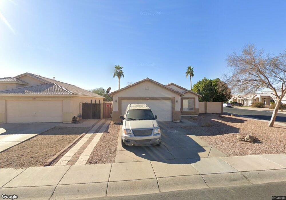
10264 N 92nd Dr Peoria, AZ 85345
Estimated Value: $335,975 - $419,000
4
Beds
2
Baths
1,657
Sq Ft
$237/Sq Ft
Est. Value
About This Home
This home is located at 10264 N 92nd Dr, Peoria, AZ 85345 and is currently estimated at $392,744, approximately $237 per square foot. 10264 N 92nd Dr is a home located in Maricopa County with nearby schools including Sun Valley Elementary School, Raymond S. Kellis, and Ombudsman - Northwest Charter.
Ownership History
Date
Name
Owned For
Owner Type
Purchase Details
Closed on
Dec 23, 2009
Sold by
Federal National Mortgage Association
Bought by
Sanchez Delia
Current Estimated Value
Home Financials for this Owner
Home Financials are based on the most recent Mortgage that was taken out on this home.
Original Mortgage
$115,862
Outstanding Balance
$75,105
Interest Rate
4.78%
Mortgage Type
FHA
Estimated Equity
$317,639
Purchase Details
Closed on
Oct 14, 2009
Sold by
Mcklveen Jennifer M and Mcklveen Christopher R
Bought by
Federal National Mortgage Association
Purchase Details
Closed on
Aug 16, 2006
Sold by
Mette Troy Michael and Mette Dena Kay
Bought by
Mcklveen Christopher R and Mcklveen Jennifer M
Home Financials for this Owner
Home Financials are based on the most recent Mortgage that was taken out on this home.
Original Mortgage
$264,000
Interest Rate
6.76%
Mortgage Type
New Conventional
Purchase Details
Closed on
Jul 26, 2005
Sold by
Manda Michael J and Iuvino Lisa
Bought by
Mette Troy Michael and Mette Dena Kay
Home Financials for this Owner
Home Financials are based on the most recent Mortgage that was taken out on this home.
Original Mortgage
$195,779
Interest Rate
1.37%
Mortgage Type
New Conventional
Purchase Details
Closed on
Nov 11, 2002
Sold by
Kolb Nicole V
Bought by
Manda Michael J and Iuvino Lisa
Home Financials for this Owner
Home Financials are based on the most recent Mortgage that was taken out on this home.
Original Mortgage
$145,950
Interest Rate
5.89%
Mortgage Type
New Conventional
Purchase Details
Closed on
Aug 25, 1998
Sold by
Godfrey Rita M
Bought by
Kolb Nicole
Purchase Details
Closed on
Feb 9, 1998
Sold by
Ryland Homes Of Arizona Inc
Bought by
Kolb Nicole and Godfrey Rita M
Home Financials for this Owner
Home Financials are based on the most recent Mortgage that was taken out on this home.
Original Mortgage
$114,250
Interest Rate
6.9%
Mortgage Type
FHA
Create a Home Valuation Report for This Property
The Home Valuation Report is an in-depth analysis detailing your home's value as well as a comparison with similar homes in the area
Home Values in the Area
Average Home Value in this Area
Purchase History
| Date | Buyer | Sale Price | Title Company |
|---|---|---|---|
| Sanchez Delia | $118,000 | Security Title Agency | |
| Federal National Mortgage Association | $232,865 | First American Title | |
| Mcklveen Christopher R | $264,000 | Security Title Agency Inc | |
| Mette Troy Michael | $245,000 | -- | |
| Manda Michael J | $150,500 | Grand Canyon Title Agency In | |
| Kolb Nicole | -- | -- | |
| Kolb Nicole | $115,575 | Transnation Title Insurance | |
| Ryland Homes Of Arizona Inc | $90,090 | Transnation Title Insurance |
Source: Public Records
Mortgage History
| Date | Status | Borrower | Loan Amount |
|---|---|---|---|
| Open | Sanchez Delia | $115,862 | |
| Previous Owner | Mcklveen Christopher R | $264,000 | |
| Previous Owner | Mette Troy Michael | $195,779 | |
| Previous Owner | Manda Michael J | $145,950 | |
| Previous Owner | Kolb Nicole | $114,250 |
Source: Public Records
Tax History Compared to Growth
Tax History
| Year | Tax Paid | Tax Assessment Tax Assessment Total Assessment is a certain percentage of the fair market value that is determined by local assessors to be the total taxable value of land and additions on the property. | Land | Improvement |
|---|---|---|---|---|
| 2025 | $1,505 | $16,105 | -- | -- |
| 2024 | $1,476 | $15,338 | -- | -- |
| 2023 | $1,476 | $29,880 | $5,970 | $23,910 |
| 2022 | $1,447 | $23,080 | $4,610 | $18,470 |
| 2021 | $1,516 | $21,180 | $4,230 | $16,950 |
| 2020 | $1,525 | $19,880 | $3,970 | $15,910 |
| 2019 | $1,264 | $18,310 | $3,660 | $14,650 |
| 2018 | $1,222 | $16,910 | $3,380 | $13,530 |
| 2017 | $1,223 | $14,830 | $2,960 | $11,870 |
| 2016 | $1,211 | $14,310 | $2,860 | $11,450 |
| 2015 | $1,130 | $12,180 | $2,430 | $9,750 |
Source: Public Records
Map
Nearby Homes
- 10245 N 93rd Dr
- 10226 N 93rd Dr
- 9243 W Brown St
- 10127 N 95th Dr Unit A
- 9134 W Peoria Ave
- 10101 N 91st Ave Unit 124
- 9627 W North Ln Unit B
- 10134 N 97th Ave Unit B
- 10810 N 91st Ave Unit 66
- 10810 N 91st Ave Unit 53
- 10810 N 91st Ave Unit 148
- 10810 N 91st Ave Unit 29
- 10810 N 91st Ave Unit 74
- 10810 N 91st Ave Unit 45
- 10810 N 91st Ave Unit 123
- 10810 N 91st Ave Unit 139
- 9564 W Purdue Ave
- 9616 W Mountain View Rd Unit A
- 11000 N 91st Ave Unit 20
- 11000 N 91st Ave Unit 84
- 10254 N 92nd Dr
- 9245 W Beryl Ave
- 10244 N 92nd Dr
- 9238 W Beryl Ave
- 9234 W Beryl Ave
- 9242 W Beryl Ave
- 9249 W Beryl Ave
- 10234 N 92nd Dr
- 9246 W Beryl Ave
- 9250 W Beryl Ave
- 10224 N 92nd Dr
- 9253 W Beryl Ave
- 9254 W Beryl Ave
- 9246 W Monroe St
- 9250 W Monroe St
- 10214 N 92nd Dr
- 9254 W Monroe St
- 9302 W Beryl Ave
- 9301 W Beryl Ave
- 9258 W Monroe St