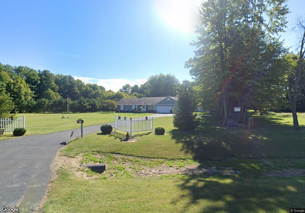
10265 Us Highway 22 and 3 Unit Lt1 Clarksville, OH 45113
Washington Township NeighborhoodEstimated Value: $431,000 - $482,000
3
Beds
2
Baths
2,208
Sq Ft
$208/Sq Ft
Est. Value
About This Home
This home is located at 10265 Us Highway 22 and 3 Unit Lt1, Clarksville, OH 45113 and is currently estimated at $459,454, approximately $208 per square foot. 10265 Us Highway 22 and 3 Unit Lt1 is a home with nearby schools including Clinton-Massie Elementary School, Clinton-Massie Middle School, and Clinton-Massie High School.
Ownership History
Date
Name
Owned For
Owner Type
Purchase Details
Closed on
May 30, 2013
Sold by
Trout James E
Bought by
Mccomas Terry D and Mccomas Karen J
Current Estimated Value
Home Financials for this Owner
Home Financials are based on the most recent Mortgage that was taken out on this home.
Original Mortgage
$151,875
Interest Rate
3.38%
Mortgage Type
VA
Purchase Details
Closed on
Aug 23, 2012
Sold by
1St National Bank
Bought by
Trout James E
Purchase Details
Closed on
Aug 9, 2010
Sold by
Fornshell Homes Ltd
Bought by
1St National Bank
Create a Home Valuation Report for This Property
The Home Valuation Report is an in-depth analysis detailing your home's value as well as a comparison with similar homes in the area
Home Values in the Area
Average Home Value in this Area
Purchase History
| Date | Buyer | Sale Price | Title Company |
|---|---|---|---|
| Mccomas Terry D | $180,000 | Lawyers Title | |
| Trout James E | $190,000 | None Available | |
| 1St National Bank | $20,000 | None Available |
Source: Public Records
Mortgage History
| Date | Status | Borrower | Loan Amount |
|---|---|---|---|
| Previous Owner | Mccomas Terry D | $151,875 |
Source: Public Records
Tax History Compared to Growth
Tax History
| Year | Tax Paid | Tax Assessment Tax Assessment Total Assessment is a certain percentage of the fair market value that is determined by local assessors to be the total taxable value of land and additions on the property. | Land | Improvement |
|---|---|---|---|---|
| 2024 | $3,880 | $116,670 | $36,370 | $80,300 |
| 2023 | $2,998 | $86,807 | $18,336 | $68,470 |
| 2022 | $3,013 | $86,807 | $18,337 | $68,471 |
| 2021 | $2,745 | $86,807 | $18,337 | $68,471 |
| 2020 | $2,660 | $73,567 | $15,540 | $58,027 |
| 2019 | $2,485 | $73,567 | $15,540 | $58,027 |
| 2018 | $2,516 | $73,567 | $15,540 | $58,027 |
| 2017 | $2,315 | $66,458 | $14,035 | $52,423 |
| 2016 | $2,390 | $66,458 | $14,035 | $52,423 |
| 2015 | $2,390 | $66,458 | $14,035 | $52,423 |
| 2014 | $2,452 | $66,460 | $14,040 | $52,420 |
| 2013 | $2,241 | $64,770 | $15,400 | $49,370 |
Source: Public Records
Map
Nearby Homes
- 0 St Rt 350 Unit 923676
- 0 St Rt 350 Unit 1824169
- 10370 Old Ccc Rd
- Lot C Blazing Trail
- Lot B Blazing Trail
- 104 Linton Ave
- 0 Gum Grove Rd Unit 941687
- 0 Gum Grove Rd Unit 1852123
- 9029 Arrowcreek Dr
- 2858 Gum Grove Rd
- 0 Wilmington Rd Unit 1856534
- 0 Wilmington Rd Unit 1856179
- 9356 Ohio 350
- 8788 Wilmington Rd
- 8784 Wilmington Rd
- 8457 Strout Rd
- 10817 Wilmington Lebanon Rd
- 1015 Settlemyre Rd
- 732 Settlemyre Rd
- 0 Meurer Field Blvd Unit 944143
- 10265 Us Highway 22 and 3
- 10126 State Route 350
- 10126 State Route 350
- 10874 Us Highway 22 and 3
- 989 Shepherds Way
- 891 Shepherds Way
- 10124 State Route 350
- 827 the Shepherds Way
- 10132 State Route 350
- 852 the Shepherds Way
- ac N Us Rt 22 & 3
- 98 N Us Rt 22 & 3
- 922 Shepherds Way
- 1065 Shepherds Way
- 10149 State Route 350
- 960 Shepherds Way
- 10199 State Route 350
- 1030 Shepherds Way
- 1062 Shepherds Way
- 41 Shepherds Way