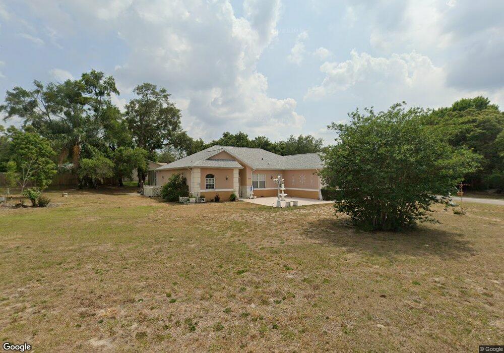
10268 Hoover St Spring Hill, FL 34608
Estimated Value: $335,140 - $422,000
3
Beds
2
Baths
1,935
Sq Ft
$198/Sq Ft
Est. Value
About This Home
This home is located at 10268 Hoover St, Spring Hill, FL 34608 and is currently estimated at $383,785, approximately $198 per square foot. 10268 Hoover St is a home located in Hernando County with nearby schools including Explorer K-8, Frank W. Springstead High School, and Gulf Coast Elementary School.
Ownership History
Date
Name
Owned For
Owner Type
Purchase Details
Closed on
Jun 25, 2012
Sold by
Pace Michael A
Bought by
Pace Michael
Current Estimated Value
Home Financials for this Owner
Home Financials are based on the most recent Mortgage that was taken out on this home.
Original Mortgage
$180,000
Interest Rate
3.72%
Mortgage Type
Reverse Mortgage Home Equity Conversion Mortgage
Purchase Details
Closed on
Feb 15, 2005
Sold by
Pace Michael A
Bought by
Pace Michael A
Create a Home Valuation Report for This Property
The Home Valuation Report is an in-depth analysis detailing your home's value as well as a comparison with similar homes in the area
Home Values in the Area
Average Home Value in this Area
Purchase History
| Date | Buyer | Sale Price | Title Company |
|---|---|---|---|
| Pace Michael | -- | Fnc Title Llc | |
| Pace Michael A | -- | -- |
Source: Public Records
Mortgage History
| Date | Status | Borrower | Loan Amount |
|---|---|---|---|
| Closed | Pace Michael | $180,000 |
Source: Public Records
Tax History Compared to Growth
Tax History
| Year | Tax Paid | Tax Assessment Tax Assessment Total Assessment is a certain percentage of the fair market value that is determined by local assessors to be the total taxable value of land and additions on the property. | Land | Improvement |
|---|---|---|---|---|
| 2024 | $1,399 | $124,585 | -- | -- |
| 2023 | $1,399 | $120,956 | $0 | $0 |
| 2022 | $1,359 | $117,433 | $0 | $0 |
| 2021 | $1,317 | $114,013 | $0 | $0 |
| 2020 | $1,193 | $112,439 | $0 | $0 |
| 2019 | $1,174 | $109,911 | $0 | $0 |
| 2018 | $589 | $107,862 | $0 | $0 |
| 2017 | $902 | $105,643 | $0 | $0 |
| 2016 | $882 | $103,470 | $0 | $0 |
| 2015 | $888 | $102,751 | $0 | $0 |
| 2014 | $864 | $101,936 | $0 | $0 |
Source: Public Records
Map
Nearby Homes
- 12043 Linden Dr
- 2392 Holston Ave
- 0 Linden Dr Unit MFRTB8413730
- 10116 Cherryhill Place
- 00 Bedford Rd
- 10177 Deer St
- 2419 Appian Ave
- 2218 Evangelina Ave
- 2124 Orchard Park Dr
- 2451 Appian Ave
- 2145 Rio Cir
- 10427 Abbeville St
- 10185 Sleepy Willow Ct
- 10186 Sleepy Willow Ct
- 10440 Laval St
- 2104 Linwood Ave
- 2124 Little Peach Ct
- 2367 Gimlet Ave
- 3018 Greynolds Ave
- 2079 Beckwith Ave
- 2228 Orchard Park Dr
- 2335 Holston Ave
- 2329 Holston Ave Unit 9
- 2222 Orchard Park Dr
- 10269 Hoover St
- 2319 Holston Ave
- 10262 Hoover St
- 2320 Sparkleberry Ct
- 2233 Orchard Park Dr
- 2359 Holston Ave
- 2227 Orchard Park Dr
- 2309 Holston Ave
- 2216 Orchard Park Dr
- 2367 Holston Ave
- 2330 Holston Ave
- 2336 Holston Ave
- 2221 Orchard Park Dr
- 2336 2336 Holston Ave
- 10295 Hoover St
- 2301 Holston Ave