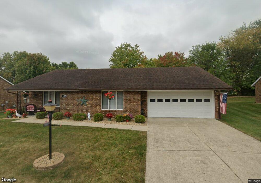
1027 Armsgate Rd Unit 13 Springfield, OH 45503
Estimated Value: $194,000 - $201,000
2
Beds
2
Baths
1,300
Sq Ft
$152/Sq Ft
Est. Value
About This Home
This home is located at 1027 Armsgate Rd Unit 13, Springfield, OH 45503 and is currently estimated at $197,895, approximately $152 per square foot. 1027 Armsgate Rd Unit 13 is a home located in Clark County with nearby schools including Northridge Elementary School, Kenton Ridge Middle & High School, and Emmanuel Christian Academy.
Ownership History
Date
Name
Owned For
Owner Type
Purchase Details
Closed on
Oct 11, 2018
Sold by
Kennedy Charlene B
Bought by
Lee Kimberly J and Lee David M
Current Estimated Value
Home Financials for this Owner
Home Financials are based on the most recent Mortgage that was taken out on this home.
Original Mortgage
$94,575
Outstanding Balance
$81,963
Interest Rate
4.5%
Mortgage Type
New Conventional
Estimated Equity
$115,932
Purchase Details
Closed on
Mar 18, 2010
Sold by
Hawke Annabelle and Hawke Jimmie D
Bought by
Kennedy Charlene B
Purchase Details
Closed on
Jun 6, 2006
Sold by
Yetter Jerrold A and Yetter Graceanna J
Bought by
Hawke Annabelle
Purchase Details
Closed on
Jan 18, 1989
Sold by
Yetter Jerrald A and Yetter Graceanna J
Bought by
Yetter Jerrold A and Yetter Graceanna J
Create a Home Valuation Report for This Property
The Home Valuation Report is an in-depth analysis detailing your home's value as well as a comparison with similar homes in the area
Home Values in the Area
Average Home Value in this Area
Purchase History
| Date | Buyer | Sale Price | Title Company |
|---|---|---|---|
| Lee Kimberly J | $97,500 | Sterling Land Title Agency I | |
| Kennedy Charlene B | $98,000 | None Available | |
| Hawke Annabelle | $107,000 | None Available | |
| Yetter Jerrold A | $63,100 | -- |
Source: Public Records
Mortgage History
| Date | Status | Borrower | Loan Amount |
|---|---|---|---|
| Open | Lee Kimberly J | $94,575 |
Source: Public Records
Tax History
| Year | Tax Paid | Tax Assessment Tax Assessment Total Assessment is a certain percentage of the fair market value that is determined by local assessors to be the total taxable value of land and additions on the property. | Land | Improvement |
|---|---|---|---|---|
| 2025 | $1,738 | $52,870 | $7,350 | $45,520 |
| 2024 | $1,680 | $40,940 | $6,300 | $34,640 |
| 2023 | $1,680 | $40,940 | $6,300 | $34,640 |
| 2022 | $1,666 | $40,940 | $6,300 | $34,640 |
| 2021 | $1,666 | $34,710 | $5,250 | $29,460 |
| 2020 | $1,668 | $34,710 | $5,250 | $29,460 |
| 2019 | $1,274 | $34,710 | $5,250 | $29,460 |
| 2018 | $1,242 | $33,220 | $5,570 | $27,650 |
| 2017 | $1,056 | $30,363 | $5,565 | $24,798 |
| 2016 | $1,049 | $30,363 | $5,565 | $24,798 |
| 2015 | $851 | $30,048 | $5,250 | $24,798 |
| 2014 | $851 | $30,048 | $5,250 | $24,798 |
| 2013 | $849 | $30,048 | $5,250 | $24,798 |
Source: Public Records
Map
Nearby Homes
- 1039 Bradford Dr Unit 42
- 1139 Bradford Dr
- 1136 Foxboro Rd Unit 202
- 3052 Brixton Dr E
- 3124 El Camino Dr
- 3135 Imperial Blvd
- 1525 Providence Ave
- 1404 Attleboro Ave
- 2943 Tarryton Ln
- 732 Grandview Dr Unit 732
- 1201 Kingsgate Rd
- 1162 Kingsgate Rd
- 2022 Westboro Ave
- 3631 Kingsgate Ln
- 3214 Revels St
- 1500 Kingsgate Rd Unit 19430
- 1502 Kingsgate Rd Unit 19432
- 1500 Kingsgate Rd
- 1502 Kingsgate Rd
- 1507 Kingsgate Rd
- 1027 Armsgate Rd Unit VILLA
- 1029 Armsgate Rd Unit 12
- 1025 Armsgate Rd
- 1026 Armsgate Rd
- 1030 Armsgate Rd Unit 29
- 1030 Armsgate Rd
- 3027 Armsgate Rd
- 1031 Armsgate Rd Unit 11
- 3028 Armsgate Rd
- 3028 Armsgate Rd
- 3042 Derr Rd
- 3024 Derr Rd
- 3029 Armsgate Rd
- 3029 Armsgate Rd
- 1033 Armsgate Rd
- 1034 Villa Rd
- 3030 Armsgate Rd Unit 26
- 1033 Bradford Dr Unit 45
- 1034 Armsgate Rd
- 3022 Derr Rd
Your Personal Tour Guide
Ask me questions while you tour the home.