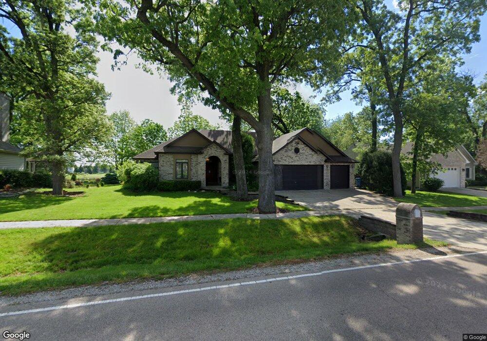
1027 Deerpath Rd Aurora, IL 60506
Blackberry Countryside NeighborhoodEstimated Value: $387,000 - $534,000
3
Beds
3
Baths
2,286
Sq Ft
$211/Sq Ft
Est. Value
About This Home
This home is located at 1027 Deerpath Rd, Aurora, IL 60506 and is currently estimated at $482,471, approximately $211 per square foot. 1027 Deerpath Rd is a home located in Kane County with nearby schools including Fearn Elementary School, Herget Middle School, and West Aurora High School.
Ownership History
Date
Name
Owned For
Owner Type
Purchase Details
Closed on
Jan 31, 2002
Sold by
Sachen Leroy J and Sachen Wilma Q
Bought by
Hay Michael and Richmond Linda M
Current Estimated Value
Home Financials for this Owner
Home Financials are based on the most recent Mortgage that was taken out on this home.
Original Mortgage
$300,000
Interest Rate
7.23%
Purchase Details
Closed on
Aug 10, 1999
Sold by
The Old Second National Bank Of Aurora
Bought by
Sachen Leroy J and Sachen Wilma Q
Create a Home Valuation Report for This Property
The Home Valuation Report is an in-depth analysis detailing your home's value as well as a comparison with similar homes in the area
Home Values in the Area
Average Home Value in this Area
Purchase History
| Date | Buyer | Sale Price | Title Company |
|---|---|---|---|
| Hay Michael | $139,000 | Fox Title Company | |
| Sachen Leroy J | $74,000 | Chicago Title Insurance Co |
Source: Public Records
Mortgage History
| Date | Status | Borrower | Loan Amount |
|---|---|---|---|
| Closed | Hay Michael | $300,000 | |
| Closed | Hay Michael | $5,000 |
Source: Public Records
Tax History
| Year | Tax Paid | Tax Assessment Tax Assessment Total Assessment is a certain percentage of the fair market value that is determined by local assessors to be the total taxable value of land and additions on the property. | Land | Improvement |
|---|---|---|---|---|
| 2024 | $10,087 | $143,392 | $28,172 | $115,220 |
| 2023 | $9,707 | $129,322 | $25,408 | $103,914 |
| 2022 | $9,413 | $119,388 | $23,456 | $95,932 |
| 2021 | $9,175 | $113,616 | $22,322 | $91,294 |
| 2020 | $9,164 | $111,192 | $21,846 | $89,346 |
| 2019 | $9,212 | $107,557 | $21,132 | $86,425 |
| 2018 | $8,909 | $102,608 | $22,726 | $79,882 |
| 2017 | $8,927 | $97,993 | $21,704 | $76,289 |
| 2016 | $8,543 | $93,675 | $20,748 | $72,927 |
| 2015 | -- | $87,156 | $19,304 | $67,852 |
| 2014 | -- | $83,339 | $18,459 | $64,880 |
| 2013 | -- | $90,587 | $18,653 | $71,934 |
Source: Public Records
Map
Nearby Homes
- 1126 Village Center Pkwy Unit 6
- 2416 Courtyard Cir Unit 2
- 2472 Fox Dr
- 873 Shady Ln
- 2487 Worthington Dr
- 1071 Almond Dr
- 5S252 Deerpath Rd
- 2140 Sandburg Dr
- 1995 Melissa Ln
- 7S355 Midfield Dr
- 1475 Elder Dr
- 1322 Croton Ct Unit A
- 980 Sapphire Ln
- 968 Sapphire Ln
- 960 Sapphire Ln
- 972 Sapphire Ln
- 988 Sapphire Ln
- 976 Sapphire Ln
- 984 Sapphire Ln
- 991 Sapphire Ln
- 1045 Deerpath Rd
- 1009 Deerpath Rd
- 1063 Deerpath Rd
- 991 Deerpath Rd
- 1030 Deerpath Rd
- 1010 Deerpath Rd
- 1050 Deerpath Rd
- 1081 Deerpath Rd
- 973 Deerpath Rd
- 994 Deerpath Rd
- 1070 Deerpath Rd
- 974 Deerpath Rd
- 1099 Deerpath Rd
- 955 Deerpath Rd
- 1090 Deerpath Rd
- 956 Deerpath Rd
- 1117 Deerpath Rd
- 937 Deerpath Rd
- 1100 Deerpath Rd
- 1135 Deerpath Rd
Your Personal Tour Guide
Ask me questions while you tour the home.