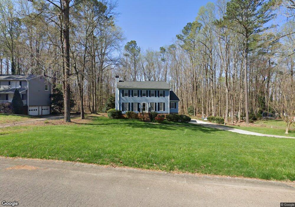
1027 Knotts Pointe Dr Woodstock, GA 30188
Estimated Value: $433,831 - $472,000
3
Beds
3
Baths
2,204
Sq Ft
$205/Sq Ft
Est. Value
About This Home
This home is located at 1027 Knotts Pointe Dr, Woodstock, GA 30188 and is currently estimated at $452,916, approximately $205 per square foot. 1027 Knotts Pointe Dr is a home located in Cherokee County with nearby schools including Arnold Mill Elementary School, Mill Creek Middle School, and River Ridge High School.
Ownership History
Date
Name
Owned For
Owner Type
Purchase Details
Closed on
Aug 2, 2004
Sold by
Shauger John C and Shauger Kathryn
Bought by
Weaver Louann and Weaver Gary
Current Estimated Value
Home Financials for this Owner
Home Financials are based on the most recent Mortgage that was taken out on this home.
Original Mortgage
$151,200
Outstanding Balance
$73,962
Interest Rate
6.01%
Mortgage Type
New Conventional
Estimated Equity
$378,954
Create a Home Valuation Report for This Property
The Home Valuation Report is an in-depth analysis detailing your home's value as well as a comparison with similar homes in the area
Home Values in the Area
Average Home Value in this Area
Purchase History
| Date | Buyer | Sale Price | Title Company |
|---|---|---|---|
| Weaver Louann | $189,000 | -- |
Source: Public Records
Mortgage History
| Date | Status | Borrower | Loan Amount |
|---|---|---|---|
| Open | Weaver Louann | $151,200 |
Source: Public Records
Tax History Compared to Growth
Tax History
| Year | Tax Paid | Tax Assessment Tax Assessment Total Assessment is a certain percentage of the fair market value that is determined by local assessors to be the total taxable value of land and additions on the property. | Land | Improvement |
|---|---|---|---|---|
| 2025 | $722 | $138,260 | $39,200 | $99,060 |
| 2024 | $698 | $132,380 | $34,000 | $98,380 |
| 2023 | $584 | $140,420 | $38,000 | $102,420 |
| 2022 | $708 | $124,300 | $26,800 | $97,500 |
| 2021 | $666 | $96,700 | $22,000 | $74,700 |
| 2020 | $649 | $91,500 | $19,200 | $72,300 |
| 2019 | $621 | $84,040 | $19,200 | $64,840 |
| 2018 | $604 | $76,720 | $19,200 | $57,520 |
| 2017 | $604 | $182,400 | $19,200 | $53,760 |
| 2016 | $595 | $164,700 | $15,200 | $50,680 |
| 2015 | $1,870 | $159,000 | $13,600 | $50,000 |
| 2014 | $1,765 | $149,800 | $13,600 | $46,320 |
Source: Public Records
Map
Nearby Homes
- 375 Crider Ct
- 359 Crider Ct
- 320 Crider Ct
- 153 Witter Way
- 146 Bellehaven Dr
- 4676 Jefferson Township Ln
- 136 Wiley Parc Cir
- 109 Wiley Parc Cir
- 415 Bellehaven Ln
- 226 Parc View Ln
- 123 Ivey Way
- 1001 Wiley Bridge Rd
- 1003 Wiley Bridge Rd
- 989 Wiley Bridge Rd
- 4673 Jefferson Township Place
- 313 Derrymore Dr
- 422 Stovall Place
- 1025 Knotts Pointe Dr
- 1029 Knotts Pointe Dr
- 1031 Knotts Pointe Dr
- 1022 Knotts Pointe Dr
- 0 Township Overlook Unit 7221425
- 1024 Knotts Pointe Dr
- 1033 Knotts Pointe Dr
- 1026 Knotts Pointe Dr
- 1020 Knotts Pointe Dr
- 1021 Knotts Pointe Dr
- 1028 Knotts Pointe Dr
- 0 Knotts Pointe Dr Unit 7380935
- 4902 Township Overlook
- 1030 Knotts Pointe Dr
- 1035 Knotts Pointe Dr
- 1019 Knotts Pointe Dr
- 4903 Township Overlook
- 1018 Knotts Pointe Dr
- 1032 Knotts Pointe Dr
- 207 Witter Way