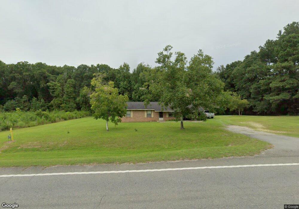
1027 Uvalda Hwy Hazlehurst, GA 31539
Estimated Value: $112,000 - $223,000
--
Bed
2
Baths
1,075
Sq Ft
$150/Sq Ft
Est. Value
About This Home
This home is located at 1027 Uvalda Hwy, Hazlehurst, GA 31539 and is currently estimated at $161,717, approximately $150 per square foot. 1027 Uvalda Hwy is a home located in Jeff Davis County with nearby schools including Jeff Davis Primary School, Jeff Davis Elementary School, and Jeff Davis Middle School.
Ownership History
Date
Name
Owned For
Owner Type
Purchase Details
Closed on
Jul 26, 2014
Sold by
International Paper Co
Bought by
Brp Llc
Current Estimated Value
Purchase Details
Closed on
Apr 26, 2013
Sold by
Harrell Joann T
Bought by
Harrell Michael Gene and Meeks Annette H
Purchase Details
Closed on
Feb 1, 2013
Sold by
Harrell Gene A
Bought by
Harrell Joann T
Purchase Details
Closed on
Jan 1, 1984
Bought by
Harrell Gene A and Harrell Joann T
Create a Home Valuation Report for This Property
The Home Valuation Report is an in-depth analysis detailing your home's value as well as a comparison with similar homes in the area
Home Values in the Area
Average Home Value in this Area
Purchase History
| Date | Buyer | Sale Price | Title Company |
|---|---|---|---|
| Brp Llc | -- | -- | |
| Harrell Michael Gene | -- | -- | |
| Harrell Joann T | -- | -- | |
| Harrell Gene A | $3,300 | -- |
Source: Public Records
Tax History Compared to Growth
Tax History
| Year | Tax Paid | Tax Assessment Tax Assessment Total Assessment is a certain percentage of the fair market value that is determined by local assessors to be the total taxable value of land and additions on the property. | Land | Improvement |
|---|---|---|---|---|
| 2024 | $794 | $33,892 | $5,920 | $27,972 |
| 2023 | $493 | $23,654 | $3,459 | $20,194 |
| 2022 | $493 | $23,653 | $3,459 | $20,194 |
| 2021 | $499 | $23,856 | $3,459 | $20,397 |
| 2020 | $499 | $23,856 | $3,459 | $20,397 |
| 2019 | $499 | $23,856 | $3,459 | $20,397 |
| 2018 | $499 | $23,856 | $3,459 | $20,397 |
| 2017 | $482 | $23,511 | $3,459 | $20,052 |
| 2016 | $476 | $23,511 | $3,459 | $20,052 |
| 2015 | -- | $23,511 | $3,459 | $20,052 |
| 2014 | -- | $23,896 | $3,459 | $20,436 |
Source: Public Records
Map
Nearby Homes
- 28 Jackson Hill Rd
- 152 Owl Head Trail
- 0 Willie Foster Rd Unit 10637076
- 0 Walter Phillips Rd
- 13 Chestnut Rd
- 3 Chestnut Rd
- 44 Long Leaf Rd
- 70 Long Leaf Rd
- 60 Ja Yawn Rd
- 138 Coley Reagin Rd
- 105 Lonnie Johnson Rd
- 00 Wragler Trail (Lot)
- 91 Lariat Ln
- 183 John Rentz Rd
- 000 Old Graham Rd
- 00 Old Graham Rd
- 0 Old Graham Rd Unit 10531283
- 142 N Tallahassee St
- 104 N Tallahassee St
- 00 N Tallahassee St
- 1018 Uvalda Hwy
- 1038 Uvalda Hwy
- 981 Uvalda Hwy
- 975 Uvalda Hwy
- 969 Uvalda Hwy
- 942 Uvalda Hwy
- 979 Uvalda Hwy
- 961 Uvalda Hwy
- 1095 Uvalda Hwy
- 37 Deer Run Rd
- 29 Kermit Carter Rd
- 966 Uvalda Hwy
- 968 Uvalda Hwy
- 77 Deer Run Rd
- 929 Uvalda Hwy
- 458 Mathis Rd
- 49 Kermit Carter Rd
- 903 Uvalda Hwy
- 65 Deer Run Rd
- 926 Uvalda Hwy Unit 1