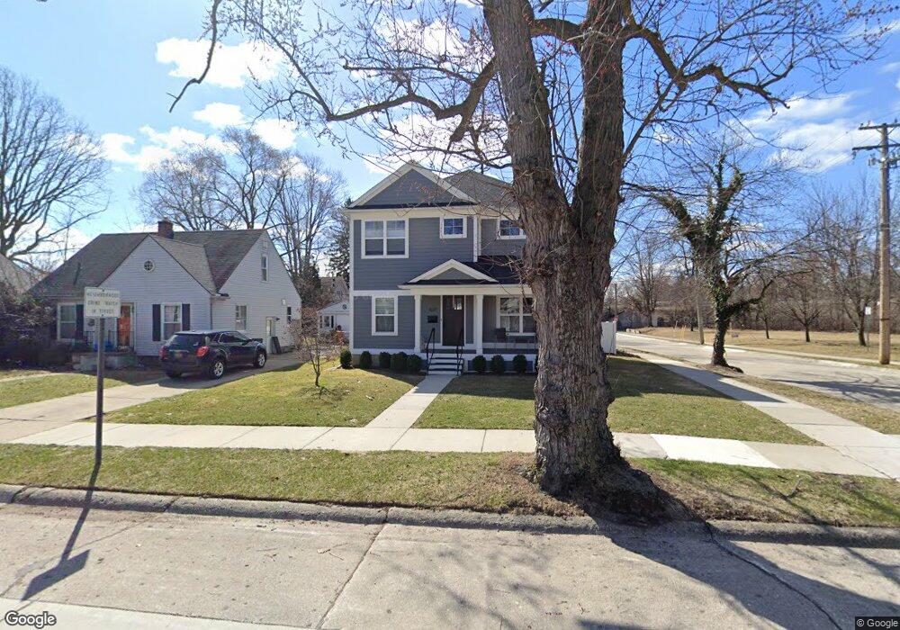
1027 Woodsboro Dr Unit Bldg-Unit Royal Oak, MI 48067
Estimated Value: $755,000 - $874,000
3
Beds
4
Baths
2,391
Sq Ft
$341/Sq Ft
Est. Value
About This Home
This home is located at 1027 Woodsboro Dr Unit Bldg-Unit, Royal Oak, MI 48067 and is currently estimated at $814,755, approximately $340 per square foot. 1027 Woodsboro Dr Unit Bldg-Unit is a home located in Oakland County with nearby schools including Northwood Elementary School, Royal Oak Middle School, and Royal Oak High School.
Ownership History
Date
Name
Owned For
Owner Type
Purchase Details
Closed on
Mar 27, 2018
Sold by
Driscoll Thomas
Bought by
Mccarville Bridget A
Current Estimated Value
Home Financials for this Owner
Home Financials are based on the most recent Mortgage that was taken out on this home.
Original Mortgage
$453,100
Outstanding Balance
$389,114
Interest Rate
4.38%
Mortgage Type
New Conventional
Estimated Equity
$425,641
Purchase Details
Closed on
May 7, 2015
Sold by
The Cecilia M Rehe Trust and Rehe Cecilia M
Bought by
Driscoll Thomas
Purchase Details
Closed on
May 3, 2002
Sold by
Rehe Cecilia M
Bought by
Cecilia M Rehe Tr
Purchase Details
Closed on
Jun 12, 1997
Sold by
Rehe Cecilia M
Bought by
Cecilia M Rehe Tr
Create a Home Valuation Report for This Property
The Home Valuation Report is an in-depth analysis detailing your home's value as well as a comparison with similar homes in the area
Home Values in the Area
Average Home Value in this Area
Purchase History
| Date | Buyer | Sale Price | Title Company |
|---|---|---|---|
| Mccarville Bridget A | $570,000 | Partners Title Agency Llc | |
| Driscoll Thomas | $155,000 | None Available | |
| Cecilia M Rehe Tr | -- | -- | |
| Cecilia M Rehe Tr | -- | -- |
Source: Public Records
Mortgage History
| Date | Status | Borrower | Loan Amount |
|---|---|---|---|
| Open | Mccarville Bridget A | $453,100 |
Source: Public Records
Tax History Compared to Growth
Tax History
| Year | Tax Paid | Tax Assessment Tax Assessment Total Assessment is a certain percentage of the fair market value that is determined by local assessors to be the total taxable value of land and additions on the property. | Land | Improvement |
|---|---|---|---|---|
| 2024 | $9,317 | $331,590 | $0 | $0 |
| 2022 | $10,639 | $298,130 | $0 | $0 |
| 2020 | $8,750 | $265,340 | $0 | $0 |
| 2018 | $10,639 | $116,580 | $0 | $0 |
| 2017 | $6,409 | $116,580 | $0 | $0 |
| 2015 | -- | $78,060 | $0 | $0 |
| 2014 | -- | $72,350 | $0 | $0 |
| 2011 | -- | $67,560 | $0 | $0 |
Source: Public Records
Map
Nearby Homes
- 912 Woodsboro Dr
- 1319 Woodsboro Dr
- 1721 Forestdale Ct
- 1103 Fernwood Rd
- 719 W 12 Mile Rd
- 934 Lockwood Rd
- 1402 Catalpa Dr
- 1022 Maplegrove Ave
- 606 Catalpa Dr
- 1507 Roseland Ave
- 1028 Edgewood Dr
- 2015 Alicia Ln
- 1630 W 12 Mile Rd
- 1631 Roseland Ave
- 800 Lockwood Rd
- 1718 W 12 Mile Rd
- 820 Oakridge Ave
- 821 Forestdale Rd
- 320 Catalpa Dr
- 1828 N Lafayette Ave
- 1027 Woodsboro Dr
- 1023 Woodsboro Dr
- 1017 Woodsboro Dr
- 1026 Greenleaf Dr
- 1022 Greenleaf Dr
- 1013 Woodsboro Dr
- 1016 Greenleaf Dr
- 1026 Woodsboro Dr
- 1022 Woodsboro Dr
- 1012 Greenleaf Dr
- 1007 Woodsboro Dr
- 1012 Woodsboro Dr
- 1003 Woodsboro Dr
- 1027 Orchard Grove Dr
- 1006 Greenleaf Dr
- 1002 Greenleaf Dr
- 1006 Woodsboro Dr
- 927 Woodsboro Dr
- 1023 Greenleaf Dr
- 1120 Greenleaf Dr