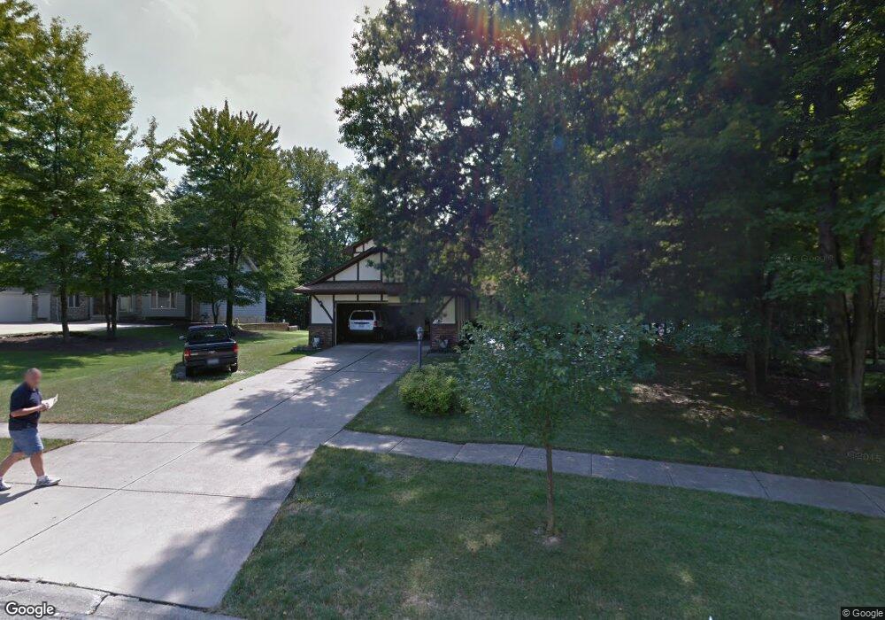
10274 Pamela Dr Strongsville, OH 44149
Estimated Value: $431,000 - $458,000
3
Beds
3
Baths
2,613
Sq Ft
$169/Sq Ft
Est. Value
About This Home
This home is located at 10274 Pamela Dr, Strongsville, OH 44149 and is currently estimated at $441,346, approximately $168 per square foot. 10274 Pamela Dr is a home located in Cuyahoga County with nearby schools including Strongsville High School and Sts Joseph & John Interparochial School.
Ownership History
Date
Name
Owned For
Owner Type
Purchase Details
Closed on
Aug 22, 2016
Sold by
Niemira Gerald A and Niemira Linda M
Bought by
Niemira Gerald A and Niemira Linda M
Current Estimated Value
Purchase Details
Closed on
Aug 22, 1997
Sold by
Messner John A
Bought by
Niemira Gerald A and Niemira Linda M
Home Financials for this Owner
Home Financials are based on the most recent Mortgage that was taken out on this home.
Original Mortgage
$117,000
Outstanding Balance
$17,568
Interest Rate
7.56%
Mortgage Type
New Conventional
Estimated Equity
$423,778
Purchase Details
Closed on
Jan 1, 1988
Bought by
Messner John A and Messner J
Create a Home Valuation Report for This Property
The Home Valuation Report is an in-depth analysis detailing your home's value as well as a comparison with similar homes in the area
Home Values in the Area
Average Home Value in this Area
Purchase History
| Date | Buyer | Sale Price | Title Company |
|---|---|---|---|
| Niemira Gerald A | -- | Attorney | |
| Niemira Gerald A | $205,000 | -- | |
| Messner John A | -- | -- |
Source: Public Records
Mortgage History
| Date | Status | Borrower | Loan Amount |
|---|---|---|---|
| Open | Niemira Gerald A | $117,000 |
Source: Public Records
Tax History Compared to Growth
Tax History
| Year | Tax Paid | Tax Assessment Tax Assessment Total Assessment is a certain percentage of the fair market value that is determined by local assessors to be the total taxable value of land and additions on the property. | Land | Improvement |
|---|---|---|---|---|
| 2024 | $6,215 | $132,370 | $24,535 | $107,835 |
| 2023 | $6,707 | $107,100 | $22,960 | $84,140 |
| 2022 | $6,658 | $107,100 | $22,960 | $84,140 |
| 2021 | $6,606 | $107,100 | $22,960 | $84,140 |
| 2020 | $6,550 | $93,940 | $20,130 | $73,820 |
| 2019 | $6,358 | $268,400 | $57,500 | $210,900 |
| 2018 | $5,771 | $93,940 | $20,130 | $73,820 |
| 2017 | $5,630 | $84,850 | $18,240 | $66,610 |
| 2016 | $5,584 | $84,850 | $18,240 | $66,610 |
| 2015 | $5,527 | $84,850 | $18,240 | $66,610 |
| 2014 | $5,497 | $82,360 | $17,710 | $64,650 |
Source: Public Records
Map
Nearby Homes
- 20424 Scotch Pine Way
- 19890 Idlewood Trail
- 20050 Idlewood Trail
- 19997 Idlewood Trail
- 9401 Pheasant Run Place
- 10986 Fawn Meadow Ln
- 20684 Albion Rd
- 11179 Fawn Meadow Ln
- 10839 Prospect Rd
- 19240 Briarwood Ln
- 21176 Hickory Branch Trail
- 21355 Hickory Branch Trail
- 11432 Pearl Rd
- 11499 Pearl Rd Unit A106
- 10353 Oak Branch Trail
- 12385 Corinth Ct
- 12647 Edgepark Cir
- 8627 Courtland Dr
- 12539 Olympus Way
- 0 Priem Rd
- 10306 Pamela Dr
- 10236 Pamela Dr
- 10237 Pamela Dr
- 10228 Pamela Dr
- 10338 Pamela Dr
- 10255 Pamela Dr
- 10220 Pamela Dr
- 10375 Pamela Dr
- 10108 Fair Rd
- 10273 Pamela Dr
- 10212 Pamela Dr
- 10122 Fair Rd
- 10311 Pamela Dr
- 10136 Fair Rd
- 10349 Pamela Dr
- 10367 Pamela Dr
- 10448 Eastland Rd
- Fair Rd
- 20695 Chestnut Dr
- 10150 Fair Rd