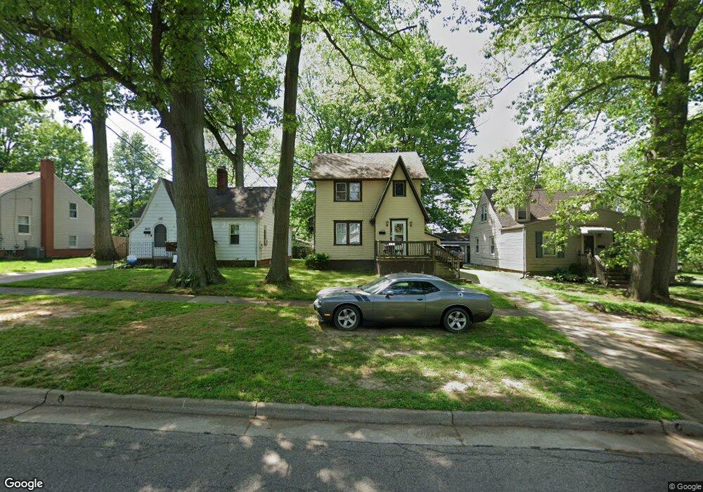
1028 Hardesty Blvd Akron, OH 44320
West Akron NeighborhoodEstimated Value: $112,362 - $132,000
4
Beds
1
Bath
1,244
Sq Ft
$98/Sq Ft
Est. Value
About This Home
This home is located at 1028 Hardesty Blvd, Akron, OH 44320 and is currently estimated at $122,091, approximately $98 per square foot. 1028 Hardesty Blvd is a home located in Summit County with nearby schools including Emmanuel Christian Academy and Julie Billiart School Akron.
Ownership History
Date
Name
Owned For
Owner Type
Purchase Details
Closed on
Dec 18, 2000
Sold by
Trustee Bankers Trust Company Of California
Bought by
Jones Wanda Y
Current Estimated Value
Home Financials for this Owner
Home Financials are based on the most recent Mortgage that was taken out on this home.
Original Mortgage
$63,000
Outstanding Balance
$23,433
Interest Rate
7.83%
Estimated Equity
$98,658
Purchase Details
Closed on
Nov 6, 1997
Sold by
Whittle Harry E
Bought by
Shekleton James
Create a Home Valuation Report for This Property
The Home Valuation Report is an in-depth analysis detailing your home's value as well as a comparison with similar homes in the area
Home Values in the Area
Average Home Value in this Area
Purchase History
| Date | Buyer | Sale Price | Title Company |
|---|---|---|---|
| Jones Wanda Y | $63,000 | Miller Examining Service Inc | |
| Shekleton James | $226,000 | -- |
Source: Public Records
Mortgage History
| Date | Status | Borrower | Loan Amount |
|---|---|---|---|
| Open | Jones Wanda Y | $63,000 |
Source: Public Records
Tax History Compared to Growth
Tax History
| Year | Tax Paid | Tax Assessment Tax Assessment Total Assessment is a certain percentage of the fair market value that is determined by local assessors to be the total taxable value of land and additions on the property. | Land | Improvement |
|---|---|---|---|---|
| 2025 | $1,870 | $34,969 | $7,634 | $27,335 |
| 2024 | $1,870 | $34,969 | $7,634 | $27,335 |
| 2023 | $1,870 | $34,969 | $7,634 | $27,335 |
| 2022 | $1,505 | $21,890 | $4,715 | $17,175 |
| 2021 | $1,506 | $21,890 | $4,715 | $17,175 |
| 2020 | $1,484 | $21,900 | $4,720 | $17,180 |
| 2019 | $1,266 | $16,790 | $5,430 | $11,360 |
| 2018 | $1,250 | $16,790 | $5,430 | $11,360 |
| 2017 | $1,232 | $16,790 | $5,430 | $11,360 |
| 2016 | $1,233 | $16,260 | $5,430 | $10,830 |
| 2015 | $1,232 | $16,260 | $5,430 | $10,830 |
| 2014 | $1,222 | $16,260 | $5,430 | $10,830 |
| 2013 | $1,261 | $17,180 | $5,430 | $11,750 |
Source: Public Records
Map
Nearby Homes
- 1013 Hardesty Blvd
- 1043 Slosson St
- 1063 Packard Dr
- 985 Peerless Ave
- 1088 Packard Dr
- 1158 Hardesty Blvd
- 1024 Roslyn Ave
- 852 Storer Ave
- 1176 Winton Ave
- 881 Stoner St
- 1245 Greenwood Ave
- 774 Storer Ave
- 861 Glenn St
- 1100 Mercer Ave
- 853 Fried St
- 1265 Greenwood Ave
- VL Mercer Ave
- 621 Noah Ave
- 923 Lawton St
- 636 Noble Ave
- 1024 Hardesty Blvd
- 1079 Hartford Ave
- 1085 Hartford Ave
- 1014 Hardesty Blvd
- 1046 Hardesty Blvd
- 1089 Hartford Ave
- 1033 Hardesty Blvd
- 1010 Hardesty Blvd
- 1063 Hartford Ave
- 1029 Hardesty Blvd
- 1023 Hardesty Blvd
- 1037 Hardesty Blvd
- 1095 Hartford Ave
- 1050 Hardesty Blvd
- 1006 Hardesty Blvd
- 1057 Hartford Ave
- 1058 Hardesty Blvd
- 1101 Hartford Ave
- 1009 Hardesty Blvd
- 1053 Hartford Ave