1028 Knapp St NE Grand Rapids, MI 49505
Creston NeighborhoodEstimated Value: $351,223 - $372,000
4
Beds
2
Baths
2,045
Sq Ft
$176/Sq Ft
Est. Value
About This Home
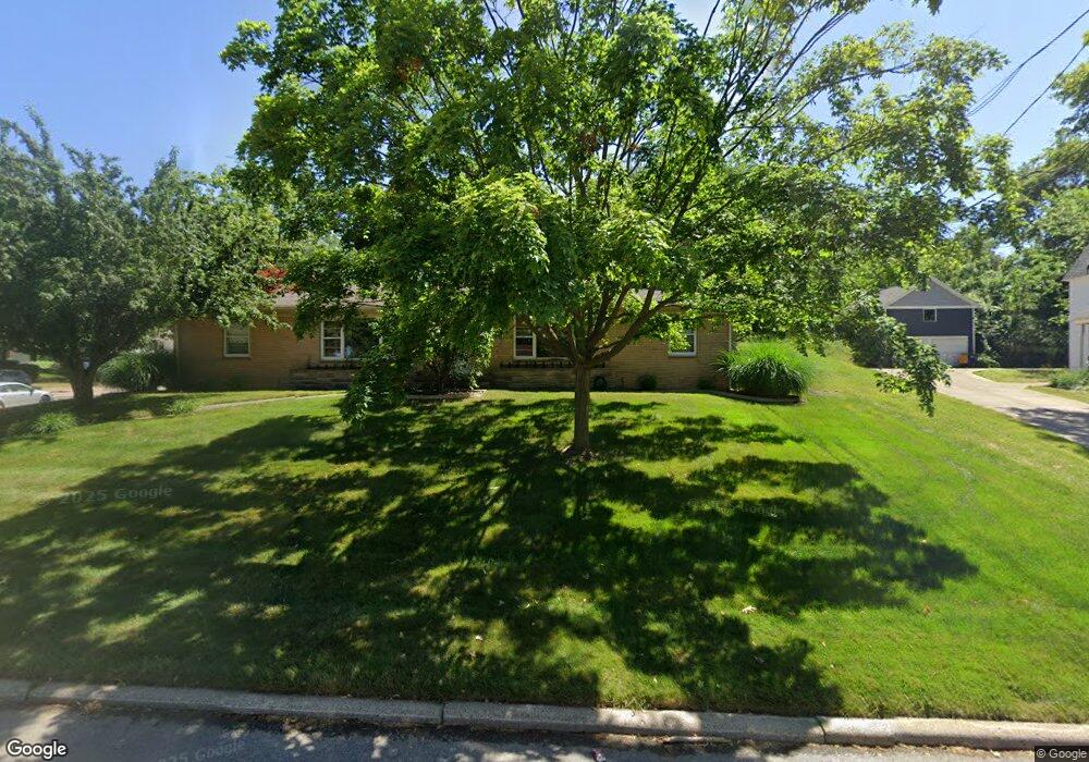
This home is located at 1028 Knapp St NE, Grand Rapids, MI 49505 and is currently estimated at $360,306, approximately $176 per square foot. 1028 Knapp St NE is a home located in Kent County with nearby schools including Kent Hills School, Riverside Middle School, and Union High School.
Ownership History
Date
Name
Owned For
Owner Type
Purchase Details
Closed on
Jun 17, 2020
Sold by
Anthony Thomas Debartolo Trust
Bought by
Debartolo Rental Trust
Current Estimated Value
Purchase Details
Closed on
May 29, 2008
Sold by
Debartolo Anthony T
Bought by
Anthony Thomas Debartolo Trust
Purchase Details
Closed on
Nov 14, 1997
Sold by
Maple Ts and Maple Debartolo A
Bought by
Debartolo A and Debartolo Anthony T Trust
Purchase Details
Closed on
Oct 28, 1996
Sold by
Maple Maple W W and Maple W
Bought by
Maple W Ts and Debartolo Anthony T Trust
Purchase Details
Closed on
May 3, 1985
Create a Home Valuation Report for This Property
The Home Valuation Report is an in-depth analysis detailing your home's value as well as a comparison with similar homes in the area
Home Values in the Area
Average Home Value in this Area
Purchase History
| Date | Buyer | Sale Price | Title Company |
|---|---|---|---|
| Debartolo Rental Trust | -- | None Listed On Document | |
| Debartolo Anthony T | -- | None Available | |
| Debartolo Rental Trust | -- | None Listed On Document | |
| Anthony Thomas Debartolo Trust | -- | None Available | |
| Debartolo A | $95,000 | -- | |
| Maple W Ts | -- | -- | |
| -- | $68,000 | -- |
Source: Public Records
Tax History Compared to Growth
Tax History
| Year | Tax Paid | Tax Assessment Tax Assessment Total Assessment is a certain percentage of the fair market value that is determined by local assessors to be the total taxable value of land and additions on the property. | Land | Improvement |
|---|---|---|---|---|
| 2025 | $3,105 | $175,700 | $0 | $0 |
| 2024 | $3,105 | $158,400 | $0 | $0 |
| 2023 | $3,080 | $113,600 | $0 | $0 |
| 2022 | $112 | $105,800 | $0 | $0 |
| 2021 | $2,852 | $99,800 | $0 | $0 |
| 2020 | $2,756 | $86,600 | $0 | $0 |
| 2019 | $2,822 | $73,200 | $0 | $0 |
| 2018 | $2,736 | $72,200 | $0 | $0 |
| 2017 | $2,669 | $63,100 | $0 | $0 |
| 2016 | $2,682 | $58,100 | $0 | $0 |
| 2015 | $2,555 | $58,100 | $0 | $0 |
| 2013 | -- | $56,500 | $0 | $0 |
Source: Public Records
Map
Nearby Homes
- 1848 Emerald Ave NE
- 1824 Herrick Ave NE
- 1119 Kentwood Dr NE
- 2100 Dawson Ave NE
- 1825 Meadowfield Dr NE
- 1335 Knapp St NE
- 1757 Westlane Dr NE
- 2027 Joan Ave NE
- 778 Eleanor St NE
- 2038 Melita Ave NE
- 738 Graceland St NE
- 1237 Dale Ct NE
- 612 Woodridge St NE
- 861 Aberdeen St NE
- 2019 Plainfield Ave NE
- 465 Kenwood St NE
- 1444 Sweet St NE
- 2030 Sinclair Ave NE
- 1119 Spencer St NE
- 1524 Sweet St NE
- 1065 Truxton Ave NE
- 1067 Truxton Dr Ne - Truxton
- 1022 Knapp St NE
- 1080 Truxton Ave NE
- 1061 Truxton Ave NE
- 1074 Truxton Ave NE
- 1074 Truxton Ave NE Unit 1076
- 1055 Truxton Ave NE
- 10661068 Knapp St NE
- 1066 Knapp St NE
- 1066 Knapp St NE Unit 2
- 1066 Knapp St NE Unit 1068
- 1012 Knapp St NE
- 1944 Diamond Ave NE
- 1070 Truxton Ave NE
- 1047 Truxton Ave NE
- 1938 Diamond Ave NE
- 1064 Truxton Ave NE
- 1039 Truxton Ave NE
- 1031 Truxton Ave NE