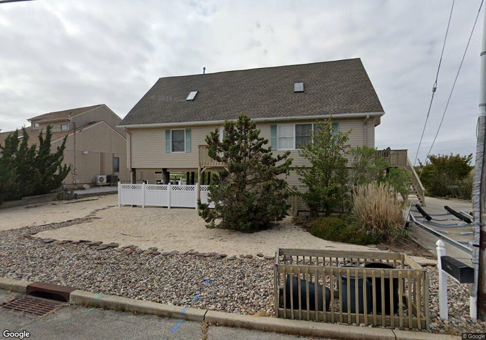
1028 Montauk Dr Forked River, NJ 08731
Lacey Township NeighborhoodEstimated Value: $828,846 - $1,138,000
3
Beds
3
Baths
2,448
Sq Ft
$394/Sq Ft
Est. Value
About This Home
This home is located at 1028 Montauk Dr, Forked River, NJ 08731 and is currently estimated at $963,462, approximately $393 per square foot. 1028 Montauk Dr is a home located in Ocean County with nearby schools including Lacey Township High School.
Ownership History
Date
Name
Owned For
Owner Type
Purchase Details
Closed on
Sep 12, 2011
Sold by
Schoen Glen and Schoen Barabra
Bought by
Gaskel Gergory S and Gaskel Virginia Mary
Current Estimated Value
Home Financials for this Owner
Home Financials are based on the most recent Mortgage that was taken out on this home.
Original Mortgage
$300,000
Outstanding Balance
$204,355
Interest Rate
4.15%
Mortgage Type
New Conventional
Estimated Equity
$759,107
Purchase Details
Closed on
Sep 13, 1996
Sold by
Barnegat Realty
Bought by
Schoen Glen and Schoen Barbara
Create a Home Valuation Report for This Property
The Home Valuation Report is an in-depth analysis detailing your home's value as well as a comparison with similar homes in the area
Home Values in the Area
Average Home Value in this Area
Purchase History
| Date | Buyer | Sale Price | Title Company |
|---|---|---|---|
| Gaskel Gergory S | $455,000 | None Available | |
| Schoen Glen | $80,000 | -- |
Source: Public Records
Mortgage History
| Date | Status | Borrower | Loan Amount |
|---|---|---|---|
| Open | Gaskel Gergory S | $300,000 |
Source: Public Records
Tax History Compared to Growth
Tax History
| Year | Tax Paid | Tax Assessment Tax Assessment Total Assessment is a certain percentage of the fair market value that is determined by local assessors to be the total taxable value of land and additions on the property. | Land | Improvement |
|---|---|---|---|---|
| 2025 | $12,019 | $474,300 | $235,200 | $239,100 |
| 2024 | $11,236 | $474,300 | $235,200 | $239,100 |
| 2023 | $10,733 | $474,300 | $235,200 | $239,100 |
| 2022 | $10,733 | $474,300 | $235,200 | $239,100 |
| 2021 | $10,553 | $474,300 | $235,200 | $239,100 |
| 2020 | $10,216 | $474,300 | $235,200 | $239,100 |
| 2019 | $10,036 | $474,300 | $235,200 | $239,100 |
| 2018 | $9,934 | $475,100 | $230,800 | $244,300 |
| 2017 | $9,706 | $475,100 | $230,800 | $244,300 |
| 2016 | $9,668 | $475,100 | $230,800 | $244,300 |
| 2015 | $9,236 | $475,100 | $230,800 | $244,300 |
| 2014 | $7,826 | $455,000 | $350,800 | $104,200 |
Source: Public Records
Map
Nearby Homes
- 1011 Neosho Dr
- 823 Forepeak Dr
- 813 Tiller Dr
- 836 Spar Dr
- 814 Ensign Dr
- 709 Richmond Dr
- 877 Sunrise Blvd
- 607 Ranger Dr
- 416 Irons St
- 318 Riviera Dr
- 308 Pine Forest Ln
- 507 Laurelwood Dr
- 905 Bowsprit Point
- 320 Cedar Dr
- 119 Driftwood Ln
- 107 Fernwood Ln
- 802 E Hickory Dr
- 1029 Bowsprit Point
- 111 Greenwood Ln
- 502 Teakwood Dr
- 1026 Montauk Dr
- 1035 Montauk Dr
- 1031 Montauk Dr
- 1024 Montauk Dr
- 1032 Montauk Dr
- 1001 Osage Dr
- 1021 Neosho Dr
- 1022 Montauk Dr
- 1020 Neosho Dr
- 1002 Osage Dr
- 1003 Neosho Dr
- 1034 Montauk Dr
- 1018 Osage Dr
- 1045 Montauk Dr
- 1005 Neosho Dr
- 1018 Neosho Dr
- 1003 Osage Dr
- 1017 Osage Dr
- 1036 Montauk Dr
- 1020 Montauk Dr