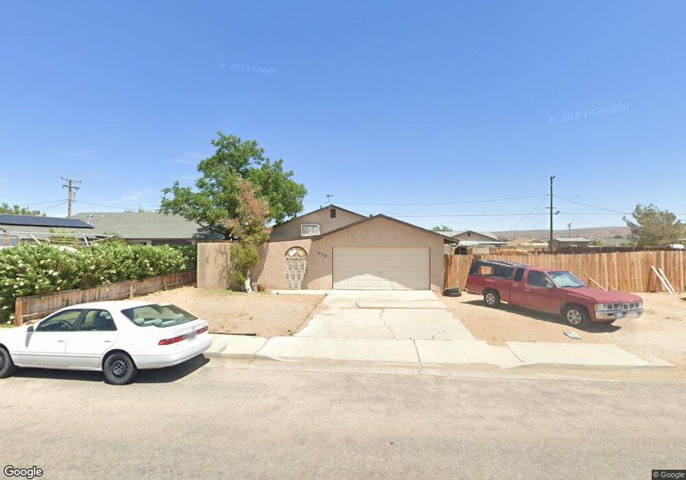
1028 Porter St Ridgecrest, CA 93555
Estimated Value: $204,081 - $268,000
3
Beds
2
Baths
1,215
Sq Ft
$187/Sq Ft
Est. Value
About This Home
This home is located at 1028 Porter St, Ridgecrest, CA 93555 and is currently estimated at $226,770, approximately $186 per square foot. 1028 Porter St is a home located in Kern County with nearby schools including Faller Elementary School, James Monroe Middle School, and Burroughs High School.
Ownership History
Date
Name
Owned For
Owner Type
Purchase Details
Closed on
Sep 6, 2001
Sold by
Weber Denis Paul and Weber Alcira Isidra
Bought by
Long Kenneth R and Long Ana M
Current Estimated Value
Home Financials for this Owner
Home Financials are based on the most recent Mortgage that was taken out on this home.
Original Mortgage
$22,800
Interest Rate
6.87%
Create a Home Valuation Report for This Property
The Home Valuation Report is an in-depth analysis detailing your home's value as well as a comparison with similar homes in the area
Home Values in the Area
Average Home Value in this Area
Purchase History
We collect this data history from publicly available records. To have your information removed, we recommend requesting removal directly through your county’s website.
| Date | Buyer | Sale Price | Title Company |
|---|---|---|---|
| Long Kenneth R | $24,000 | First American Title Co |
Source: Public Records
Mortgage History
We collect this data history from publicly available records. To have your information removed, we recommend requesting removal directly through your county’s website.
| Date | Status | Borrower | Loan Amount |
|---|---|---|---|
| Previous Owner | Long Kenneth R | $22,800 |
Source: Public Records
Tax History
| Year | Tax Paid | Tax Assessment Tax Assessment Total Assessment is a certain percentage of the fair market value that is determined by local assessors to be the total taxable value of land and additions on the property. | Land | Improvement |
|---|---|---|---|---|
| 2025 | $941 | $35,429 | $5,896 | $29,533 |
| 2024 | $919 | $34,735 | $5,781 | $28,954 |
| 2023 | $919 | $34,055 | $5,668 | $28,387 |
| 2022 | $901 | $33,388 | $5,557 | $27,831 |
| 2021 | $842 | $32,735 | $5,449 | $27,286 |
| 2020 | $814 | $32,401 | $5,394 | $27,007 |
| 2019 | $807 | $32,401 | $5,394 | $27,007 |
| 2018 | $908 | $31,145 | $5,186 | $25,959 |
| 2017 | $906 | $30,535 | $5,085 | $25,450 |
| 2016 | $882 | $29,937 | $4,986 | $24,951 |
| 2015 | $867 | $29,489 | $4,912 | $24,577 |
| 2014 | $755 | $28,912 | $4,816 | $24,096 |
Source: Public Records
Map
Nearby Homes
- 1024 Porter St
- 0 S Mahan St Unit 2607773
- 0 S Mahan St Unit 2607771
- 0 S Mahan St Unit 2608461
- 1112 Porter St
- 1032 S Farragut St
- 1020 S Farragut St
- 1141 Mayo St
- 1358 Wildrose Ave
- 0 W Vulcan Ave
- 1033 W Bataan Ave
- 1108 S Mccall St
- 1216 Sims St
- 1021 S Ranger St
- 1213 W Willow Ave
- 1009 S Ranger St
- 0 Mayo St
- 1301 W Willow Ave
- 1104 W Coronado Ave
- 1329 W Willow Ave
Your Personal Tour Guide
Ask me questions while you tour the home.