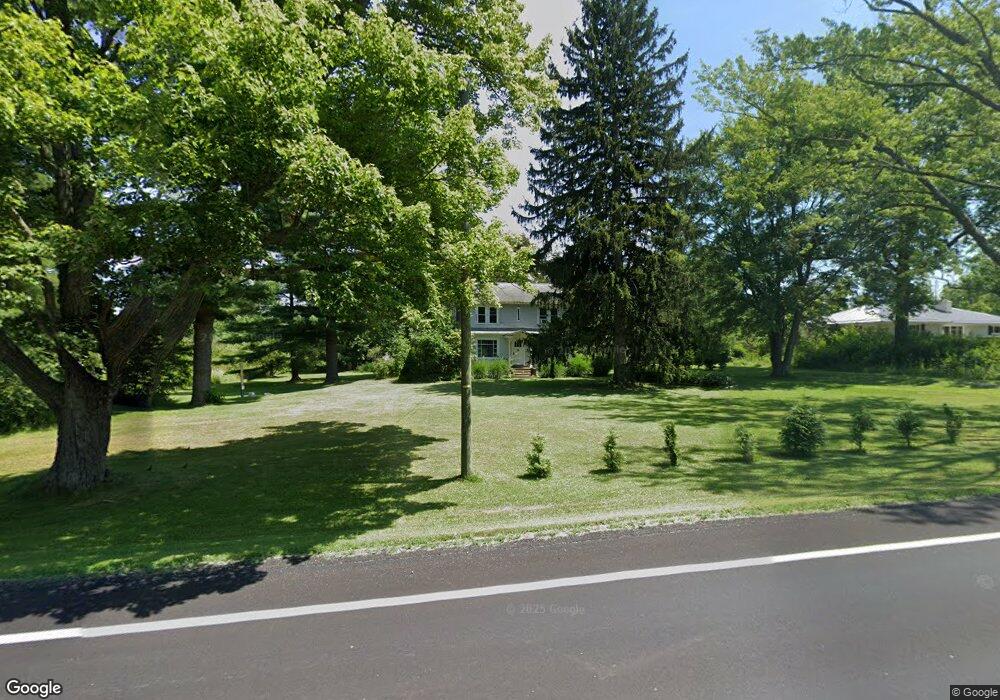
1028 State Route 7 NE Brookfield, OH 44403
Estimated Value: $123,000 - $233,000
3
Beds
1
Bath
1,380
Sq Ft
$123/Sq Ft
Est. Value
About This Home
This home is located at 1028 State Route 7 NE, Brookfield, OH 44403 and is currently estimated at $170,261, approximately $123 per square foot. 1028 State Route 7 NE is a home with nearby schools including Brookfield Elementary School, Brookfield Middle School, and Brookfield High School.
Ownership History
Date
Name
Owned For
Owner Type
Purchase Details
Closed on
May 2, 2019
Sold by
Pitoscia Christina Lynn
Bought by
Montgomery Adam James
Current Estimated Value
Purchase Details
Closed on
Oct 3, 2018
Sold by
Wellas Fargo Bank Na
Bought by
Pitoscia Christina Lynn
Purchase Details
Closed on
Sep 18, 2018
Sold by
Milijons Robert G
Bought by
Wells Fargo Bank Na
Create a Home Valuation Report for This Property
The Home Valuation Report is an in-depth analysis detailing your home's value as well as a comparison with similar homes in the area
Home Values in the Area
Average Home Value in this Area
Purchase History
| Date | Buyer | Sale Price | Title Company |
|---|---|---|---|
| Montgomery Adam James | $20,800 | None Available | |
| Pitoscia Christina Lynn | $20,000 | None Available | |
| Wells Fargo Bank Na | $32,000 | None Available |
Source: Public Records
Tax History Compared to Growth
Tax History
| Year | Tax Paid | Tax Assessment Tax Assessment Total Assessment is a certain percentage of the fair market value that is determined by local assessors to be the total taxable value of land and additions on the property. | Land | Improvement |
|---|---|---|---|---|
| 2024 | $1,967 | $36,650 | $7,140 | $29,510 |
| 2023 | $1,720 | $36,650 | $7,140 | $29,510 |
| 2022 | $1,590 | $27,480 | $6,510 | $20,970 |
| 2021 | $1,492 | $27,480 | $6,510 | $20,970 |
| 2020 | $1,483 | $27,480 | $6,510 | $20,970 |
| 2019 | $1,433 | $24,750 | $6,020 | $18,730 |
| 2018 | $1,581 | $24,750 | $6,020 | $18,730 |
| 2017 | $1,418 | $24,750 | $6,020 | $18,730 |
| 2016 | $1,308 | $21,950 | $6,690 | $15,260 |
| 2015 | $1,310 | $21,950 | $6,690 | $15,260 |
| 2014 | $1,304 | $21,950 | $6,690 | $15,260 |
| 2013 | $1,348 | $23,110 | $6,690 | $16,420 |
Source: Public Records
Map
Nearby Homes
- 209 Wyngate Dr
- 1212 State Route 7 NE
- 7085 Sunnydell Dr
- 7086 Warren Sharon Rd
- 7290 Lee Rd NE
- 1370 Custer Orangeville Rd
- 0 Albright McKay Rd NE
- 6130 Warren Sharon Rd
- 872 Yankee Run Rd
- 887 State Route 7 SE
- 1921 Custer Orangeville Rd
- 365 Brookfield Ave
- 928 Bedford Rd
- 6855 Stewart Sharon Rd
- 7406 Thompson Sharpsville Rd NE
- 7182 Stewart Sharon Rd
- 7440 Stewart Sharon Rd
- 461 Grove St
- 414 Wilson St
- 425 Grove St
- 0 Ohio 7
- 1010 State Route 7 NE
- 231 Joshua Dr
- 1043 State Route 7 NE
- 987 State Route 7 NE
- 1076 State Route 7 NE
- 238 Joshua Dr
- 971 State Route 7 NE
- 968 State Route 7 NE
- 239 Joshua Dr
- 963 State Route 7 NE
- 965 David Ln NE
- 1091 State Route 7 NE
- 217 Joshua Dr
- 1104 State Route 7 NE
- 955 David Ln NE
- 1005 David Ln NE
- 945 State Route 7 NE
- 1105 State Route 7 NE
- 945 David Ln NE