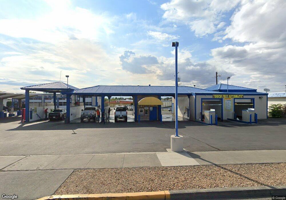
1028 W Broadway Ave Moses Lake, WA 98837
Estimated Value: $1,244,122
--
Bed
--
Bath
6,593
Sq Ft
$189/Sq Ft
Est. Value
About This Home
This home is located at 1028 W Broadway Ave, Moses Lake, WA 98837 and is currently estimated at $1,244,122, approximately $188 per square foot. 1028 W Broadway Ave is a home located in Grant County with nearby schools including Midway Elementary School & Early Learning Preschool, Frontier Middle School, and Moses Lake High School.
Ownership History
Date
Name
Owned For
Owner Type
Purchase Details
Closed on
Apr 23, 2015
Sold by
City Of Moses Lake
Bought by
Pro Touch Car Wash & Auto Detail Llc
Current Estimated Value
Purchase Details
Closed on
May 24, 2007
Sold by
Admiral Holdings Llc
Bought by
Diaz Carlos and Diaz Norma
Home Financials for this Owner
Home Financials are based on the most recent Mortgage that was taken out on this home.
Original Mortgage
$412,250
Interest Rate
8%
Mortgage Type
Seller Take Back
Create a Home Valuation Report for This Property
The Home Valuation Report is an in-depth analysis detailing your home's value as well as a comparison with similar homes in the area
Home Values in the Area
Average Home Value in this Area
Purchase History
| Date | Buyer | Sale Price | Title Company |
|---|---|---|---|
| Pro Touch Car Wash & Auto Detail Llc | -- | None Available | |
| Diaz Carlos | -- | None Available | |
| Diaz Carlos | $485,000 | Grant County Title | |
| Admiral Holdings Llc | -- | Grant County Title |
Source: Public Records
Mortgage History
| Date | Status | Borrower | Loan Amount |
|---|---|---|---|
| Previous Owner | Diaz Carlos | $412,250 |
Source: Public Records
Tax History Compared to Growth
Tax History
| Year | Tax Paid | Tax Assessment Tax Assessment Total Assessment is a certain percentage of the fair market value that is determined by local assessors to be the total taxable value of land and additions on the property. | Land | Improvement |
|---|---|---|---|---|
| 2024 | $5,647 | $457,615 | $42,490 | $415,125 |
| 2023 | $4,413 | $396,910 | $57,665 | $339,245 |
| 2022 | $4,749 | $396,910 | $57,665 | $339,245 |
| 2021 | $3,320 | $396,910 | $57,665 | $339,245 |
| 2020 | $5,003 | $261,600 | $57,665 | $203,935 |
| 2019 | $5,036 | $346,570 | $57,665 | $288,905 |
| 2018 | $5,246 | $343,220 | $57,665 | $285,555 |
| 2017 | $4,611 | $295,630 | $57,665 | $237,965 |
| 2016 | $5,512 | $362,170 | $55,440 | $306,730 |
| 2013 | -- | $290,225 | $27,720 | $262,505 |
Source: Public Records
Map
Nearby Homes
- 1133 W Ivy Ave
- 1138 W Columbia Ave
- 1300 W Marina Dr Unit 33
- 0 Unit NWM2429641
- 1129 W Windrose Dr
- 906 S C St
- 709 Sage Bay Dr
- 724 Sage Bay Dr
- 1329 W Columbia Ave
- 207 W Newfield Place
- 909 W Polo Ridge Dr
- 908 W Polo Ridge Dr
- 319 N Grape Dr
- 1405 W Lakeside Dr
- 305 S Gibby Rd
- 308 N Dale Rd
- 305 N Earl Rd
- 318 N Saratoga Way
- 948 S Eastlake Dr
- 401 N Grape Dr
- 1090 W Marina Dr
- 1037 W Marina Dr
- 1036 W Broadway Ave
- 1043 W Marina Dr
- 1014 W Marina Dr
- 1041 W Marina Dr
- 0 L8-11 Marina Dr
- 0 NNA Marina Dr
- 1002 W Marina Dr
- 940 W Broadway Ave
- 1056 W Marina Dr
- 1001 W Broadway Ave
- 945 W 3rd Ave
- 1065 W Marina Dr
- 1006 W Ivy Ave
- 1045 W Broadway Ave
- 604 -608 A St
- 1065 W Broadway Ave
- 601 S A St
- 1006 W 3rd Ave