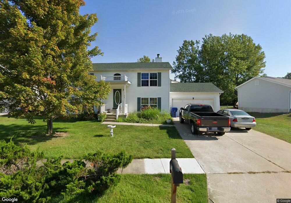
1028 Wrigley Cir Warrenton, MO 63383
Estimated Value: $283,944 - $314,000
Studio
--
Bath
1,976
Sq Ft
$151/Sq Ft
Est. Value
About This Home
This home is located at 1028 Wrigley Cir, Warrenton, MO 63383 and is currently estimated at $297,736, approximately $150 per square foot. 1028 Wrigley Cir is a home with nearby schools including Warrior Ridge Elementary School, Black Hawk Middle School, and Warrenton High School.
Ownership History
Date
Name
Owned For
Owner Type
Purchase Details
Closed on
Dec 10, 2009
Sold by
Wallace Donna M
Bought by
Wallace Elbert P
Current Estimated Value
Home Financials for this Owner
Home Financials are based on the most recent Mortgage that was taken out on this home.
Original Mortgage
$153,644
Outstanding Balance
$98,738
Interest Rate
5.01%
Mortgage Type
FHA
Estimated Equity
$198,998
Create a Home Valuation Report for This Property
The Home Valuation Report is an in-depth analysis detailing your home's value as well as a comparison with similar homes in the area
Home Values in the Area
Average Home Value in this Area
Purchase History
| Date | Buyer | Sale Price | Title Company |
|---|---|---|---|
| Wallace Elbert P | -- | None Available |
Source: Public Records
Mortgage History
| Date | Status | Borrower | Loan Amount |
|---|---|---|---|
| Open | Wallace Elbert P | $153,644 |
Source: Public Records
Tax History
| Year | Tax Paid | Tax Assessment Tax Assessment Total Assessment is a certain percentage of the fair market value that is determined by local assessors to be the total taxable value of land and additions on the property. | Land | Improvement |
|---|---|---|---|---|
| 2025 | $1,970 | $30,733 | $5,797 | $24,936 |
| 2024 | $1,970 | $27,197 | $5,130 | $22,067 |
| 2023 | $1,712 | $27,197 | $5,130 | $22,067 |
| 2022 | $1,589 | $25,183 | $4,750 | $20,433 |
| 2021 | $1,589 | $25,183 | $4,750 | $20,433 |
| 2020 | $1,597 | $25,183 | $4,750 | $20,433 |
| 2019 | $1,596 | $25,183 | $0 | $0 |
| 2017 | $1,579 | $25,183 | $0 | $0 |
| 2016 | $1,575 | $25,183 | $0 | $0 |
| 2015 | -- | $25,183 | $0 | $0 |
| 2011 | -- | $25,180 | $0 | $0 |
Source: Public Records
Map
Nearby Homes
- 0 Unknown Unit MIS25074536
- 0 Unknown Unit MIS25074694
- 0 Unknown Unit MIS25074528
- 0 Unknown Unit MIS25074531
- 0 Unknown Unit MIS25074699
- 0 Unknown Unit MIS25074540
- 0 Unknown Unit MIS25074696
- 0 Unknown Unit MIS25074614
- 0 Unknown Unit MIS25074589
- 0 Unknown Unit MIS25074705
- 0 Unknown Unit MIS25074703
- 0 Unknown Unit MIS25074700
- 0 Unknown Unit MIS25074931
- 0 Unknown Unit MIS26008953
- 0 Unknown Unit MIS26008873
- 0 Unknown Unit MIS25074704
- 0 Unknown Unit MIS25074602
- 916 Aspen Ave Unit 3
- 902 Pine Ave
- 811 Navajo Trail
- 1026 Wrigley Cir
- 1030 Wrigley Cir
- 1017 Yankee Ct
- 1031 Wrigley Cir
- 1024 Wrigley Cir
- 1032 Wrigley Cir
- 1033 Wrigley Cir
- 1016 Yankee Ct
- 1021 Comiskey Ct
- 1015 Yankee Ct
- 1034 Wrigley Cir
- 1016 Busch Dr
- 1024 Comiskey Ct
- 1035 Wrigley Cir
- 1014 Busch Dr
- 1014 Yankee Ct
- 1013 Yankee Ct
- 1023 Comiskey Ct
- 1025 Comiskey Ct
- 1036 Wrigley Cir
Your Personal Tour Guide
Ask me questions while you tour the home.