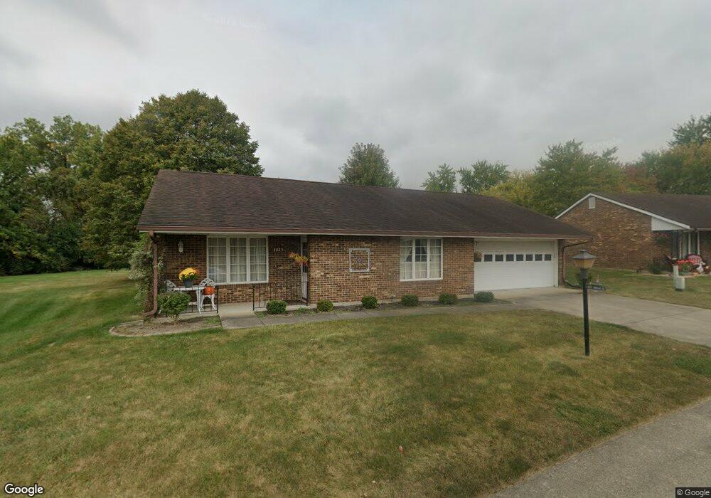
1029 Armsgate Rd Unit 12 Springfield, OH 45503
Estimated Value: $188,000 - $196,801
2
Beds
2
Baths
1,300
Sq Ft
$149/Sq Ft
Est. Value
About This Home
This home is located at 1029 Armsgate Rd Unit 12, Springfield, OH 45503 and is currently estimated at $193,200, approximately $148 per square foot. 1029 Armsgate Rd Unit 12 is a home located in Clark County with nearby schools including Northridge Elementary School, Kenton Ridge Middle & High School, and Emmanuel Christian Academy.
Ownership History
Date
Name
Owned For
Owner Type
Purchase Details
Closed on
Dec 16, 2013
Sold by
Payne Ernest F and Payne Rose Marie
Bought by
Payne Raymond S
Current Estimated Value
Purchase Details
Closed on
Aug 30, 2006
Sold by
Mcmillen Robert C and Mcmillen Betty J
Bought by
Payne Raymond S and Payne Ernest F
Home Financials for this Owner
Home Financials are based on the most recent Mortgage that was taken out on this home.
Original Mortgage
$75,000
Interest Rate
6.7%
Mortgage Type
Purchase Money Mortgage
Create a Home Valuation Report for This Property
The Home Valuation Report is an in-depth analysis detailing your home's value as well as a comparison with similar homes in the area
Home Values in the Area
Average Home Value in this Area
Purchase History
| Date | Buyer | Sale Price | Title Company |
|---|---|---|---|
| Payne Raymond S | -- | Attorney | |
| Payne Raymond S | $125,000 | None Available |
Source: Public Records
Mortgage History
| Date | Status | Borrower | Loan Amount |
|---|---|---|---|
| Closed | Payne Raymond S | $75,000 |
Source: Public Records
Tax History
| Year | Tax Paid | Tax Assessment Tax Assessment Total Assessment is a certain percentage of the fair market value that is determined by local assessors to be the total taxable value of land and additions on the property. | Land | Improvement |
|---|---|---|---|---|
| 2025 | $1,662 | $53,260 | $7,350 | $45,910 |
| 2024 | $1,606 | $39,170 | $6,300 | $32,870 |
| 2023 | $1,606 | $39,170 | $6,300 | $32,870 |
| 2022 | $1,612 | $39,170 | $6,300 | $32,870 |
| 2021 | $1,843 | $38,300 | $5,250 | $33,050 |
| 2020 | $1,845 | $38,300 | $5,250 | $33,050 |
| 2019 | $1,882 | $38,300 | $5,250 | $33,050 |
| 2018 | $1,575 | $31,100 | $5,570 | $25,530 |
| 2017 | $1,339 | $30,436 | $5,565 | $24,871 |
| 2016 | $1,329 | $30,436 | $5,565 | $24,871 |
| 2015 | $621 | $30,121 | $5,250 | $24,871 |
| 2014 | $1,242 | $30,121 | $5,250 | $24,871 |
| 2013 | $1,239 | $30,121 | $5,250 | $24,871 |
Source: Public Records
Map
Nearby Homes
- 1039 Bradford Dr Unit 42
- 1139 Bradford Dr
- 1136 Foxboro Rd Unit 202
- 3052 Brixton Dr E
- 3124 El Camino Dr
- 3135 Imperial Blvd
- 1525 Providence Ave
- 1404 Attleboro Ave
- 2943 Tarryton Ln
- 732 Grandview Dr Unit 732
- 1201 Kingsgate Rd
- 1162 Kingsgate Rd
- 2022 Westboro Ave
- 3631 Kingsgate Ln
- 3214 Revels St
- 1500 Kingsgate Rd Unit 19430
- 1502 Kingsgate Rd Unit 19432
- 1500 Kingsgate Rd
- 1502 Kingsgate Rd
- 1507 Kingsgate Rd
- 1027 Armsgate Rd Unit 13
- 1027 Armsgate Rd Unit VILLA
- 1031 Armsgate Rd Unit 11
- 1030 Armsgate Rd Unit 29
- 1030 Armsgate Rd
- 1026 Armsgate Rd
- 1033 Armsgate Rd
- 1025 Armsgate Rd
- 1034 Villa Rd
- 3028 Armsgate Rd
- 3028 Armsgate Rd
- 3027 Armsgate Rd
- 1035 Armsgate Rd Unit 9
- 1034 Armsgate Rd
- 3042 Derr Rd
- 3024 Derr Rd
- 1046 Villa Rd
- 1033 Bradford Dr Unit 45
- 3022 Derr Rd
- 3030 Armsgate Rd Unit 26
Your Personal Tour Guide
Ask me questions while you tour the home.