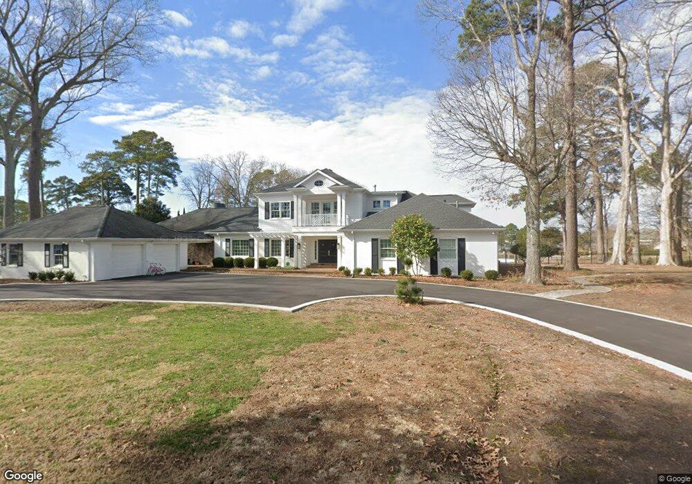
1029 Bobolink Dr Virginia Beach, VA 23451
Birdneck NeighborhoodEstimated Value: $2,824,000 - $2,956,000
5
Beds
5
Baths
4,618
Sq Ft
$627/Sq Ft
Est. Value
About This Home
This home is located at 1029 Bobolink Dr, Virginia Beach, VA 23451 and is currently estimated at $2,894,167, approximately $626 per square foot. 1029 Bobolink Dr is a home located in Virginia Beach City with nearby schools including Linkhorn Park Elementary School, Virginia Beach Middle School, and Frank W. Cox High School.
Ownership History
Date
Name
Owned For
Owner Type
Purchase Details
Closed on
Oct 13, 2011
Sold by
Schmidt Peter W
Bought by
Ward Jennifer G
Current Estimated Value
Home Financials for this Owner
Home Financials are based on the most recent Mortgage that was taken out on this home.
Original Mortgage
$765,000
Outstanding Balance
$523,016
Interest Rate
4.15%
Mortgage Type
New Conventional
Estimated Equity
$2,371,151
Create a Home Valuation Report for This Property
The Home Valuation Report is an in-depth analysis detailing your home's value as well as a comparison with similar homes in the area
Home Values in the Area
Average Home Value in this Area
Purchase History
| Date | Buyer | Sale Price | Title Company |
|---|---|---|---|
| Ward Jennifer G | $1,215,000 | -- |
Source: Public Records
Mortgage History
| Date | Status | Borrower | Loan Amount |
|---|---|---|---|
| Open | Ward Jennifer G | $765,000 |
Source: Public Records
Tax History Compared to Growth
Tax History
| Year | Tax Paid | Tax Assessment Tax Assessment Total Assessment is a certain percentage of the fair market value that is determined by local assessors to be the total taxable value of land and additions on the property. | Land | Improvement |
|---|---|---|---|---|
| 2025 | $20,011 | $2,189,600 | $1,149,500 | $1,040,100 |
| 2024 | $20,011 | $2,063,000 | $1,045,000 | $1,018,000 |
| 2023 | $17,064 | $1,723,600 | $916,700 | $806,900 |
| 2022 | $16,867 | $1,703,700 | $916,700 | $787,000 |
| 2021 | $15,632 | $1,579,000 | $916,700 | $662,300 |
| 2020 | $14,341 | $1,409,400 | $798,300 | $611,100 |
| 2019 | $14,127 | $1,369,400 | $798,300 | $571,100 |
| 2018 | $13,728 | $1,369,400 | $798,300 | $571,100 |
| 2017 | $12,032 | $1,200,200 | $798,000 | $402,200 |
| 2016 | $11,813 | $1,193,200 | $798,000 | $395,200 |
| 2015 | $10,518 | $1,062,400 | $703,000 | $359,400 |
| 2014 | $9,120 | $980,600 | $617,500 | $363,100 |
Source: Public Records
Map
Nearby Homes
- 1304 Mockingbird Place
- 920 Cardinal Rd
- 952 Oriole Dr
- 1109 S Bay Shore Dr
- 1329 Chewink Ct
- 1116 Rose Ln
- 1301 Penguin Cir
- 1500 Horse Point Ct
- 1401 Linlier Dr
- 1801 Eden Way
- 1501 N Horseshoe Cir
- 1005 Ditchley Rd
- 1284 Laskin Rd Unit 302
- 1721 Vintage Quay
- 506 Cavalier Dr
- 1240 Peoples Way
- 1236 Peoples Way
- 1872 Eden Way
- 909 Royal Cove Way
- 700 Oriole Dr Unit 523
- 1036 Bobolink Dr
- 1301 Mockingbird Place
- 1021 Bobolink Dr
- 1037 Bobolink Dr
- 1309 Mockingbird Place
- 1016 Bobolink Dr
- 1040 Bobolink Dr
- 1045 Bobolink Dr
- 1044 Bobolink Dr
- 1008 Bobolink Dr
- 1328 Starling Ct
- 1053 Bobolink Dr
- 1000 Bobolink Dr
- 1048 Bobolink Dr
- 1332 Starling Ct
- 1052 Cardinal Rd
- 1057 Bobolink Dr
- 960 Bobolink Dr
- 957 Bobolink Dr
- 1061 Bobolink Dr