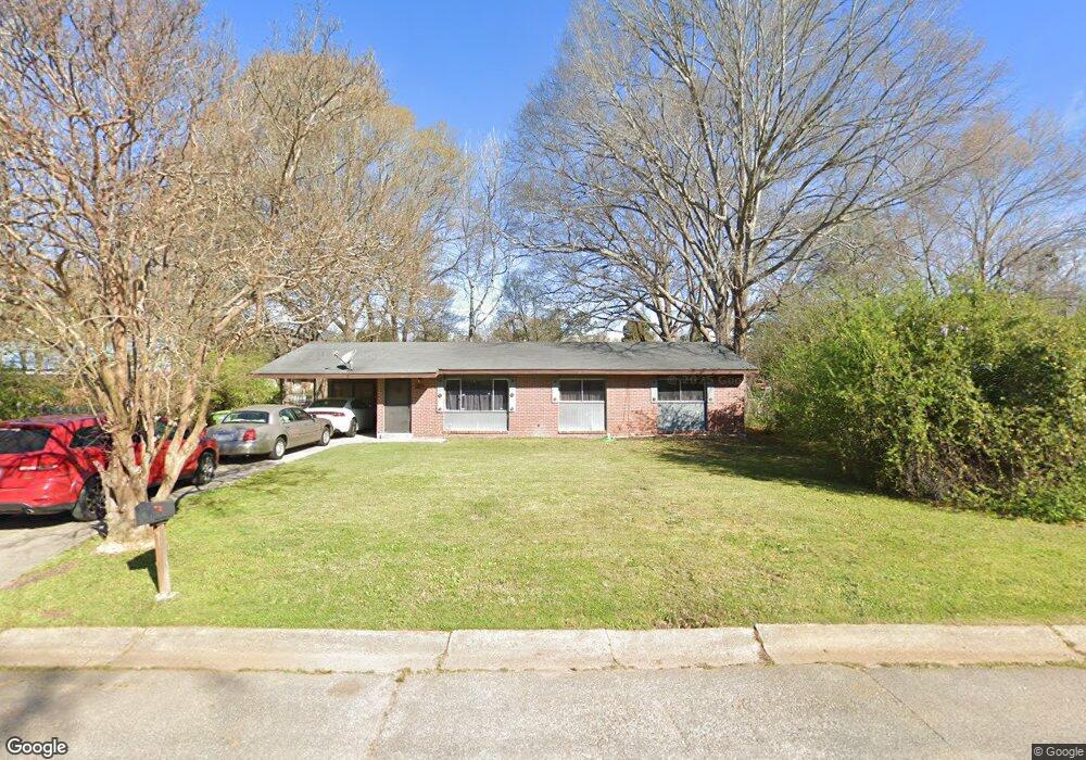
1029 Brighton Rd Columbus, GA 31906
South Columbus NeighborhoodEstimated Value: $100,000 - $123,650
3
Beds
3
Baths
1,347
Sq Ft
$82/Sq Ft
Est. Value
About This Home
This home is located at 1029 Brighton Rd, Columbus, GA 31906 and is currently estimated at $109,913, approximately $81 per square foot. 1029 Brighton Rd is a home located in Muscogee County with nearby schools including Lonnie Jackson Academy, Rothschild Leadership Academy, and Carver High School.
Ownership History
Date
Name
Owned For
Owner Type
Purchase Details
Closed on
Dec 14, 2017
Sold by
Jones Maurice
Bought by
Jones Enterprise And Sales Llc
Current Estimated Value
Purchase Details
Closed on
Jul 10, 2013
Sold by
Deutsche Bank National Tru
Bought by
Jones Maurice
Purchase Details
Closed on
Mar 5, 2013
Sold by
Walton Pleas M
Bought by
Deutsche Bank National Trust C
Create a Home Valuation Report for This Property
The Home Valuation Report is an in-depth analysis detailing your home's value as well as a comparison with similar homes in the area
Home Values in the Area
Average Home Value in this Area
Purchase History
| Date | Buyer | Sale Price | Title Company |
|---|---|---|---|
| Jones Enterprise And Sales Llc | -- | -- | |
| Jones Maurice | $21,421 | -- | |
| Deutsche Bank National Trust C | $21,573 | -- |
Source: Public Records
Tax History
| Year | Tax Paid | Tax Assessment Tax Assessment Total Assessment is a certain percentage of the fair market value that is determined by local assessors to be the total taxable value of land and additions on the property. | Land | Improvement |
|---|---|---|---|---|
| 2025 | $1,463 | $43,976 | $5,112 | $38,864 |
| 2024 | $1,721 | $43,976 | $5,112 | $38,864 |
| 2023 | $1,732 | $43,976 | $5,112 | $38,864 |
| 2022 | $722 | $24,228 | $5,112 | $19,116 |
| 2021 | $732 | $17,940 | $5,112 | $12,828 |
| 2020 | $733 | $17,940 | $5,112 | $12,828 |
| 2019 | $414 | $11,886 | $2,972 | $8,914 |
| 2018 | $840 | $24,132 | $5,112 | $19,020 |
| 2017 | $1,121 | $24,132 | $5,112 | $19,020 |
| 2016 | $821 | $19,908 | $2,895 | $17,013 |
| 2015 | $822 | $19,908 | $2,895 | $17,013 |
| 2014 | $354 | $8,568 | $2,895 | $5,673 |
| 2013 | -- | $19,419 | $2,895 | $16,524 |
Source: Public Records
Map
Nearby Homes
- 939 Pembrook Dr
- 3914 N Linden Dr
- 827 Brighton Rd
- 1235 Woodburn Ct
- 3938 Linden Cir
- 920 Ashland Ave
- 1043 Vera Dr
- 1232 Alta Vista Dr
- 1448 Cypress Ridge Dr
- 946 Woodburn Dr
- 937 Diggs Ave
- 776 Terminal Ct
- 3319 Decatur St
- 758 Terminal Ct
- 523 N Oakley Dr
- 1061 Dunbar Ave
- 3122 Glenwood Dr
- 559 Chandler Dr
- 869 Goodson Dr
- 944 Booker Ave
- 1037 Brighton Rd
- 1025 Brighton Rd
- 1056 Quincy Dr
- 1064 Quincy Dr
- 1048 Quincy Dr
- 1019 Brighton Rd
- 1045 Brighton Rd
- 1047 Farwell Dr
- 1026 Brighton Rd
- 1042 Quincy Dr
- 1038 Brighton Rd
- 1011 Brighton Rd
- 1068 Quincy Dr
- 1018 Brighton Rd
- 1046 Brighton Rd
- 1030 Quincy Dr
- 1020 Quincy Dr
- 1008 Brighton Rd
- 1055 Quincy Dr
- 1049 Quincy Dr
Your Personal Tour Guide
Ask me questions while you tour the home.