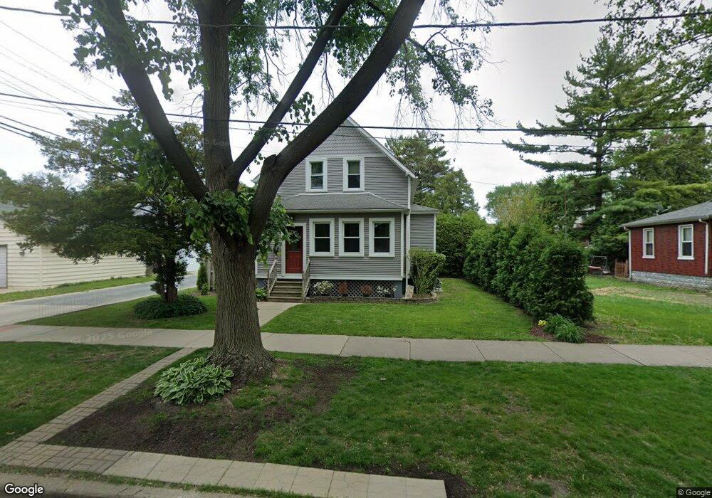
1029 Center St Des Plaines, IL 60016
Estimated Value: $347,978 - $397,000
2
Beds
2
Baths
704
Sq Ft
$521/Sq Ft
Est. Value
About This Home
This home is located at 1029 Center St, Des Plaines, IL 60016 and is currently estimated at $366,745, approximately $520 per square foot. 1029 Center St is a home located in Cook County with nearby schools including Central Elementary School, Chippewa Middle School, and Maine West High School.
Ownership History
Date
Name
Owned For
Owner Type
Purchase Details
Closed on
Apr 5, 2006
Sold by
Wolski Mildred
Bought by
Dietz Justin B
Current Estimated Value
Home Financials for this Owner
Home Financials are based on the most recent Mortgage that was taken out on this home.
Original Mortgage
$160,000
Outstanding Balance
$91,840
Interest Rate
6.34%
Mortgage Type
Fannie Mae Freddie Mac
Estimated Equity
$274,905
Purchase Details
Closed on
Aug 3, 2005
Sold by
Wolski Mildred
Bought by
Wolski Mildred and Mildred Wolski Declaration Of Trust
Create a Home Valuation Report for This Property
The Home Valuation Report is an in-depth analysis detailing your home's value as well as a comparison with similar homes in the area
Home Values in the Area
Average Home Value in this Area
Purchase History
| Date | Buyer | Sale Price | Title Company |
|---|---|---|---|
| Dietz Justin B | $200,000 | Attorneys Title Guaranty Fun | |
| Wolski Mildred | -- | -- |
Source: Public Records
Mortgage History
| Date | Status | Borrower | Loan Amount |
|---|---|---|---|
| Open | Dietz Justin B | $160,000 |
Source: Public Records
Tax History Compared to Growth
Tax History
| Year | Tax Paid | Tax Assessment Tax Assessment Total Assessment is a certain percentage of the fair market value that is determined by local assessors to be the total taxable value of land and additions on the property. | Land | Improvement |
|---|---|---|---|---|
| 2024 | $5,981 | $26,000 | $6,000 | $20,000 |
| 2023 | $5,810 | $26,000 | $6,000 | $20,000 |
| 2022 | $5,810 | $26,000 | $6,000 | $20,000 |
| 2021 | $4,630 | $18,393 | $4,875 | $13,518 |
| 2020 | $4,621 | $18,393 | $4,875 | $13,518 |
| 2019 | $4,577 | $20,437 | $4,875 | $15,562 |
| 2018 | $3,707 | $15,832 | $4,312 | $11,520 |
| 2017 | $3,660 | $15,832 | $4,312 | $11,520 |
| 2016 | $3,705 | $15,832 | $4,312 | $11,520 |
| 2015 | $3,347 | $13,696 | $3,750 | $9,946 |
| 2014 | $3,293 | $13,696 | $3,750 | $9,946 |
| 2013 | $3,193 | $13,696 | $3,750 | $9,946 |
Source: Public Records
Map
Nearby Homes
- 1365 Ashland Ave Unit 302
- 905 Center St Unit B507
- 905 Center St Unit B208
- 1524 Oakwood Ave
- 843 Lexington Cir E
- 1489 E Algonquin Rd
- 915 Graceland Ave Unit 1E
- 821 Lexington Cir E
- 799 Graceland Ave Unit 504A
- 960 S River Rd Unit 410
- 960 S River Rd Unit 208
- 750 Pearson St Unit 904
- 711 S River Rd Unit 401
- 1700 E Forest Ave
- 1685 Mill St Unit 605
- 1278 E River Dr
- 648 1st Ave
- 1509 Center St
- 1374 Jefferson St
- 1389 Perry St Unit 303
- 1404 E Walnut Ave
- 1416 E Walnut Ave
- 1424 E Walnut Ave
- 1407 Oakwood Ave
- 1405 Oakwood Ave
- 1415 Oakwood Ave
- 1421 Oakwood Ave
- 1428 E Walnut Ave
- 1427 Oakwood Ave
- 1390 E Walnut Ave
- 1434 E Walnut Ave
- 1442 E Walnut Ave
- 1409 E Walnut Ave
- 1415 E Walnut Ave
- 1380 E Walnut Ave
- 1405 E Walnut Ave
- 1441 Oakwood Ave
- 1375 Oakwood Ave
- 1450 E Walnut Ave
- 1427 E Walnut Ave