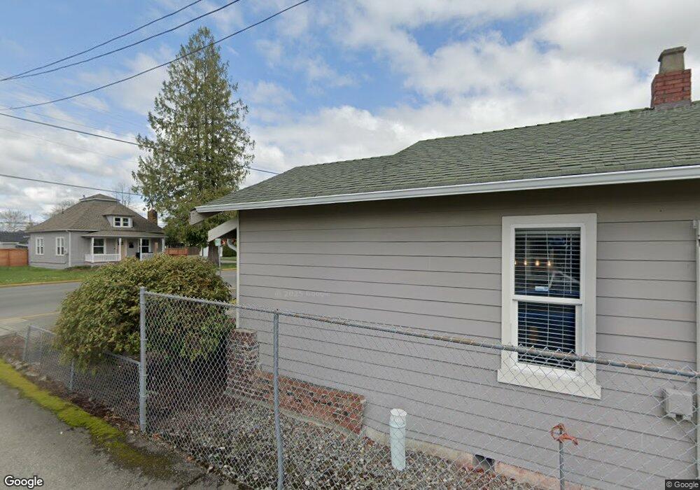
1029 Cole St Enumclaw, WA 98022
Estimated Value: $533,150
--
Bed
2
Baths
823
Sq Ft
$648/Sq Ft
Est. Value
About This Home
This home is located at 1029 Cole St, Enumclaw, WA 98022 and is currently estimated at $533,150, approximately $647 per square foot. 1029 Cole St is a home located in King County with nearby schools including Byron Kibler Elementary School, Enumclaw Middle School, and Enumclaw Senior High School.
Ownership History
Date
Name
Owned For
Owner Type
Purchase Details
Closed on
Apr 17, 2018
Sold by
Reynolds Michael J and Reynolds Christie S
Bought by
Emry Eric J and Binion Anthony M
Current Estimated Value
Home Financials for this Owner
Home Financials are based on the most recent Mortgage that was taken out on this home.
Original Mortgage
$310,000
Outstanding Balance
$225,546
Interest Rate
4.46%
Estimated Equity
$307,604
Purchase Details
Closed on
Nov 11, 1993
Sold by
Reynolds Lynn D
Bought by
Reynolds Michael J
Create a Home Valuation Report for This Property
The Home Valuation Report is an in-depth analysis detailing your home's value as well as a comparison with similar homes in the area
Home Values in the Area
Average Home Value in this Area
Purchase History
| Date | Buyer | Sale Price | Title Company |
|---|---|---|---|
| Emry Eric J | $310,000 | First American Title Insuran | |
| Reynolds Michael J | -- | -- |
Source: Public Records
Mortgage History
| Date | Status | Borrower | Loan Amount |
|---|---|---|---|
| Open | Emry Eric J | $310,000 |
Source: Public Records
Tax History Compared to Growth
Tax History
| Year | Tax Paid | Tax Assessment Tax Assessment Total Assessment is a certain percentage of the fair market value that is determined by local assessors to be the total taxable value of land and additions on the property. | Land | Improvement |
|---|---|---|---|---|
| 2024 | $2,779 | $289,200 | $131,600 | $157,600 |
| 2023 | $2,623 | $288,100 | $125,000 | $163,100 |
| 2022 | $2,893 | $288,100 | $115,000 | $173,100 |
| 2021 | $3,175 | $288,100 | $110,000 | $178,100 |
| 2020 | $2,574 | $288,100 | $110,000 | $178,100 |
| 2018 | $1,666 | $135,800 | $110,000 | $25,800 |
| 2017 | $1,469 | $135,800 | $105,000 | $30,800 |
| 2016 | $1,395 | $123,500 | $100,000 | $23,500 |
| 2015 | $1,457 | $115,500 | $47,300 | $68,200 |
| 2014 | -- | $115,500 | $50,000 | $65,500 |
| 2013 | -- | $107,300 | $60,000 | $47,300 |
Source: Public Records
Map
Nearby Homes
- 2040 Roosevelt Ave
- 2054 Roosevelt Ave
- 837 Myrtine St
- 1170 Cedar Dr
- 1207 Maple Dr
- 1165 Harding St
- 1107 Griffin Ave
- 520 Willow Dr Unit 111
- 915 Mountain Villa Dr
- 930 Mountain Villa Dr
- 1486 Division St
- 806 Pine Dr
- 525 Grand Fir Dr
- 1953 Pine Cone Ave Unit 106
- 1091 Aspen Ln
- 349 Rainier Ave
- 209 Noble Fir Cir Unit 60
- 250 Holly Dr
- 207 Noble Fir Cir
- 310 Johnson St
- 1039 Cole St
- 1019 Cole St
- 1049 Cole St
- 1023 Cole St
- 1103 Cole St
- 1028 Cole St
- 1036 Cole St
- 1014 Cole St
- 1115 Cole St
- 1008 Cole St
- 1234 Lincoln Ave
- 1240 Lincoln Ave
- 0 Roosevelt Ave Unit NWM2020495
- 0 Roosevelt Ave Unit NWM1873382
- 0 Roosevelt Ave
- 1134 Cole St
- 1101 Wells St
- 1055 Division St
- 1145 Cole St
- 2001 Roosevelt Ave