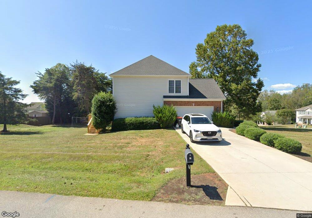
1029 Daltons Dr Forest, VA 24551
Estimated Value: $960,372 - $1,222,000
3
Beds
3
Baths
1,665
Sq Ft
$632/Sq Ft
Est. Value
About This Home
This home is located at 1029 Daltons Dr, Forest, VA 24551 and is currently estimated at $1,052,593, approximately $632 per square foot. 1029 Daltons Dr is a home located in Bedford County with nearby schools including Forest Elementary School, Forest Middle School, and Jefferson Forest High School.
Ownership History
Date
Name
Owned For
Owner Type
Purchase Details
Closed on
Jul 14, 2025
Sold by
Mcneill Bradley D and Mcneill Katherine Pate
Bought by
119 Obw Llc
Current Estimated Value
Purchase Details
Closed on
Jul 11, 2012
Sold by
A and K
Bought by
Mcneill Bradley D and Mcneill Katherine Pate
Home Financials for this Owner
Home Financials are based on the most recent Mortgage that was taken out on this home.
Original Mortgage
$538,000
Interest Rate
3.7%
Mortgage Type
Purchase Money Mortgage
Create a Home Valuation Report for This Property
The Home Valuation Report is an in-depth analysis detailing your home's value as well as a comparison with similar homes in the area
Purchase History
| Date | Buyer | Sale Price | Title Company |
|---|---|---|---|
| 119 Obw Llc | -- | None Listed On Document | |
| Mcneill Bradley D | $300,000 | Old Republic National Title |
Source: Public Records
Mortgage History
| Date | Status | Borrower | Loan Amount |
|---|---|---|---|
| Previous Owner | Mcneill Bradley D | $538,000 |
Source: Public Records
Tax History
| Year | Tax Paid | Tax Assessment Tax Assessment Total Assessment is a certain percentage of the fair market value that is determined by local assessors to be the total taxable value of land and additions on the property. | Land | Improvement |
|---|---|---|---|---|
| 2025 | $3,328 | $811,800 | $500,000 | $311,800 |
| 2024 | $3,328 | $811,800 | $500,000 | $311,800 |
| 2023 | $3,328 | $405,900 | $0 | $0 |
| 2022 | $2,836 | $283,600 | $0 | $0 |
| 2021 | $2,836 | $567,200 | $270,000 | $297,200 |
| 2020 | $2,836 | $567,200 | $270,000 | $297,200 |
| 2019 | $2,836 | $567,200 | $270,000 | $297,200 |
| 2018 | $2,972 | $571,600 | $280,000 | $291,600 |
| 2017 | $2,972 | $571,600 | $280,000 | $291,600 |
| 2016 | $2,972 | $571,600 | $280,000 | $291,600 |
| 2015 | $2,972 | $571,600 | $280,000 | $291,600 |
| 2014 | $2,984 | $573,900 | $292,500 | $281,400 |
Source: Public Records
Map
Nearby Homes
- 1040 Hooper Woods Dr
- 103 Brockenbrough Place
- 1079 High Oaks Dr
- 1110 Adam Hill Ct
- 1118 Carnegie Place
- 0 Lejack Cir
- 0 Lejack Cir Unit 333233
- 1450 Lejack Cir
- 464 Oak Point Rd
- 118 Sailview Dr
- 1300 Stoney Ridge Blvd Unit 208
- 2212 Deer Run
- 1301 Stoney Ridge Blvd
- 2223 Cottontown Rd
- 2199 Cottontown Rd
- 726 Lake Vista Dr
- 1148 Val Terrace Ct
- 1102 Twin Springs Ct
- 0 Gilfield Dr
- 112 Haines Point Terrace
- 1029 Daltons Dr
- 1029 Daltons Dr
- 1029 Daltons Dr
- 1029 Daltons Dr
- 1170 Hooper Woods Dr
- 1061 Daltons Dr
- 1202 Hooper Woods Dr
- 1014 Daltons Dr
- 1050 Daltons Dr
- 1037 Cossman Ct
- 1062 Daltons Dr
- 1208 Hooper Woods Dr
- 1157 Hooper Woods Dr
- 1141 Hooper Woods Dr
- 1049 Cossman Ct
- 1049 W Crossing Dr
- 1185 Hooper Woods Dr
- 1129 Hooper Woods Dr
- 1086 Daltons Dr
- 1232 Hooper Woods Dr
Your Personal Tour Guide
Ask me questions while you tour the home.