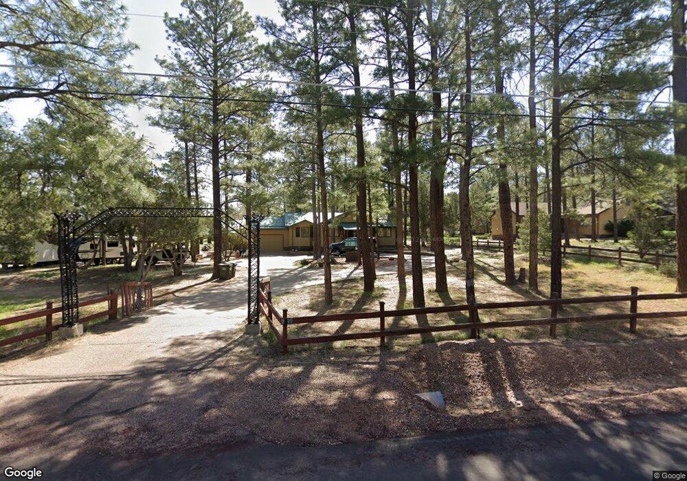
1029 Dwight Dr Show Low, AZ 85901
Estimated Value: $411,000 - $549,000
Studio
--
Bath
1,680
Sq Ft
$285/Sq Ft
Est. Value
About This Home
This home is located at 1029 Dwight Dr, Show Low, AZ 85901 and is currently estimated at $479,578, approximately $285 per square foot. 1029 Dwight Dr is a home located in Navajo County with nearby schools including Linden Elementary School, Show Low High School, and Show Low Junior High School.
Ownership History
Date
Name
Owned For
Owner Type
Purchase Details
Closed on
Oct 21, 2025
Sold by
Troy And Kristin Bell Revocable Living T and Bell Troy M
Bought by
Chaparral Property Llc
Current Estimated Value
Purchase Details
Closed on
Jan 17, 2025
Sold by
Steven W Quinn And Stacey L Quinn Trust and Quinn Steven W
Bought by
Troy And Kristin Bell Revocable Living Trust and Bell
Purchase Details
Closed on
Sep 16, 2014
Sold by
Quinn Steven Wayne and Quinn Stacey Lynn
Bought by
Quinn Steven W and Quinn Stacey L
Purchase Details
Closed on
May 10, 2012
Sold by
Caliva Caliva Ken Ken
Bought by
Quinn Steven Wayne and Quinn Stacey Lynn
Home Financials for this Owner
Home Financials are based on the most recent Mortgage that was taken out on this home.
Original Mortgage
$116,000
Interest Rate
3.84%
Mortgage Type
New Conventional
Create a Home Valuation Report for This Property
The Home Valuation Report is an in-depth analysis detailing your home's value as well as a comparison with similar homes in the area
Home Values in the Area
Average Home Value in this Area
Purchase History
| Date | Buyer | Sale Price | Title Company |
|---|---|---|---|
| Chaparral Property Llc | -- | None Listed On Document | |
| Troy And Kristin Bell Revocable Living Trust | $370,000 | Pioneer Title Agency | |
| Quinn Steven W | -- | None Available | |
| Quinn Steven Wayne | $145,000 | Lawyers Title Of Arizona Inc |
Source: Public Records
Mortgage History
| Date | Status | Borrower | Loan Amount |
|---|---|---|---|
| Previous Owner | Quinn Steven Wayne | $116,000 |
Source: Public Records
Tax History
| Year | Tax Paid | Tax Assessment Tax Assessment Total Assessment is a certain percentage of the fair market value that is determined by local assessors to be the total taxable value of land and additions on the property. | Land | Improvement |
|---|---|---|---|---|
| 2026 | $1,651 | -- | -- | -- |
| 2025 | $1,625 | $44,745 | $9,900 | $34,845 |
| 2024 | $1,526 | $45,041 | $10,440 | $34,601 |
| 2023 | $1,625 | $30,635 | $5,832 | $24,803 |
| 2022 | $1,526 | $0 | $0 | $0 |
| 2021 | $1,549 | $0 | $0 | $0 |
| 2020 | $1,442 | $0 | $0 | $0 |
| 2019 | $1,708 | $0 | $0 | $0 |
| 2018 | $1,629 | $0 | $0 | $0 |
| 2017 | $1,504 | $0 | $0 | $0 |
| 2016 | $1,483 | $0 | $0 | $0 |
| 2015 | $1,392 | $11,599 | $3,400 | $8,199 |
Source: Public Records
Map
Nearby Homes
- 1009 Chaparral Dr
- 1010 Chaparral Dr
- 1053 Lone Pine Dam Rd Unit FS13
- 1107 Cochran Ln
- 1085 Pine Ridge Dr
- 7022 Kims Way
- 7124 Simons Way
- 3401 N Eagles Creek Dr
- 7046 Stagecoach Pass
- 3160 N Eagle Landing Rd
- 3180 N Eagles Creek Dr
- 2701 N Eagle View Cir
- 7025 Dusty Saddle Trail
- 4870 W Eagle Mountain Dr Unit 14
- 7092 Shilo Trail
- 2800 N Eagle View Loop
- 4800 W Mountain Hollow Loop
- 6923 Laura's Place
- 4790 Mountain Hollow Loop
- 4780 Mountain Hollow Loop
- 1033 Dwight Dr
- 1025 Dwight Dr
- 1039 Dwight Dr
- 1021 Dwight Dr
- 1030 Dwight Dr
- 1030 Ponderosa Dr
- 1044 Ponderosa Dr
- 1034 Sunset View Cir
- 1026 Dwight Dr
- 1019 Dwight Dr
- 1043 Dwight Dr
- 1017 Dwight Dr
- 1037 Sunset View Cir
- 1022 Dwight Dr
- 1024 Ponderosa Dr
- 1018 Dwight Dr
- 1044 Dwight Dr
- 1047 Dwight Dr
- 1013 Dwight Dr
- 1029 Chaparral Dr
Your Personal Tour Guide
Ask me questions while you tour the home.