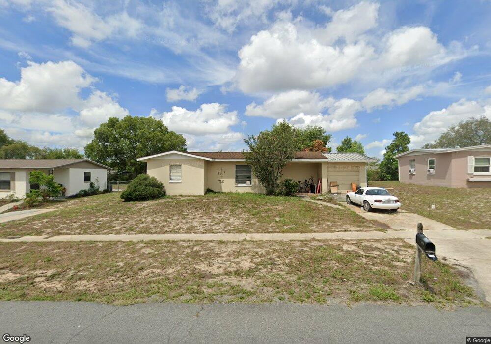
1029 Embassy Ave Spring Hill, FL 34606
Estimated Value: $162,000 - $189,000
2
Beds
1
Bath
880
Sq Ft
$201/Sq Ft
Est. Value
About This Home
This home is located at 1029 Embassy Ave, Spring Hill, FL 34606 and is currently estimated at $177,046, approximately $201 per square foot. 1029 Embassy Ave is a home located in Hernando County with nearby schools including Westside Elementary School, Fox Chapel Middle School, and Frank W. Springstead High School.
Ownership History
Date
Name
Owned For
Owner Type
Purchase Details
Closed on
May 19, 2006
Sold by
Elliott Thomas James and Elliott Dawn Tenice
Bought by
Mcclune Michael S
Current Estimated Value
Home Financials for this Owner
Home Financials are based on the most recent Mortgage that was taken out on this home.
Original Mortgage
$76,000
Outstanding Balance
$43,634
Interest Rate
6.44%
Mortgage Type
Stand Alone Second
Estimated Equity
$133,412
Purchase Details
Closed on
Mar 31, 2005
Sold by
Mcclune Michael S
Bought by
Elliott Thomas James and Elliott Dawn Tenice
Home Financials for this Owner
Home Financials are based on the most recent Mortgage that was taken out on this home.
Original Mortgage
$60,000
Interest Rate
7.7%
Mortgage Type
Purchase Money Mortgage
Purchase Details
Closed on
May 5, 2000
Sold by
Mcclune Linda
Bought by
Mcclune Michael S
Create a Home Valuation Report for This Property
The Home Valuation Report is an in-depth analysis detailing your home's value as well as a comparison with similar homes in the area
Home Values in the Area
Average Home Value in this Area
Purchase History
| Date | Buyer | Sale Price | Title Company |
|---|---|---|---|
| Mcclune Michael S | $95,000 | Continental America Title Co | |
| Elliott Thomas James | $75,000 | Continental America Title Co | |
| Mcclune Michael S | -- | -- |
Source: Public Records
Mortgage History
| Date | Status | Borrower | Loan Amount |
|---|---|---|---|
| Open | Mcclune Michael S | $76,000 | |
| Closed | Mcclune Michael S | $76,000 | |
| Previous Owner | Elliott Thomas James | $60,000 |
Source: Public Records
Tax History
| Year | Tax Paid | Tax Assessment Tax Assessment Total Assessment is a certain percentage of the fair market value that is determined by local assessors to be the total taxable value of land and additions on the property. | Land | Improvement |
|---|---|---|---|---|
| 2025 | $1,931 | $74,468 | -- | -- |
| 2024 | $1,828 | $67,698 | -- | -- |
| 2023 | $1,828 | $61,544 | $0 | $0 |
| 2022 | $1,649 | $55,949 | $0 | $0 |
| 2021 | $887 | $58,614 | $7,875 | $50,739 |
| 2020 | $1,283 | $53,919 | $7,125 | $46,794 |
| 2019 | $1,244 | $50,885 | $6,825 | $44,060 |
| 2018 | $615 | $42,560 | $4,950 | $37,610 |
| 2017 | $853 | $39,258 | $6,150 | $33,108 |
| 2016 | $759 | $31,582 | $0 | $0 |
| 2015 | $737 | $30,057 | $0 | $0 |
| 2014 | $284 | $28,613 | $0 | $0 |
Source: Public Records
Map
Nearby Homes
- 7223 Tarrytown Dr
- 7319 Holiday Dr
- 7369 Tarrytown Dr
- 1173 Cobblestone Dr
- 7222 Holiday Dr
- 7185 Holiday Dr
- 405 Copperfield Rd
- 7314 Pinehurst Dr
- 589 Swallow Ln
- 7232 Spring Hill Dr
- 7162 Cambridge St
- 6422 Fairlawn St
- 383 Cobblestone Dr
- 6471 Catalina St
- 7797 Pinehurst Dr
- 0 Sylvia
- 444 Edgehill Ave
- 7631 Pinehurst Dr
- 1241 Sylvia Ave
- 000 Sylvia Ave
- 1035 Embassy Ave
- 1018 Cobblestone Dr
- 1010 Cobblestone Dr
- 1026 Cobblestone Dr
- 1013 Embassy Ave
- 1043 Embassy Ave
- 1038 Embassy Ave
- 1002 Cobblestone Dr
- 1046 Embassy Ave
- 1034 Cobblestone Dr
- 1022 Embassy Ave
- 1051 Embassy Ave
- 1005 Embassy Ave
- 994 Cobblestone Dr
- 1042 Cobblestone Dr
- 1039 Marlow Ave
- 1031 Marlow Ave
- 1017 Cobblestone Dr
- 1062 Embassy Ave
Your Personal Tour Guide
Ask me questions while you tour the home.