Estimated Value: $226,506 - $270,000
3
Beds
1
Bath
1,008
Sq Ft
$241/Sq Ft
Est. Value
About This Home
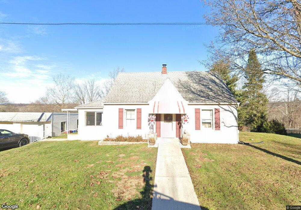
This home is located at 1029 Forrest Rd, York, PA 17408 and is currently estimated at $242,627, approximately $240 per square foot. 1029 Forrest Rd is a home located in York County with nearby schools including Spring Grove Area Middle School, Spring Grove Area High School, and St Rose Of Lima School.
Ownership History
Date
Name
Owned For
Owner Type
Purchase Details
Closed on
Mar 2, 2012
Sold by
Anderson Barry L and Estate Of Warren D Anderson
Bought by
Behne Brian
Current Estimated Value
Home Financials for this Owner
Home Financials are based on the most recent Mortgage that was taken out on this home.
Original Mortgage
$114,285
Outstanding Balance
$78,954
Interest Rate
3.99%
Mortgage Type
New Conventional
Estimated Equity
$163,673
Purchase Details
Closed on
Jun 23, 1947
Bought by
Anderson Warren D
Create a Home Valuation Report for This Property
The Home Valuation Report is an in-depth analysis detailing your home's value as well as a comparison with similar homes in the area
Home Values in the Area
Average Home Value in this Area
Purchase History
| Date | Buyer | Sale Price | Title Company |
|---|---|---|---|
| Behne Brian | $107,200 | None Available | |
| Anderson Warren D | $1,500 | -- |
Source: Public Records
Mortgage History
| Date | Status | Borrower | Loan Amount |
|---|---|---|---|
| Open | Behne Brian | $114,285 |
Source: Public Records
Tax History
| Year | Tax Paid | Tax Assessment Tax Assessment Total Assessment is a certain percentage of the fair market value that is determined by local assessors to be the total taxable value of land and additions on the property. | Land | Improvement |
|---|---|---|---|---|
| 2025 | $3,472 | $104,100 | $21,800 | $82,300 |
| 2024 | $3,365 | $102,000 | $21,800 | $80,200 |
| 2023 | $3,365 | $102,000 | $21,800 | $80,200 |
| 2022 | $3,365 | $102,000 | $21,800 | $80,200 |
| 2021 | $3,220 | $102,000 | $21,800 | $80,200 |
| 2020 | $3,220 | $102,000 | $21,800 | $80,200 |
| 2019 | $3,197 | $102,000 | $21,800 | $80,200 |
| 2018 | $3,155 | $102,000 | $21,800 | $80,200 |
| 2017 | $3,083 | $102,000 | $21,800 | $80,200 |
| 2016 | $0 | $102,000 | $21,800 | $80,200 |
| 2015 | -- | $102,000 | $21,800 | $80,200 |
| 2014 | -- | $102,000 | $21,800 | $80,200 |
Source: Public Records
Map
Nearby Homes
- 1015 Trinity Rd
- 4009 Robinhood Dr
- 3971 Little John Dr
- 286 N Main St
- 3449 Indian Rock Dam Rd
- 3450 Heather Dr
- 51 N Main St
- 3108 King Richards Ct S
- 29 W George St
- 4158 Robinhood Dr
- 4025 Rolling Meadow Ct
- 1570 Woodberry Rd
- 121 Chestnut Hill Dr
- 119 Chestnut Hill Dr
- 170 Timber Crest Dr
- 208 Country Ridge Dr
- 1709 Country Manor Dr
- 4125 W Market St
- 1484 Clayoma Ave
- 1483 Linton Terrace
- 1023 Forrest Rd
- 1035 Forrest Rd
- 1030 Forrest Rd
- 1024 Forrest Rd
- 1015 Hilltop Rd
- 1015 Forrest Rd
- 1011 Smith Hill Rd
- 1015 Smith Hill Rd
- 1003 Smith Hill Rd
- 1019 Smith Hill Rd
- 1019 Hilltop Rd
- 1041 Forrest Hill Rd
- 1041 Forrest Rd
- 1023 Smith Hill Rd
- 1027 Smith Hill Rd
- 1025 Ginger Dr
- 3312 W College Ave
- 1033 Smith Hill Rd
- 1030 Ginger Dr
- 1026 Ginger Dr
Your Personal Tour Guide
Ask me questions while you tour the home.