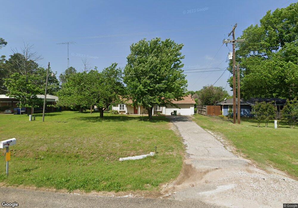
1029 Highway 377 N Whitesboro, TX 76273
Estimated Value: $177,000 - $194,679
2
Beds
1
Bath
1,230
Sq Ft
$151/Sq Ft
Est. Value
About This Home
This home is located at 1029 Highway 377 N, Whitesboro, TX 76273 and is currently estimated at $185,840, approximately $151 per square foot. 1029 Highway 377 N is a home located in Grayson County with nearby schools including J.W. Hayes Primary School, Whitesboro Intermediate School, and Whitesboro Middle School.
Ownership History
Date
Name
Owned For
Owner Type
Purchase Details
Closed on
Dec 21, 2023
Sold by
Lichtman Cynthia L
Bought by
Morin Steven and Morin Jessica
Current Estimated Value
Home Financials for this Owner
Home Financials are based on the most recent Mortgage that was taken out on this home.
Original Mortgage
$140,000
Outstanding Balance
$96,827
Interest Rate
7.5%
Mortgage Type
Seller Take Back
Estimated Equity
$89,013
Purchase Details
Closed on
May 7, 2020
Sold by
Batchelor Rodney E and Batchelor Jerry Lynn
Bought by
Herod Orrena H
Create a Home Valuation Report for This Property
The Home Valuation Report is an in-depth analysis detailing your home's value as well as a comparison with similar homes in the area
Home Values in the Area
Average Home Value in this Area
Purchase History
| Date | Buyer | Sale Price | Title Company |
|---|---|---|---|
| Morin Steven | -- | Red River Title | |
| Lichtman Cynthia L | -- | Red River Title | |
| Herod Orrena H | -- | Red River Title Co |
Source: Public Records
Mortgage History
| Date | Status | Borrower | Loan Amount |
|---|---|---|---|
| Open | Morin Steven | $140,000 |
Source: Public Records
Tax History Compared to Growth
Tax History
| Year | Tax Paid | Tax Assessment Tax Assessment Total Assessment is a certain percentage of the fair market value that is determined by local assessors to be the total taxable value of land and additions on the property. | Land | Improvement |
|---|---|---|---|---|
| 2025 | $1,668 | $148,475 | $26,164 | $122,311 |
| 2024 | $2,889 | $146,651 | $23,691 | $122,960 |
| 2023 | $2,559 | $141,953 | $21,420 | $120,533 |
| 2022 | $2,764 | $140,226 | $13,600 | $126,626 |
| 2021 | $2,749 | $128,220 | $13,600 | $114,620 |
| 2020 | $2,283 | $107,579 | $13,600 | $93,979 |
| 2019 | $2,183 | $92,968 | $7,140 | $85,828 |
| 2018 | $2,151 | $89,928 | $5,100 | $84,828 |
| 2017 | $2,027 | $83,768 | $5,100 | $78,668 |
| 2016 | $1,403 | $84,179 | $5,100 | $79,079 |
| 2015 | $480 | $70,938 | $5,100 | $65,838 |
| 2014 | $480 | $74,094 | $5,100 | $68,994 |
Source: Public Records
Map
Nearby Homes
- 205 Anderson Rd
- 873 Anderson Rd
- 53 ac U S Highway 82
- US U S Highway 82
- 2403 Evelyn Rd
- 400 Wild Wood Ln
- 203 Red River Dr
- 2424 Jolinda Ln
- TBD Bones Chapel Rd
- 790 Bones Chapel Rd
- 216 Red River Rd
- 313 Texoma Dr
- 707 N Union St
- 299 Sadler Rd
- 701 Park Place
- TBD Center Park Dr
- 1052 Bones Chapel Rd
- 627 Bois d Arc St
- 115 D St
- 230 Center St
- 1031 Highway 377 N
- 1033 Highway 377 N
- 1025 Highway 377 N
- 1030 Highway 377 N
- 1035 Highway 377 N
- 1023 Highway 377 N
- 1027 Highway 377 N
- 1032 Highway 377 N
- 1037 Highway 377 N
- 1039 Highway 377 N
- 1017 Highway 377 N
- 1040 U S 377
- 1036 Highway 377 N
- 1015 Highway 377 N
- 1043 Highway 377 N
- 1013 Highway 377 N
- 1040 Highway 377 N
- 1047 Highway 377 N
- 1011 Highway 377 N
- 1009 Highway 377 N