Estimated Value: $444,000 - $610,000
3
Beds
1
Bath
1,480
Sq Ft
$359/Sq Ft
Est. Value
About This Home
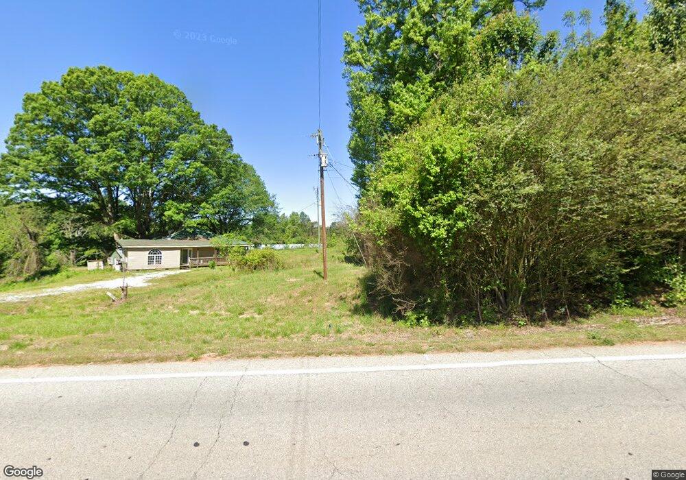
This home is located at 1029 Highway 63, Homer, GA 30547 and is currently estimated at $531,648, approximately $359 per square foot. 1029 Highway 63 is a home located in Banks County with nearby schools including Banks County Primary School, Banks County Elementary School, and Banks County Middle School.
Ownership History
Date
Name
Owned For
Owner Type
Purchase Details
Closed on
Oct 2, 2015
Sold by
Reid Bobby
Bought by
Reid Bobby and Abbs Heather
Current Estimated Value
Purchase Details
Closed on
Nov 26, 2014
Sold by
Kures Michele A
Bought by
Kures Brittni
Purchase Details
Closed on
Nov 5, 2014
Sold by
Usry Hugh E
Bought by
Kures Brittni
Purchase Details
Closed on
Jan 19, 2010
Sold by
Alexander Dan W
Bought by
Kures Marc S and Kures Michele A
Purchase Details
Closed on
Aug 18, 2006
Sold by
Baxter Carol
Bought by
Alexander Dan W and Alexander Leslie
Create a Home Valuation Report for This Property
The Home Valuation Report is an in-depth analysis detailing your home's value as well as a comparison with similar homes in the area
Home Values in the Area
Average Home Value in this Area
Purchase History
| Date | Buyer | Sale Price | Title Company |
|---|---|---|---|
| Reid Bobby | -- | -- | |
| Reid Bobby | $225,000 | -- | |
| Kures Brittni | -- | -- | |
| Kures Brittni | -- | -- | |
| Kures Marc S | $390,490 | -- | |
| Alexander Dan W | $455,000 | -- |
Source: Public Records
Tax History Compared to Growth
Tax History
| Year | Tax Paid | Tax Assessment Tax Assessment Total Assessment is a certain percentage of the fair market value that is determined by local assessors to be the total taxable value of land and additions on the property. | Land | Improvement |
|---|---|---|---|---|
| 2024 | $1,243 | $140,207 | $92,229 | $47,978 |
| 2023 | $1,243 | $136,959 | $89,953 | $47,006 |
| 2022 | $1,260 | $115,134 | $68,128 | $47,006 |
| 2021 | $1,334 | $115,134 | $68,128 | $47,006 |
| 2020 | $1,339 | $99,012 | $52,006 | $47,006 |
| 2019 | $1,343 | $99,012 | $52,006 | $47,006 |
| 2018 | $1,360 | $99,012 | $52,006 | $47,006 |
| 2017 | $1,185 | $83,189 | $35,866 | $47,323 |
| 2016 | $1,196 | $73,906 | $35,866 | $38,040 |
| 2015 | $1,059 | $73,906 | $35,866 | $38,040 |
| 2014 | $1,059 | $107,212 | $69,172 | $38,040 |
| 2013 | -- | $107,212 | $69,172 | $38,040 |
Source: Public Records
Map
Nearby Homes
- 1111 Georgia 63
- 823 Highway 63
- 0 Bennett Rd Unit 23200799
- 2090 Southern Seed Way
- 0 Highway 59 Unit 10257605
- 0 Highway 59 Unit 10257590
- 251 Cedar Ridge Dr
- 247 Cedar Ridge Dr
- 127 Mayfield Rd
- 0 Carlan Rd Unit Tract 4 CL339038
- 0 Carlan Rd Unit Tract 3
- 0 Carlan Rd Unit Tract 2 CL339031
- 0 Carlan Rd Unit TRACT 4 10597640
- 0 Carlan Rd Unit TRACT 3 10597631
- 0 Carlan Rd Unit TRACT 2 10597626
- 2046 Westbrook Rd
- 135 Horseshoe Trail
- 1486 McCoy Bridge Rd
- 237 Oakwood Dr
- 0 McCoy Bridge Rd Unit 20148799
- 1029 Highway 63
- 1023 Highway 63
- 0 Highway 63 Unit 8107731
- 0 Highway 63 Unit 1012068
- 0 Georgia 63 Unit 8387638
- 0 Georgia 63 Unit 7335881
- 0 Georgia 63 Unit 8858419
- 0 Georgia 63 Unit 8955994
- 0 Highway 63 Unit 8858419
- 0 Highway 63 Unit 8890088
- 0 Highway 63 Unit 8890091
- 2252 Georgia 63
- 0 Highway 63 Unit 8858454
- 0 Georgia 63
- 1019 Highway 63
- 2080 Bennett Rd
- 1210 Martin Bridge Rd
- 2117 Bennett Rd
- 1892 Bennett Rd
- 1856 Bennett Rd