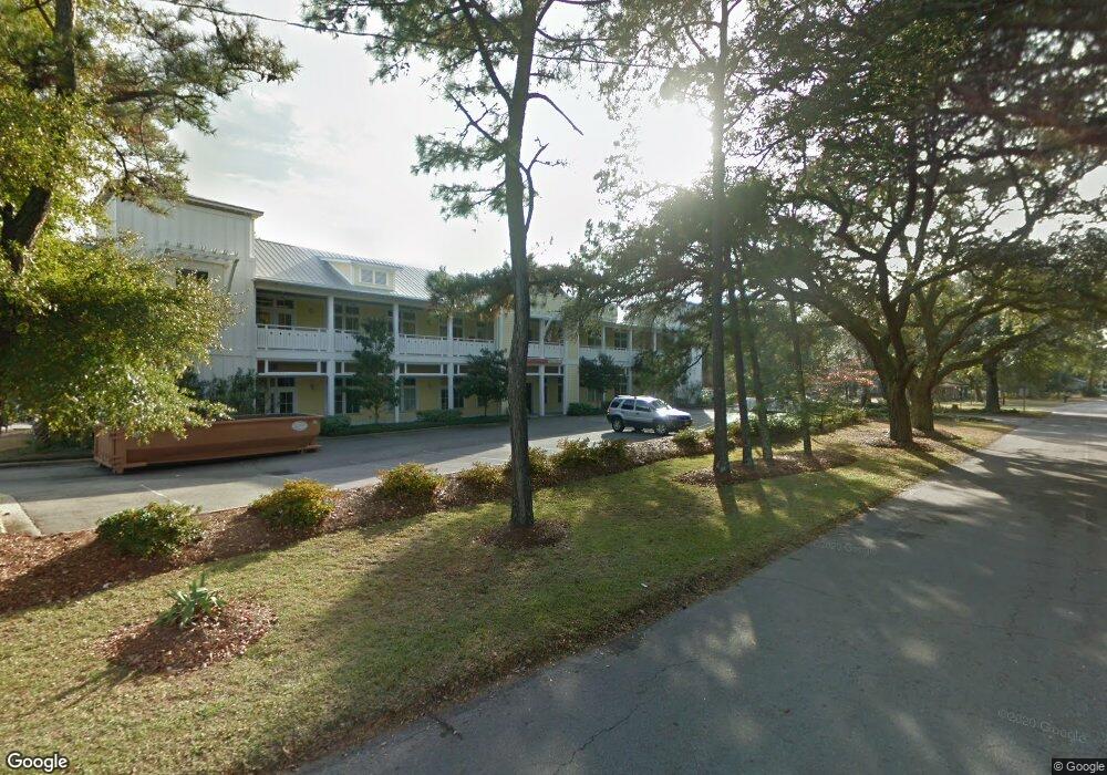
1029 N Howe St Southport, NC 28461
Estimated Value: $3,201,321
--
Bed
--
Bath
26,136
Sq Ft
$122/Sq Ft
Est. Value
About This Home
This home is located at 1029 N Howe St, Southport, NC 28461 and is currently estimated at $3,201,321, approximately $122 per square foot. 1029 N Howe St is a home located in Brunswick County with nearby schools including Southport Elementary School, South Brunswick Middle School, and South Brunswick High School.
Ownership History
Date
Name
Owned For
Owner Type
Purchase Details
Closed on
Jul 29, 2015
Sold by
The Br Of Trustees Of Brunswick Cmnty Co
Bought by
City Of Southport
Current Estimated Value
Purchase Details
Closed on
Dec 19, 2012
Sold by
Manthybug Llc
Bought by
City Of Southport
Purchase Details
Closed on
Dec 1, 2007
Sold by
Port Properties Llc
Bought by
Manthybug Llc
Home Financials for this Owner
Home Financials are based on the most recent Mortgage that was taken out on this home.
Original Mortgage
$1,445,000
Interest Rate
6.29%
Mortgage Type
Future Advance Clause Open End Mortgage
Purchase Details
Closed on
Mar 29, 2007
Sold by
Port Properties Llc
Bought by
Port Properties Llc
Home Financials for this Owner
Home Financials are based on the most recent Mortgage that was taken out on this home.
Original Mortgage
$1,190,000
Interest Rate
6.27%
Mortgage Type
Purchase Money Mortgage
Create a Home Valuation Report for This Property
The Home Valuation Report is an in-depth analysis detailing your home's value as well as a comparison with similar homes in the area
Home Values in the Area
Average Home Value in this Area
Purchase History
| Date | Buyer | Sale Price | Title Company |
|---|---|---|---|
| City Of Southport | -- | None Available | |
| City Of Southport | $18,000 | None Available | |
| Manthybug Llc | $1,700,000 | None Available | |
| Port Properties Llc | -- | None Available |
Source: Public Records
Mortgage History
| Date | Status | Borrower | Loan Amount |
|---|---|---|---|
| Previous Owner | Manthybug Llc | $1,445,000 | |
| Previous Owner | Port Properties Llc | $1,190,000 |
Source: Public Records
Tax History Compared to Growth
Tax History
| Year | Tax Paid | Tax Assessment Tax Assessment Total Assessment is a certain percentage of the fair market value that is determined by local assessors to be the total taxable value of land and additions on the property. | Land | Improvement |
|---|---|---|---|---|
| 2025 | -- | $2,224,710 | $328,600 | $1,896,110 |
| 2024 | $2,000 | $2,224,710 | $328,600 | $1,896,110 |
| 2023 | $1,600 | $2,224,710 | $328,600 | $1,896,110 |
| 2022 | $0 | $1,430,210 | $349,800 | $1,080,410 |
| 2021 | $800 | $1,430,210 | $349,800 | $1,080,410 |
| 2020 | $0 | $1,430,210 | $349,800 | $1,080,410 |
| 2019 | $1,100 | $366,980 | $349,800 | $17,180 |
| 2018 | $1,100 | $222,420 | $201,600 | $20,820 |
| 2017 | $1,000 | $222,420 | $201,600 | $20,820 |
| 2016 | $800 | $222,420 | $201,600 | $20,820 |
| 2015 | $800 | $1,233,930 | $201,600 | $1,032,330 |
| 2014 | $11,241 | $1,433,938 | $384,000 | $1,049,938 |
Source: Public Records
Map
Nearby Homes
- 1676 N Howe St
- 304 W 11th St
- Lot 5b Hankinsville Rd
- 1200 N Caswell Ave
- 27 Lots N Caswell Ave
- 457 Raven Glen Dr
- 826 N Caswell Ave
- 110 Highland Park
- 818 Cades Trail
- 822 N Lord St
- 1218 N Caswell Ave
- 1028 Downrigger Trail
- 813 Cades Trail
- 114 W 14th St Unit B
- Tr-2 W 9th St
- Tr-1 W 9th St
- 422 Raven Glen Dr
- 430 Raven Glen Dr
- Lot 5a N Caswell Ave
- 29 N Caswell Ave
- 1026 N Lord St
- 1024 N Lord St
- 1105 N Howe St
- 1030 N Howe St
- 3803 Sundew Dr
- 3803 Sundew Dr Unit 52a
- 3797 Sundew Dr Unit 52b
- 3781 Sundew Dr Unit 54b
- 1109 N Howe St
- 1106 N Lord St
- 201 W 11th St
- 1023 N Lord St
- 1101 N Lord St
- 1019 N Lord St
- 1111 N Howe St
- 1110 N Lord St
- 1100 N Caswell Ave
- 1006 N Lord St
- 1105 18 N Lord St
- 0000 N Howe St