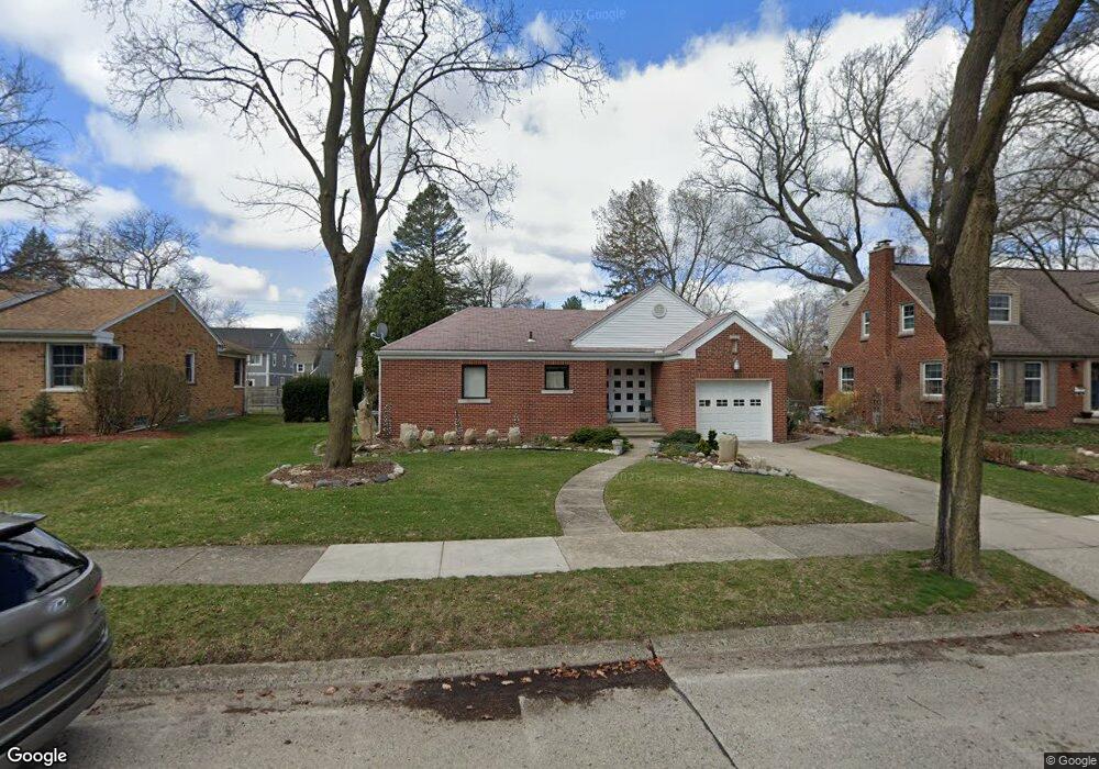
1029 N Lafayette Ave Royal Oak, MI 48067
Estimated Value: $350,000 - $397,000
2
Beds
2
Baths
1,391
Sq Ft
$269/Sq Ft
Est. Value
About This Home
This home is located at 1029 N Lafayette Ave, Royal Oak, MI 48067 and is currently estimated at $374,465, approximately $269 per square foot. 1029 N Lafayette Ave is a home located in Oakland County with nearby schools including Northwood Elementary School, Royal Oak Middle School, and Royal Oak High School.
Ownership History
Date
Name
Owned For
Owner Type
Purchase Details
Closed on
Jun 19, 2014
Sold by
Ficyk Paula M
Bought by
Ficyk Paula M and The Paula M Ficyk Living Trust
Current Estimated Value
Purchase Details
Closed on
Sep 28, 2001
Sold by
Adnrews Denise
Bought by
Ficyk Paula M
Purchase Details
Closed on
Aug 29, 1995
Sold by
Fries Henry
Bought by
Andrews Denise
Home Financials for this Owner
Home Financials are based on the most recent Mortgage that was taken out on this home.
Original Mortgage
$128,250
Interest Rate
7.8%
Mortgage Type
Purchase Money Mortgage
Create a Home Valuation Report for This Property
The Home Valuation Report is an in-depth analysis detailing your home's value as well as a comparison with similar homes in the area
Home Values in the Area
Average Home Value in this Area
Purchase History
| Date | Buyer | Sale Price | Title Company |
|---|---|---|---|
| Ficyk Paula M | -- | None Available | |
| Ficyk Paula M | $199,500 | -- | |
| Andrews Denise | $135,000 | -- |
Source: Public Records
Mortgage History
| Date | Status | Borrower | Loan Amount |
|---|---|---|---|
| Previous Owner | Andrews Denise | $128,250 |
Source: Public Records
Tax History Compared to Growth
Tax History
| Year | Tax Paid | Tax Assessment Tax Assessment Total Assessment is a certain percentage of the fair market value that is determined by local assessors to be the total taxable value of land and additions on the property. | Land | Improvement |
|---|---|---|---|---|
| 2024 | $3,218 | $155,860 | $0 | $0 |
| 2022 | $3,802 | $137,670 | $0 | $0 |
| 2020 | $3,127 | $121,310 | $0 | $0 |
| 2018 | $3,802 | $107,520 | $0 | $0 |
| 2017 | $3,655 | $107,520 | $0 | $0 |
| 2015 | -- | $102,060 | $0 | $0 |
| 2014 | -- | $96,820 | $0 | $0 |
| 2011 | -- | $84,980 | $0 | $0 |
Source: Public Records
Map
Nearby Homes
- 320 Catalpa Dr
- 1028 Edgewood Dr
- 606 Catalpa Dr
- 410 Crane Ave
- 908 N Maple Ave
- 122 Euclid Ave
- 912 Woodsboro Dr
- 312 Park Ave
- 719 W 12 Mile Rd
- 713 W Farnum Ave
- 1821 N Washington Ave
- 1828 N Lafayette Ave
- 1833 N Washington Ave
- 934 Lockwood Rd
- 402 N West St
- 408 Forest Ave
- 414 Oakland Ave
- 800 Lockwood Rd
- 307 Marlin Ave
- 517 Forest Ave
- 1025 N Lafayette Ave
- 1107 N Lafayette Ave
- 1102 Marywood Dr
- 1026 Marywood Dr
- 1106 Marywood Dr
- 1015 N Lafayette Ave
- 1022 Marywood Dr
- 1028 N Lafayette Ave
- 1102 N Lafayette Ave
- 1119 N Lafayette Ave
- 1114 Marywood Dr
- 1020 N Lafayette Ave
- 1014 Marywood Dr
- 1014 N Lafayette Ave
- 1122 Marywood Dr
- 1122 N Lafayette Ave
- 406 Catalpa Dr
- 410 Catalpa Dr
- 400 Catalpa Dr Unit Bldg-Unit
- 400 Catalpa Dr