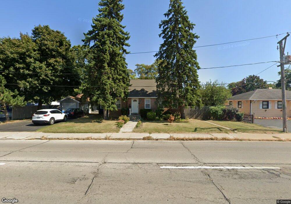
1029 N Lewis Ave Waukegan, IL 60085
Waukegan Gardens NeighborhoodEstimated Value: $216,000 - $248,000
2
Beds
2
Baths
1,520
Sq Ft
$153/Sq Ft
Est. Value
About This Home
This home is located at 1029 N Lewis Ave, Waukegan, IL 60085 and is currently estimated at $232,000, approximately $152 per square foot. 1029 N Lewis Ave is a home located in Lake County with nearby schools including Glenwood Elementary School, Miguel Juarez Middle School, and Waukegan High School.
Ownership History
Date
Name
Owned For
Owner Type
Purchase Details
Closed on
Oct 5, 2024
Sold by
Robles Tomas and Robles Maria
Bought by
Robles Tomas and Robles Maria
Current Estimated Value
Purchase Details
Closed on
Jul 31, 1996
Sold by
Abdullah Ayisha F and Cooper Gail J
Bought by
Robles Tomas and Robles Maria
Home Financials for this Owner
Home Financials are based on the most recent Mortgage that was taken out on this home.
Original Mortgage
$61,750
Interest Rate
8.33%
Create a Home Valuation Report for This Property
The Home Valuation Report is an in-depth analysis detailing your home's value as well as a comparison with similar homes in the area
Home Values in the Area
Average Home Value in this Area
Purchase History
| Date | Buyer | Sale Price | Title Company |
|---|---|---|---|
| Robles Tomas | -- | Accommodation/Courtesy Recordi | |
| Robles Tomas | $65,000 | Chicago Title Insurance Co |
Source: Public Records
Mortgage History
| Date | Status | Borrower | Loan Amount |
|---|---|---|---|
| Previous Owner | Robles Tomas | $61,750 |
Source: Public Records
Tax History Compared to Growth
Tax History
| Year | Tax Paid | Tax Assessment Tax Assessment Total Assessment is a certain percentage of the fair market value that is determined by local assessors to be the total taxable value of land and additions on the property. | Land | Improvement |
|---|---|---|---|---|
| 2024 | $3,480 | $58,517 | $10,707 | $47,810 |
| 2023 | $4,232 | $52,907 | $9,681 | $43,226 |
| 2022 | $4,232 | $54,286 | $10,371 | $43,915 |
| 2021 | $3,884 | $48,587 | $9,069 | $39,518 |
| 2020 | $3,813 | $45,265 | $8,449 | $36,816 |
| 2019 | $3,813 | $41,478 | $7,742 | $33,736 |
| 2018 | $2,274 | $29,288 | $9,739 | $19,549 |
| 2017 | $2,121 | $25,911 | $8,616 | $17,295 |
| 2016 | $1,780 | $22,516 | $7,487 | $15,029 |
| 2015 | $1,546 | $20,152 | $6,701 | $13,451 |
| 2014 | $2,685 | $26,022 | $6,861 | $19,161 |
| 2012 | -- | $28,192 | $7,433 | $20,759 |
Source: Public Records
Map
Nearby Homes
- 1019 N Lewis Ave
- 1005 N Lewis Ave
- 1023 N Elmwood Ave
- 1038 Indiana Ave
- 968 Judge Ave
- 1117 Judge Ave
- 1504 W Glen Flora Ave
- 1213 Grand Ave
- 2009 Harding Ave
- 824 N Butrick St
- 1000 Pine St
- 2008 Harding Ave
- 12352 W Atlantic Ave
- 1105 Woodlawn Cir
- 615 Tiffany Dr
- 1312 N Linden Ave
- 1109 Massena Ave
- 917 N Linden Ave
- 2115 Lydia St
- 2207 Williamsburg Dr
- 1031 N Lewis Ave
- 1023 N Lewis Ave
- 1037 N Lewis Ave
- 1028 N Elmwood Ave
- 1024 N Elmwood Ave
- 1039 N Lewis Ave
- 1032 N Elmwood Ave
- 1020 N Elmwood Ave
- 1040 N Elmwood Ave
- 1015 N Lewis Ave
- 1016 N Elmwood Ave
- 1028 N Lewis Ave
- 1024 N Lewis Ave
- 1032 N Lewis Ave
- 1041 N Lewis Ave
- 1018 N Lewis Ave
- 1102 N Lewis Ave
- 1011 N Lewis Ave
- 1012 N Elmwood Ave
- 1014 N Elmwood Ave