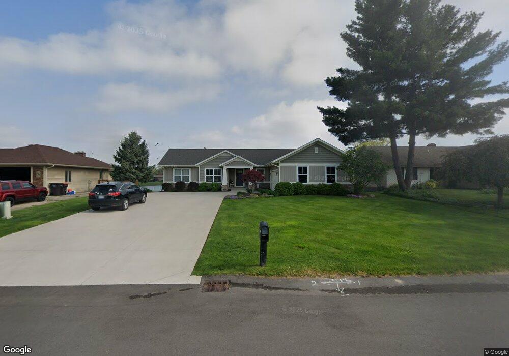
1029 Rushmore St Jenison, MI 49428
Estimated Value: $462,000 - $541,000
3
Beds
3
Baths
1,609
Sq Ft
$311/Sq Ft
Est. Value
About This Home
This home is located at 1029 Rushmore St, Jenison, MI 49428 and is currently estimated at $499,904, approximately $310 per square foot. 1029 Rushmore St is a home located in Ottawa County with nearby schools including Bursley School, Jenison Junior High School, and Jenison High School.
Ownership History
Date
Name
Owned For
Owner Type
Purchase Details
Closed on
Oct 1, 2008
Sold by
Strangways James and Stangways Kathy
Bought by
Smaby Joseph and Smaby Laurie
Current Estimated Value
Home Financials for this Owner
Home Financials are based on the most recent Mortgage that was taken out on this home.
Original Mortgage
$276,000
Interest Rate
5.95%
Mortgage Type
Commercial
Purchase Details
Closed on
Oct 1, 2007
Sold by
Strangways James H and Strangways Kathleen C
Bought by
Strangways James H and Strangways Kathleen C
Create a Home Valuation Report for This Property
The Home Valuation Report is an in-depth analysis detailing your home's value as well as a comparison with similar homes in the area
Home Values in the Area
Average Home Value in this Area
Purchase History
| Date | Buyer | Sale Price | Title Company |
|---|---|---|---|
| Smaby Joseph | $262,000 | Chicago Title | |
| Strangways James H | -- | None Available |
Source: Public Records
Mortgage History
| Date | Status | Borrower | Loan Amount |
|---|---|---|---|
| Previous Owner | Smaby Joseph | $276,000 |
Source: Public Records
Tax History
| Year | Tax Paid | Tax Assessment Tax Assessment Total Assessment is a certain percentage of the fair market value that is determined by local assessors to be the total taxable value of land and additions on the property. | Land | Improvement |
|---|---|---|---|---|
| 2025 | $4,149 | $279,800 | $0 | $0 |
| 2024 | $40 | $229,200 | $0 | $0 |
| 2023 | $3,807 | $211,900 | $0 | $0 |
| 2022 | $4,354 | $199,800 | $0 | $0 |
| 2021 | $4,233 | $176,000 | $0 | $0 |
| 2020 | $4,188 | $172,700 | $0 | $0 |
| 2019 | $4,191 | $165,900 | $0 | $0 |
| 2018 | $3,921 | $153,700 | $0 | $0 |
| 2017 | $3,855 | $151,000 | $0 | $0 |
| 2016 | $3,833 | $149,200 | $0 | $0 |
| 2015 | $3,666 | $142,400 | $0 | $0 |
| 2014 | $3,666 | $128,700 | $0 | $0 |
Source: Public Records
Map
Nearby Homes
- 6374 Clover Ln
- 6325 8th Ave SW
- 7350 Glendora Ave
- 7391 Terrace Ln
- 1519 Eagle Shore Ct
- 776 Chancellor Dr SW
- 925 Parsons St SW
- 1025 Parsons St
- 7425 Boulder Bluff Dr Unit 112
- 578 Stonehenge Dr SW
- 6029 Hillsborough Ct SW
- 91 Grand Village Ct SW Unit 34
- 7341 Pinegrove Dr
- 7373 Pinegrove Dr Unit 109
- 2111 Timberlane Dr
- 7528 Pinegrove Dr
- 7763 Coachman Ln
- 5650 16th Ave
- 636 Village Ln Unit 94
- 336 Normandy Ct SW
- 1043 Rushmore St
- 1015 Rushmore St
- 1057 Rushmore St
- 1001 Rushmore St
- 1042 Rushmore St
- 6668 Cherrywood Ave
- 6680 Rushmore St
- 1056 Rushmore St
- 6696 Rushmore St
- 6649 Cherrywood Ave
- 6691 Rushmore Ct
- 6650 Cherrywood Ave
- 6703 Rushmore Ct
- 1070 Rushmore St
- 994 Rushmore St
- 6715 Rushmore Ct
- 6706 Rushmore St
- 6633 Cherrywood Ave
- 6633 Cherrywood Ave Unit 6635
- 6634 Cherrywood Ave
Your Personal Tour Guide
Ask me questions while you tour the home.