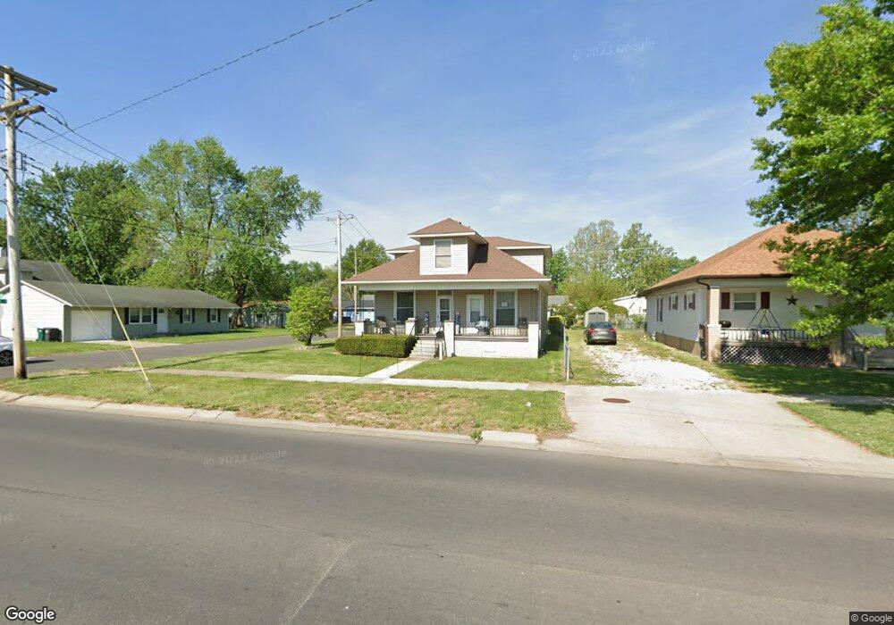
1029 S Williams St Moberly, MO 65270
Estimated Value: $148,000 - $182,000
5
Beds
2
Baths
1,850
Sq Ft
$91/Sq Ft
Est. Value
About This Home
This home is located at 1029 S Williams St, Moberly, MO 65270 and is currently estimated at $168,550, approximately $91 per square foot. 1029 S Williams St is a home located in Randolph County with nearby schools including Moberly Senior High School, St. Pius X. Catholic School, and Maranatha Seventh-day Adventist School.
Ownership History
Date
Name
Owned For
Owner Type
Purchase Details
Closed on
Nov 20, 2009
Sold by
Thurston Virgil Turner and Thurston Bonnie Joan
Bought by
Devenport Colby E and Devenport Grace R
Current Estimated Value
Home Financials for this Owner
Home Financials are based on the most recent Mortgage that was taken out on this home.
Original Mortgage
$65,786
Outstanding Balance
$42,934
Interest Rate
4.99%
Estimated Equity
$125,616
Purchase Details
Closed on
May 27, 2008
Sold by
Robinson Carma L
Bought by
Thurston Virgil Turner and Thurston Bonnie Joan
Create a Home Valuation Report for This Property
The Home Valuation Report is an in-depth analysis detailing your home's value as well as a comparison with similar homes in the area
Home Values in the Area
Average Home Value in this Area
Purchase History
| Date | Buyer | Sale Price | Title Company |
|---|---|---|---|
| Devenport Colby E | -- | -- | |
| Thurston Virgil Turner | -- | -- |
Source: Public Records
Mortgage History
| Date | Status | Borrower | Loan Amount |
|---|---|---|---|
| Open | Devenport Colby E | $65,786 |
Source: Public Records
Tax History Compared to Growth
Tax History
| Year | Tax Paid | Tax Assessment Tax Assessment Total Assessment is a certain percentage of the fair market value that is determined by local assessors to be the total taxable value of land and additions on the property. | Land | Improvement |
|---|---|---|---|---|
| 2025 | $859 | $13,210 | $1,520 | $11,690 |
| 2024 | $859 | $11,790 | $1,330 | $10,460 |
| 2023 | $872 | $11,790 | $1,330 | $10,460 |
| 2022 | $887 | $12,320 | $1,330 | $10,990 |
| 2021 | $836 | $12,320 | $1,330 | $10,990 |
| 2020 | $836 | $11,620 | $1,330 | $10,290 |
| 2019 | $834 | $11,620 | $1,330 | $10,290 |
| 2018 | $659 | $9,200 | $1,329 | $7,871 |
| 2017 | $657 | $9,200 | $0 | $0 |
| 2016 | $640 | $9,010 | $0 | $0 |
| 2014 | -- | $8,430 | $0 | $0 |
| 2013 | -- | $8,430 | $0 | $0 |
| 2012 | -- | $8,430 | $0 | $0 |
Source: Public Records
Map
Nearby Homes
- 411 Shumate Ave
- 1000 S Williams St
- 417 W Longview St
- 432 W Longview St
- 1216 Shepherds Dr
- 809 S 4th St
- 1365 Lantern Pointe Dr
- 700 S 5th St
- 602 Gilman St
- 713 Homestead Dr
- 608 Gilman St
- 208 Wisdom St
- 708 Gilman St
- 1377 Conestoga Trail
- LOT 2 County Rd
- 517 S Clark St
- 319 Halleck St
- 407 Epperson St
- 419 S 4th St
- 1227 Conestoga Trace
- 1025 S Williams St
- 1021 S Williams St
- 304 Shumate Ave
- 304 Shumate Ln
- 1026 S 4th St
- 1015 S Williams St
- 1024 S 4th St
- 1018 S 4th St
- 1101 Lowry Ct Unit 32B
- 1106 Lowry Ct
- 1102 Lowry Ct Unit 22A
- 1102 S 4th St
- 1111 Lowry Ct
- 1107 S Williams St
- 1011 S Williams St
- 1014 S 4th St
- 1104 S 4th St
- 1008 S 4th St
- 1109 S Williams St
- 1007 S Williams St