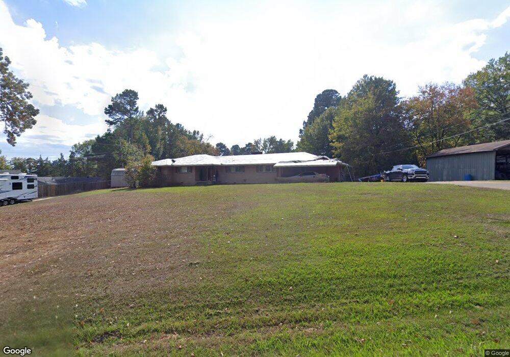
1029 W Maple Ave de Queen, AR 71832
Estimated Value: $220,976 - $283,000
Studio
4
Baths
2,830
Sq Ft
$90/Sq Ft
Est. Value
About This Home
This home is located at 1029 W Maple Ave, de Queen, AR 71832 and is currently estimated at $255,744, approximately $90 per square foot. 1029 W Maple Ave is a home located in Sevier County with nearby schools including Dequeen Primary School, Dequeen Elementary School, and Dequeen Junior High School.
Ownership History
Date
Name
Owned For
Owner Type
Purchase Details
Closed on
Jul 20, 2012
Bought by
Ridley Davonna
Current Estimated Value
Purchase Details
Closed on
Dec 22, 2011
Bought by
Ridley Davonna
Purchase Details
Closed on
Nov 28, 2011
Bought by
Federal National Mortgage and Association
Purchase Details
Closed on
Oct 20, 2011
Bought by
Federal National Mortgage and Association
Purchase Details
Closed on
Sep 7, 2011
Bought by
Sims Richard P and Sims Donna L
Purchase Details
Closed on
Jul 8, 2011
Bought by
Sims Richard P and Sims Donna L
Purchase Details
Closed on
Feb 2, 2011
Bought by
Sims Richard P and Sims Donna L
Purchase Details
Closed on
Nov 3, 2006
Bought by
Sims Richard P and Sims Donna L
Purchase Details
Closed on
Nov 7, 1989
Bought by
Floyd, Anita Kimball Trustee
Create a Home Valuation Report for This Property
The Home Valuation Report is an in-depth analysis detailing your home's value as well as a comparison with similar homes in the area
Home Values in the Area
Average Home Value in this Area
Purchase History
| Date | Buyer | Sale Price | Title Company |
|---|---|---|---|
| Ridley Davonna | -- | -- | |
| Ridley Davonna | $81,600 | -- | |
| Federal National Mortgage | -- | -- | |
| Federal National Mortgage | -- | -- | |
| Sims Richard P | -- | -- | |
| Sims Richard P | -- | -- | |
| Sims Richard P | -- | -- | |
| Sims Richard P | $141,000 | -- | |
| Floyd, Anita Kimball Trustee | -- | -- |
Source: Public Records
Tax History
| Year | Tax Paid | Tax Assessment Tax Assessment Total Assessment is a certain percentage of the fair market value that is determined by local assessors to be the total taxable value of land and additions on the property. | Land | Improvement |
|---|---|---|---|---|
| 2025 | $1,262 | $39,490 | $7,200 | $32,290 |
| 2024 | $1,273 | $39,490 | $7,200 | $32,290 |
| 2023 | $1,348 | $39,490 | $7,200 | $32,290 |
| 2022 | $1,330 | $39,490 | $7,200 | $32,290 |
| 2021 | $1,255 | $39,490 | $7,200 | $32,290 |
| 2020 | $1,181 | $39,490 | $7,200 | $32,290 |
| 2019 | $1,107 | $33,010 | $7,200 | $25,810 |
| 2018 | $1,132 | $33,010 | $7,200 | $25,810 |
| 2017 | $970 | $33,010 | $7,200 | $25,810 |
| 2016 | $970 | $33,010 | $7,200 | $25,810 |
| 2015 | $970 | $33,010 | $7,200 | $25,810 |
| 2014 | $970 | $33,510 | $7,200 | $26,310 |
Source: Public Records
Map
Nearby Homes
- TBD Collin Raye Dr
- TBD W Collin Raye Dr
- 115 Heritage Place
- 0 To Be Determined Unit 23001783
- 181 Craig Ln
- 129 Ridgewood Dr
- 407 N 4th St
- 608 W Eighty Thousand Rd
- 109 Jt Cir
- 107 Jt Cir
- 105 Jt Cir
- 108 Jt Cir
- 139 Leopard Dr
- 141 Leopard Dr
- 142 Leopard Dr
- 140 Leopard Dr
- 145 Leopard Dr
- 138 Leopard Dr
- 904 E Collin Raye Dr
- 0 Chapel Hill Rd
- 1105 W Maple Ave
- 1017 W Maple Ave
- 1008 W Maple Ave
- 1101 Circle Dr
- 1117 W Maple Ave
- 1007 W Holly Ave
- 1031 W Holly Ave
- 1109 Circle Dr
- 0 Maple
- 1025 Circle Dr
- 0 Circle Dr
- 1003 W Maple Ave
- 1201 W Maple Ave
- 1202 W Holly Ave
- W Maple Ave
- 1115 Circle Dr
- 1221 N 9th St
- 917 Circle Dr
- 1207 Maple Ave Ave W
- 1121 Circle Dr
Your Personal Tour Guide
Ask me questions while you tour the home.