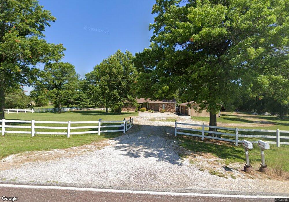
10290 State Highway M Wright City, MO 63390
Estimated Value: $448,798 - $786,000
3
Beds
2
Baths
1,800
Sq Ft
$333/Sq Ft
Est. Value
About This Home
This home is located at 10290 State Highway M, Wright City, MO 63390 and is currently estimated at $599,266, approximately $332 per square foot. 10290 State Highway M is a home located in Warren County with nearby schools including Wright City East Elementary School, Wright City West Elementary School, and Wright City Middle School.
Ownership History
Date
Name
Owned For
Owner Type
Purchase Details
Closed on
Jul 23, 2012
Sold by
Tullock Darrell E and Tullock Sandra J
Bought by
Dickherber Brenda K and Brenda K Dickherber Trust
Current Estimated Value
Purchase Details
Closed on
Apr 4, 2006
Sold by
Sullivan Sandra J
Bought by
Sullivan Sandra J and Sullivan Trust
Purchase Details
Closed on
May 31, 2005
Sold by
Shinkle Lucille F
Bought by
Tullock Darrell E and Sullivan Sandra J
Home Financials for this Owner
Home Financials are based on the most recent Mortgage that was taken out on this home.
Original Mortgage
$277,200
Interest Rate
5.78%
Mortgage Type
Adjustable Rate Mortgage/ARM
Create a Home Valuation Report for This Property
The Home Valuation Report is an in-depth analysis detailing your home's value as well as a comparison with similar homes in the area
Purchase History
| Date | Buyer | Sale Price | Title Company |
|---|---|---|---|
| Dickherber Brenda K | -- | None Available | |
| Sullivan Sandra J | -- | None Available | |
| Tullock Drrel E | -- | None Available | |
| Tullock Darrell E | -- | None Available |
Source: Public Records
Mortgage History
| Date | Status | Borrower | Loan Amount |
|---|---|---|---|
| Previous Owner | Tullock Darrell E | $277,200 |
Source: Public Records
Tax History
| Year | Tax Paid | Tax Assessment Tax Assessment Total Assessment is a certain percentage of the fair market value that is determined by local assessors to be the total taxable value of land and additions on the property. | Land | Improvement |
|---|---|---|---|---|
| 2025 | $1,880 | $29,958 | $4,154 | $25,804 |
| 2024 | $1,871 | $26,918 | $3,775 | $23,143 |
| 2023 | $1,649 | $26,918 | $3,775 | $23,143 |
| 2022 | $1,547 | $25,139 | $3,513 | $21,626 |
| 2021 | $1,547 | $25,139 | $3,513 | $21,626 |
| 2020 | $1,550 | $25,139 | $3,513 | $21,626 |
| 2019 | $1,545 | $25,139 | $0 | $0 |
| 2017 | $1,492 | $25,144 | $0 | $0 |
| 2016 | $1,491 | $25,144 | $0 | $0 |
| 2015 | -- | $25,144 | $0 | $0 |
| 2011 | -- | $25,130 | $0 | $0 |
Source: Public Records
Map
Nearby Homes
- 11 Serenity Lake Ct
- 14 Serenity Lake Ct
- 7 Serenity Lake Ct
- 7 Serenity Ct
- 1 Serenity Lake Ct
- 9 Serenity Lake Ct
- 6 Serenity Lake Ct
- 3+/- Acres Hwy O
- 6+/- Acres Hwy O
- 10 Acres Highway O
- 22710 State Highway O
- 00 State Highway Oo
- 541 Woods Creek Dr
- 0 Schnarre Rd
- 670 Whitetail Creek Dr
- 1203 Whitetail Point Dr
- 10497 State Highway Oo
- 25667 Booneslick Farm Rd
- 0 Oberhelman Rd Unit MIS25041755
- 25726 S Lohman Rd
- 23450 Redbird Ln Unit 1550
- 10459 State Highway M
- 23473 Redbird Ln
- 23667 Redbird Ln
- 10469 State Highway M
- 23780 Redbird Ln
- 10520 State Highway M
- 23705 Redbird Ln
- 24079 Carter Ln
- 10879 State Highway M
- 24396 Carter Ln
- 24106 Carter Ln
- 10901 State Highway M
- 2795 State Highway O
- 0 118 30 Hwy O Unit 12019459
- 24035 Carter Ln
- 0 Raymond Dr Unit 80029619
- 0 Raymond Dr Unit 12005678
- 10287 Plantation Manor
- 11200 Raymond Dr
Your Personal Tour Guide
Ask me questions while you tour the home.