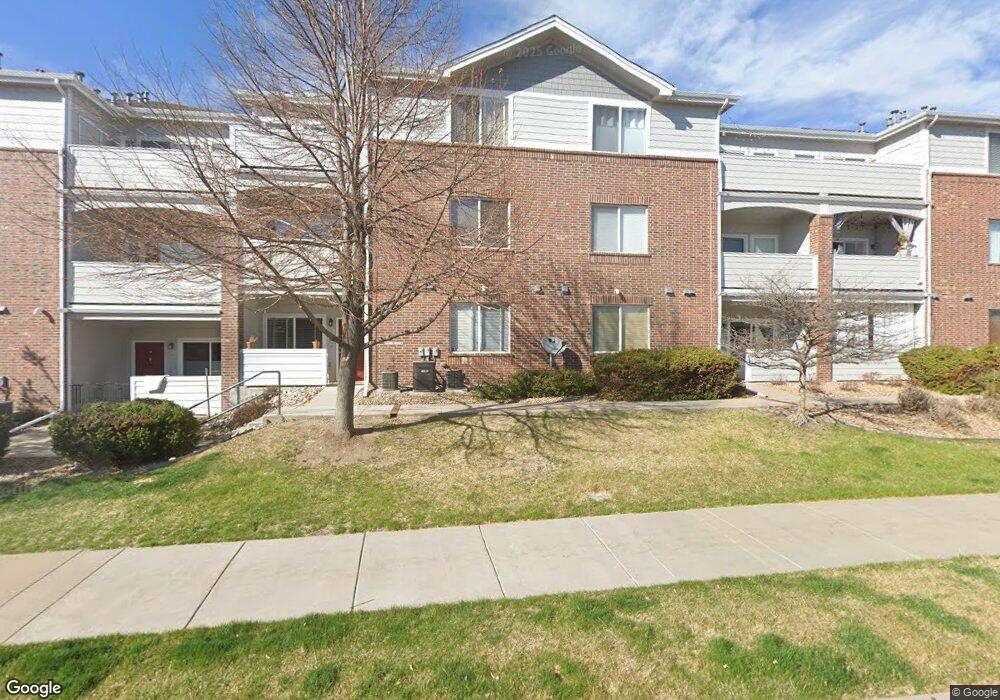
10290 W 55th Ln Unit 102 Arvada, CO 80002
Rainbow Ridge NeighborhoodEstimated Value: $335,000 - $381,000
1
Bed
1
Bath
915
Sq Ft
$382/Sq Ft
Est. Value
About This Home
This home is located at 10290 W 55th Ln Unit 102, Arvada, CO 80002 and is currently estimated at $349,854, approximately $382 per square foot. 10290 W 55th Ln Unit 102 is a home located in Jefferson County with nearby schools including Vanderhoof Elementary School, Drake Junior High School, and Arvada West High School.
Ownership History
Date
Name
Owned For
Owner Type
Purchase Details
Closed on
May 21, 2010
Sold by
Phillips Kathleen M
Bought by
Finegan Carie L
Current Estimated Value
Home Financials for this Owner
Home Financials are based on the most recent Mortgage that was taken out on this home.
Original Mortgage
$148,006
Outstanding Balance
$97,733
Interest Rate
4.75%
Mortgage Type
FHA
Estimated Equity
$252,121
Purchase Details
Closed on
May 27, 2005
Sold by
D R Horton Inc Denver
Bought by
Phillips Kathleen M
Home Financials for this Owner
Home Financials are based on the most recent Mortgage that was taken out on this home.
Original Mortgage
$142,728
Interest Rate
4.27%
Mortgage Type
Purchase Money Mortgage
Create a Home Valuation Report for This Property
The Home Valuation Report is an in-depth analysis detailing your home's value as well as a comparison with similar homes in the area
Home Values in the Area
Average Home Value in this Area
Purchase History
| Date | Buyer | Sale Price | Title Company |
|---|---|---|---|
| Finegan Carie L | $150,000 | Land Title Guarantee Company | |
| Phillips Kathleen M | $178,411 | Land Title Guarantee Company |
Source: Public Records
Mortgage History
| Date | Status | Borrower | Loan Amount |
|---|---|---|---|
| Open | Finegan Carie L | $148,006 | |
| Previous Owner | Phillips Kathleen M | $142,728 |
Source: Public Records
Tax History Compared to Growth
Tax History
| Year | Tax Paid | Tax Assessment Tax Assessment Total Assessment is a certain percentage of the fair market value that is determined by local assessors to be the total taxable value of land and additions on the property. | Land | Improvement |
|---|---|---|---|---|
| 2024 | $1,904 | $19,627 | -- | $19,627 |
| 2023 | $1,904 | $19,627 | $0 | $19,627 |
| 2022 | $1,984 | $20,262 | $0 | $20,262 |
| 2021 | $2,017 | $20,845 | $0 | $20,845 |
| 2020 | $1,696 | $17,576 | $0 | $17,576 |
| 2019 | $1,673 | $17,576 | $0 | $17,576 |
| 2018 | $1,127 | $11,506 | $0 | $11,506 |
| 2017 | $1,031 | $11,506 | $0 | $11,506 |
| 2016 | $1,131 | $11,885 | $1 | $11,884 |
| 2015 | $907 | $11,885 | $1 | $11,884 |
| 2014 | $907 | $8,956 | $1 | $8,955 |
Source: Public Records
Map
Nearby Homes
- 5537 Lewis Ct Unit 4
- 5544 Lewis St Unit 203
- 10380 W 55th Ln Unit 206
- 6730 W 54th Ave
- 10239 W 55th Dr Unit 3
- 5362 Lynn Dr
- 5387 Pierson Ct
- 11237 W 55th Ln
- 5368 Quail St
- 5336 Johnson St
- 11201 W 53rd Dr
- 11205 W 53rd Ln
- 5870 Nelson Ct
- 5293 Quail Way
- 9678 W 56th Place
- 5406 Iris St
- 5864 Parfet St
- 10331 W 59th Ave
- 5812 Queen St
- 5182 Rob Way
- 10290 W 55th Ln Unit 206
- 10290 W 55th Ln Unit 205
- 10290 W 55th Ln Unit 204
- 10290 W 55th Ln Unit 203
- 10290 W 55th Ln Unit 202
- 10290 W 55th Ln Unit 201
- 10290 W 55th Ln Unit 106
- 10290 W 55th Ln Unit 105
- 10290 W 55th Ln Unit 104
- 10290 W 55th Ln Unit 103
- 10290 W 55th Ln Unit 101
- 10290 W 55th Ln Unit 4
- 10290 W 55th Ln Unit 3
- 10290 W 55th Ln Unit 2
- 10290 W 55th Ln Unit 1
- 10290 W 55th Ln
- 5534 Lewis St Unit 206
- 5534 Lewis St Unit 205
- 5534 Lewis St Unit 204
- 5534 Lewis St Unit 203