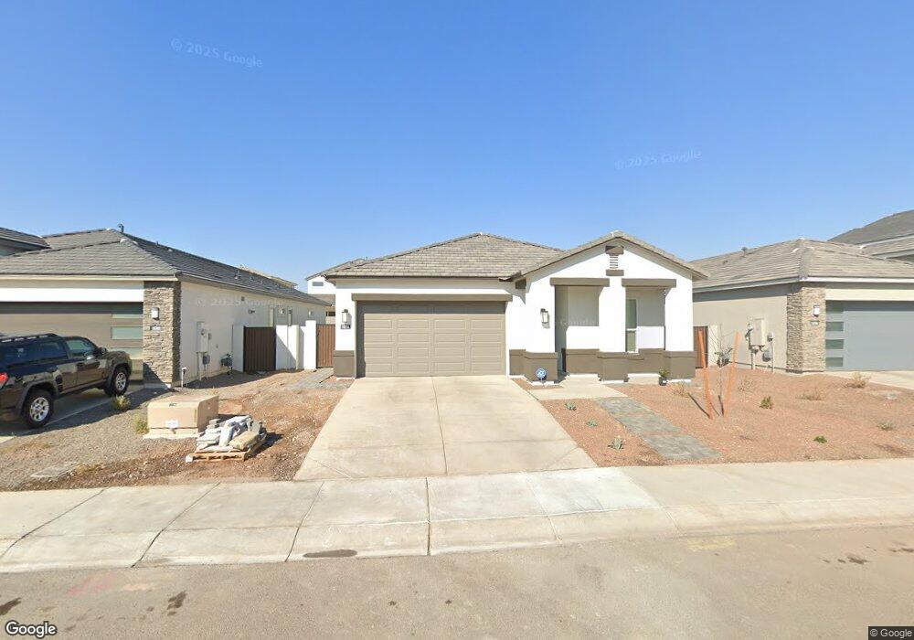
10296 W Albert Ln Peoria, AZ 85382
Estimated Value: $491,000 - $576,176
--
Bed
3
Baths
--
Sq Ft
5,750
Sq Ft Lot
About This Home
This home is located at 10296 W Albert Ln, Peoria, AZ 85382 and is currently estimated at $533,588. 10296 W Albert Ln is a home located in Maricopa County with nearby schools including Parkridge Elementary School, Sunrise Mountain High School, and Candeo Peoria.
Ownership History
Date
Name
Owned For
Owner Type
Purchase Details
Closed on
Oct 8, 2025
Sold by
Marin D Hamel Revocable Living Trust and Hamel Marin Dawn
Bought by
Danax Family Trust and Czech
Current Estimated Value
Purchase Details
Closed on
Feb 14, 2025
Sold by
Hamel Marin Dawn
Bought by
Marin D Hamel Revocable Living Trust and Hamel
Purchase Details
Closed on
Jul 29, 2024
Sold by
Dr Horton Inc
Bought by
Hamel Marin Dawn
Home Financials for this Owner
Home Financials are based on the most recent Mortgage that was taken out on this home.
Original Mortgage
$550,990
Interest Rate
6.95%
Mortgage Type
New Conventional
Create a Home Valuation Report for This Property
The Home Valuation Report is an in-depth analysis detailing your home's value as well as a comparison with similar homes in the area
Home Values in the Area
Average Home Value in this Area
Purchase History
| Date | Buyer | Sale Price | Title Company |
|---|---|---|---|
| Danax Family Trust | -- | None Listed On Document | |
| Marin D Hamel Revocable Living Trust | -- | None Listed On Document | |
| Hamel Marin Dawn | $579,990 | Dhi Title Agency |
Source: Public Records
Mortgage History
| Date | Status | Borrower | Loan Amount |
|---|---|---|---|
| Previous Owner | Hamel Marin Dawn | $550,990 |
Source: Public Records
Tax History Compared to Growth
Tax History
| Year | Tax Paid | Tax Assessment Tax Assessment Total Assessment is a certain percentage of the fair market value that is determined by local assessors to be the total taxable value of land and additions on the property. | Land | Improvement |
|---|---|---|---|---|
| 2025 | $1,873 | $1,662 | $1,662 | -- |
| 2024 | $152 | $1,583 | $1,583 | -- |
| 2023 | $152 | $3,870 | $3,870 | $0 |
| 2022 | $149 | $2,610 | $2,610 | $0 |
Source: Public Records
Map
Nearby Homes
- 21479 N 104th Dr
- 10447 W Lone Cactus Dr
- 10446 W Lone Cactus Dr
- 10368 W Ross Ave
- 21635 N 102nd Ave
- 10169 W Potter Dr
- 10549 W Albert Ln
- 10344 W Burnett Rd
- 10528 W Potter Dr
- 10347 W Mohawk Ln
- 20615 N 105th Ave
- 20640 N 100th Ln
- 10001 W Potter Dr
- 10672 W Ross Ave
- 20670 N 105th Dr
- 10296 W Sands Dr Unit 485
- 10370 W Sands Dr Unit 463
- 20769 N 106th Ln
- 10379 W Tonopah Dr
- 21978 N 100th Ave
- 10290 W Albert Ln
- 10284 W Albert Ln
- 10308 W Albert Ln
- 10295 W Albert Ln
- 10266 W Albert Ln
- 10326 W Albert Ln
- 10271 W Albert Ln
- 10322 W Deanna Dr
- 10304 W Quail Ave
- 10306 W Deanna Dr
- 10268 W Quail Ave
- 10316 W Quail Ave
- 10283 W Adam Ave
- 10248 W Quail Ave
- 10340 W Albert Ln
- 10313 W Deanna Dr
- 10338 W Quail Ave
- 10346 W Albert Ln
- 10344 W Deanna Dr
- 10232 W Quail Ave