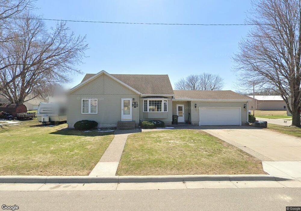
103 2nd St S Brownton, MN 55312
Estimated Value: $213,603 - $250,000
3
Beds
3
Baths
1,232
Sq Ft
$189/Sq Ft
Est. Value
About This Home
This home is located at 103 2nd St S, Brownton, MN 55312 and is currently estimated at $233,401, approximately $189 per square foot. 103 2nd St S is a home with nearby schools including Lincoln Elementary School, Lakeside Elementary School, and Glencoe-Silver Lake Jr. High School.
Ownership History
Date
Name
Owned For
Owner Type
Purchase Details
Closed on
May 1, 2015
Sold by
Lindeman Adam B and Lindeman Angela M
Bought by
Trullinger Cody L and Trullinger Kari B
Current Estimated Value
Home Financials for this Owner
Home Financials are based on the most recent Mortgage that was taken out on this home.
Original Mortgage
$130,099
Outstanding Balance
$98,244
Interest Rate
3.62%
Mortgage Type
FHA
Estimated Equity
$135,157
Create a Home Valuation Report for This Property
The Home Valuation Report is an in-depth analysis detailing your home's value as well as a comparison with similar homes in the area
Purchase History
| Date | Buyer | Sale Price | Title Company |
|---|---|---|---|
| Trullinger Cody L | -- | Crow River Title Guaranty |
Source: Public Records
Mortgage History
| Date | Status | Borrower | Loan Amount |
|---|---|---|---|
| Open | Trullinger Cody L | $130,099 |
Source: Public Records
Tax History
| Year | Tax Paid | Tax Assessment Tax Assessment Total Assessment is a certain percentage of the fair market value that is determined by local assessors to be the total taxable value of land and additions on the property. | Land | Improvement |
|---|---|---|---|---|
| 2025 | $4,436 | $220,000 | $32,000 | $188,000 |
| 2024 | $4,002 | $193,500 | $29,100 | $164,400 |
| 2023 | $4,002 | $193,500 | $29,100 | $164,400 |
| 2022 | $3,596 | $167,300 | $25,300 | $142,000 |
| 2021 | $3,646 | $142,700 | $22,000 | $120,700 |
| 2020 | $3,756 | $142,700 | $22,000 | $120,700 |
| 2019 | $2,600 | $131,900 | $20,000 | $111,900 |
| 2018 | $2,602 | $0 | $0 | $0 |
| 2017 | $2,112 | $0 | $0 | $0 |
| 2016 | $1,376 | $0 | $0 | $0 |
| 2015 | $1,250 | $0 | $0 | $0 |
| 2014 | -- | $0 | $0 | $0 |
Source: Public Records
Map
Nearby Homes
- xxx Lot 3 Division St W
- 226 3rd Ave S
- 140 1st Ave N
- 124 3rd Ave S
- 304 5th Ave N
- 352 4th St N
- Lot 2 U S Highway 212
- XXX US Hwy 212
- 0 57th St
- 11462 Highway 15
- 11462 Minnesota 15
- 11742 Sunset Cir
- 12893 County Road 7
- 12406 Highway 212
- 426 Main St
- 540 Mowbray St
- 821 North St
- 101 Bowman St
- 8655 8th Ave
- 1199 E 2nd St
- 207 1st Ave S
- 104 2nd St S
- 208 2nd Ave S
- 202 2nd Ave S
- 204 204 1st-Avenue-s
- 204 1st Ave S
- 206 1st Ave S
- 214 2nd Ave S
- 102 3rd St S
- 110 2nd Ave S
- 132 1st Ave S
- 132 1st Ave S
- 220 2nd Ave S
- 205 2nd Ave S
- 103 1st Ave S
- 0 1st (Unassigned Address) Ave S
- 215 2nd Ave S
- 209 2nd Ave S
- 307 1st Ave S
- 107 3rd St S
Your Personal Tour Guide
Ask me questions while you tour the home.