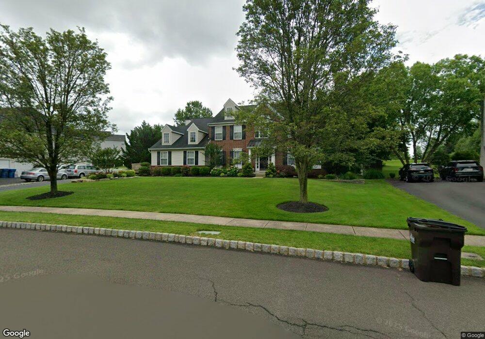
103 Arbor Ridge Dr Warrington, PA 18976
Estimated Value: $820,000 - $951,000
4
Beds
4
Baths
3,132
Sq Ft
$286/Sq Ft
Est. Value
About This Home
This home is located at 103 Arbor Ridge Dr, Warrington, PA 18976 and is currently estimated at $894,723, approximately $285 per square foot. 103 Arbor Ridge Dr is a home located in Bucks County with nearby schools including Titus Elementary School, Tamanend Middle School, and Central Bucks High School - South.
Ownership History
Date
Name
Owned For
Owner Type
Purchase Details
Closed on
Jul 13, 2001
Sold by
Crestland Lp
Bought by
Downie Robert and Downie Lidia
Current Estimated Value
Home Financials for this Owner
Home Financials are based on the most recent Mortgage that was taken out on this home.
Original Mortgage
$150,000
Outstanding Balance
$58,058
Interest Rate
7.2%
Estimated Equity
$836,665
Create a Home Valuation Report for This Property
The Home Valuation Report is an in-depth analysis detailing your home's value as well as a comparison with similar homes in the area
Home Values in the Area
Average Home Value in this Area
Purchase History
| Date | Buyer | Sale Price | Title Company |
|---|---|---|---|
| Downie Robert | $325,820 | -- |
Source: Public Records
Mortgage History
| Date | Status | Borrower | Loan Amount |
|---|---|---|---|
| Open | Downie Robert | $150,000 |
Source: Public Records
Tax History Compared to Growth
Tax History
| Year | Tax Paid | Tax Assessment Tax Assessment Total Assessment is a certain percentage of the fair market value that is determined by local assessors to be the total taxable value of land and additions on the property. | Land | Improvement |
|---|---|---|---|---|
| 2025 | $9,555 | $51,760 | $10,840 | $40,920 |
| 2024 | $9,555 | $51,760 | $10,840 | $40,920 |
| 2023 | $8,846 | $51,760 | $10,840 | $40,920 |
| 2022 | $8,671 | $51,760 | $10,840 | $40,920 |
| 2021 | $8,575 | $51,760 | $10,840 | $40,920 |
| 2020 | $8,575 | $51,760 | $10,840 | $40,920 |
| 2019 | $8,523 | $51,760 | $10,840 | $40,920 |
| 2018 | $8,429 | $51,760 | $10,840 | $40,920 |
| 2017 | $8,315 | $51,760 | $10,840 | $40,920 |
| 2016 | $8,289 | $51,760 | $10,840 | $40,920 |
| 2015 | -- | $51,760 | $10,840 | $40,920 |
| 2014 | -- | $51,760 | $10,840 | $40,920 |
Source: Public Records
Map
Nearby Homes
- 418 Homestead Cir
- 430 Homestead Cir
- 753 S Settlers Cir
- 623 Addison Way
- 3237 Pickertown Rd
- 3146 Wier Dr E Unit E
- 506 McNaney Farm Dr Lot # 27
- 406 Primrose Place
- 503
- 508 Fullerton Farm Court Lot#21
- 500
- 511 McNaney Farm Dr Lot #6
- 506 Fullerton Farm Court Lot #22
- 528 Fullerton Farm Ct
- 3174 Wier Dr E Unit E
- 803 Sweet Cherry St
- 3302 Applewood Ct
- 3220 Wier Dr W Unit W
- 2756 Pickertown Rd
- 858 Elbow Ln
- 105 Arbor Ridge Dr
- 101 Arbor Ridge Dr
- 207 Trellis Dr
- 205 Trellis Dr
- 109 Arbor Ridge Dr
- 104 Arbor Ridge Dr
- 102 Arbor Ridge Dr
- 106 Arbor Ridge Dr
- 208 Trellis Dr
- 203 Trellis Dr
- 108 Arbor Ridge Dr
- 420 Homestead Cir
- 110 Arbor Ridge Dr
- 860 Folly Rd
- 422 Homestead Cir
- 832 Folly Rd
- 204 Trellis Dr
- 416 Homestead Cir
- 112 Arbor Ridge Dr
- 202 Trellis Dr