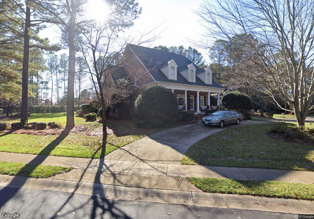
103 Barnstable Ct Mooresville, NC 28117
Estimated Value: $1,811,000 - $2,143,000
4
Beds
5
Baths
6,775
Sq Ft
$292/Sq Ft
Est. Value
About This Home
This home is located at 103 Barnstable Ct, Mooresville, NC 28117 and is currently estimated at $1,978,114, approximately $291 per square foot. 103 Barnstable Ct is a home with nearby schools including Woodland Heights Elementary School and Lake Norman High School.
Ownership History
Date
Name
Owned For
Owner Type
Purchase Details
Closed on
Apr 1, 1999
Sold by
Potter Builders Inc
Bought by
Lowder Edward R and Lowder Anne T
Current Estimated Value
Home Financials for this Owner
Home Financials are based on the most recent Mortgage that was taken out on this home.
Original Mortgage
$483,250
Outstanding Balance
$136,609
Interest Rate
6.85%
Mortgage Type
Commercial
Estimated Equity
$1,841,505
Create a Home Valuation Report for This Property
The Home Valuation Report is an in-depth analysis detailing your home's value as well as a comparison with similar homes in the area
Home Values in the Area
Average Home Value in this Area
Purchase History
| Date | Buyer | Sale Price | Title Company |
|---|---|---|---|
| Lowder Edward R | $95,000 | -- |
Source: Public Records
Mortgage History
| Date | Status | Borrower | Loan Amount |
|---|---|---|---|
| Open | Lowder Edward R | $483,250 |
Source: Public Records
Tax History Compared to Growth
Tax History
| Year | Tax Paid | Tax Assessment Tax Assessment Total Assessment is a certain percentage of the fair market value that is determined by local assessors to be the total taxable value of land and additions on the property. | Land | Improvement |
|---|---|---|---|---|
| 2024 | $8,687 | $1,462,180 | $250,000 | $1,212,180 |
| 2023 | $8,687 | $1,462,180 | $250,000 | $1,212,180 |
| 2022 | $5,445 | $858,140 | $156,250 | $701,890 |
| 2021 | $5,441 | $858,140 | $156,250 | $701,890 |
| 2020 | $5,441 | $858,140 | $156,250 | $701,890 |
| 2019 | $5,262 | $843,140 | $156,250 | $686,890 |
| 2018 | $4,360 | $720,990 | $156,250 | $564,740 |
| 2017 | $4,360 | $720,990 | $156,250 | $564,740 |
| 2016 | $4,360 | $720,990 | $156,250 | $564,740 |
| 2015 | $4,360 | $720,990 | $156,250 | $564,740 |
| 2014 | $4,137 | $719,800 | $156,250 | $563,550 |
Source: Public Records
Map
Nearby Homes
- 102 Eastham Ct
- 1946 Brawley School Rd
- 111 Kent Ct
- 541 Isle of Pines Rd
- 143 Jeremy Point Place
- 142 Jeremy Point Place
- 133 Brick Kiln Way
- 115 Union Chapel Dr
- 168 Brownstone Dr
- 111 Keel Ct Unit 29
- 804 Langtree Rd
- 106 Ballston Dr
- 117 Lake Hills Dr
- 106 Lightship Dr
- 121 Marstons Mill Dr
- 175 Rehoboth Ln
- 405 Isle of Pines Rd
- 124 Lightship Dr
- 166 White Horse Dr
- 173 Rehoboth Ln
- 107 Barnstable Ct
- 108 Barnstable Ct Unit 24
- 108 Barnstable Ct
- 125 Falmouth Rd
- 104 Barnstable Ct Unit L23A
- 104 Barnstable Ct
- 119 Falmouth Rd
- 113 Falmouth Rd
- 129 Falmouth Rd
- 104 Waterhouse Ct
- 108 Waterhouse Ct
- 107 Falmouth Rd
- 135 Falmouth Rd
- 188 Old Post Rd
- 108 Essex Ct
- 145 Falmouth Rd
- 107 Essex Ct
- 30 Waterhouse Ct
- 182 Old Post Rd
- 189 Old Post Rd